Lingering wintry mix chances & slick roads will continue for Thursday
SUMMARY: After two winter storms for the first half of the week, our weather pattern will slowly start improving for the second half of the workweek into next week as we get more sunshine returning and temperatures start warming back up. Some lingering freezing drizzle and a light wintry mix are still possible on Thursday. Roads will still have some slick spots and black ice concerns during the overnight/early morning hours through Sunday morning.
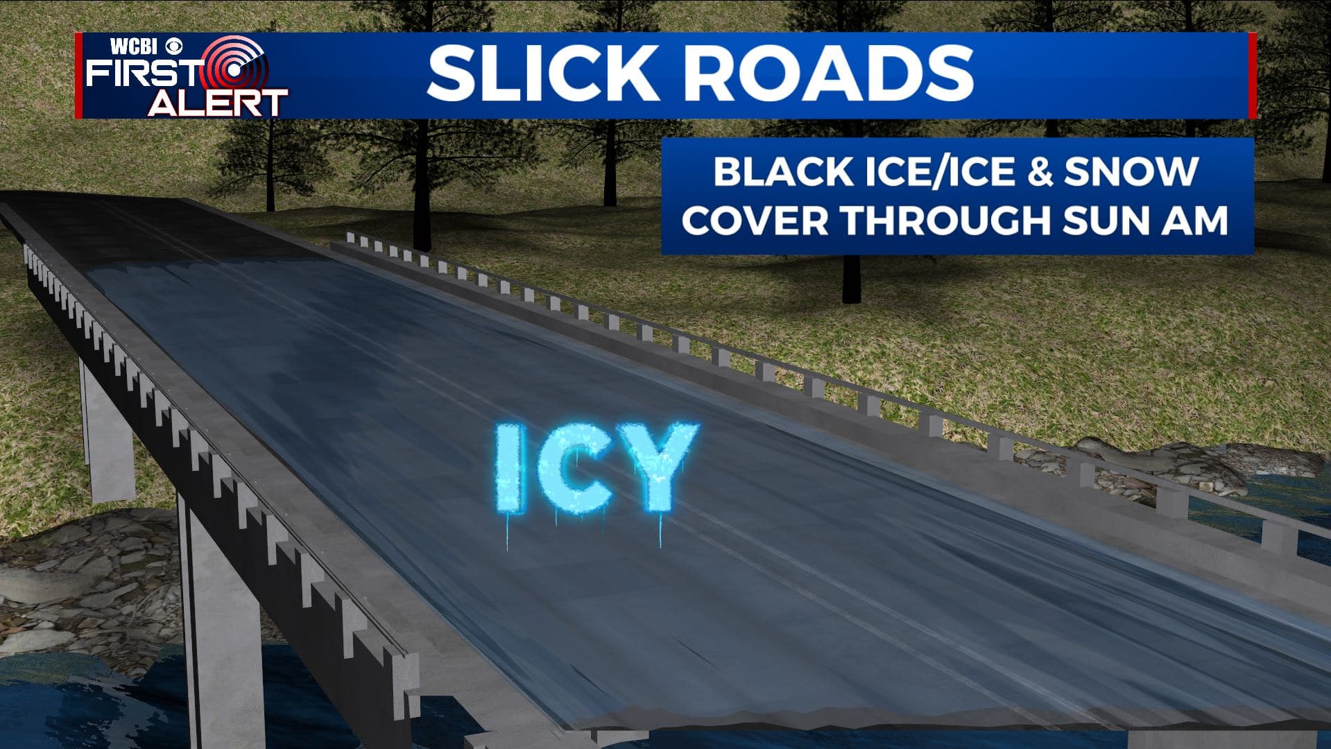
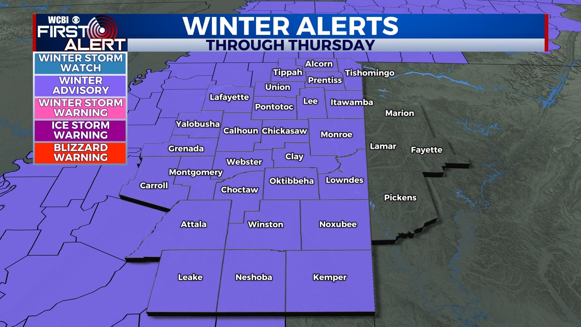
THIS MORNING: Winter Weather Advisories are in effect through Thursday afternoon as we’ll have a light lingering wintry mix or freezing drizzle that will cause additional issues out on the roads. Drive with caution if you do need to head out.
THURSDAY: Cloudy overcast skies with areas of a light wintry mix or freezing drizzle are still possible this morning and early afternoon. Highs will be a bit chilly still in the lower to mid 30s. Winds NW 10-15 mph.
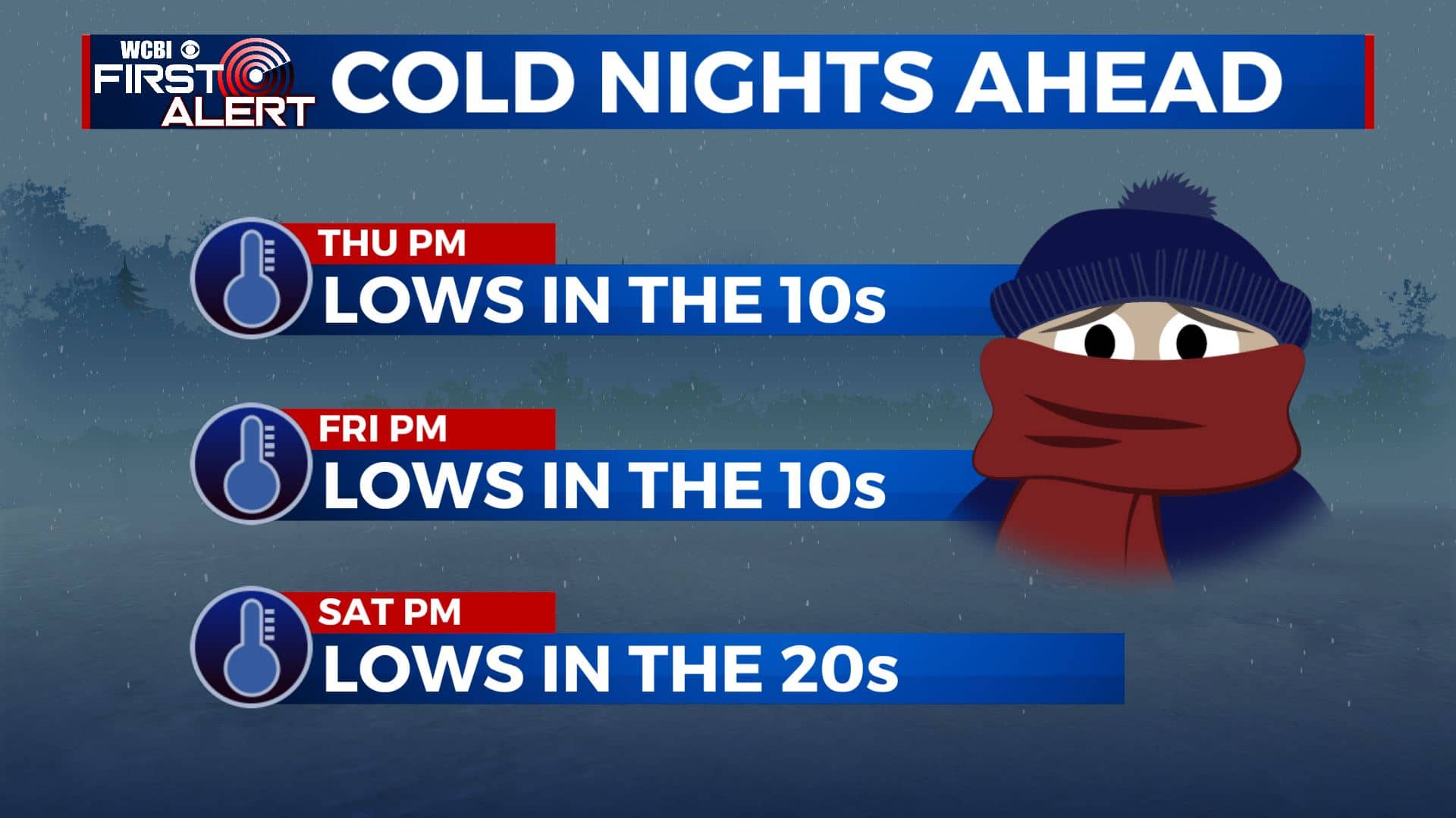
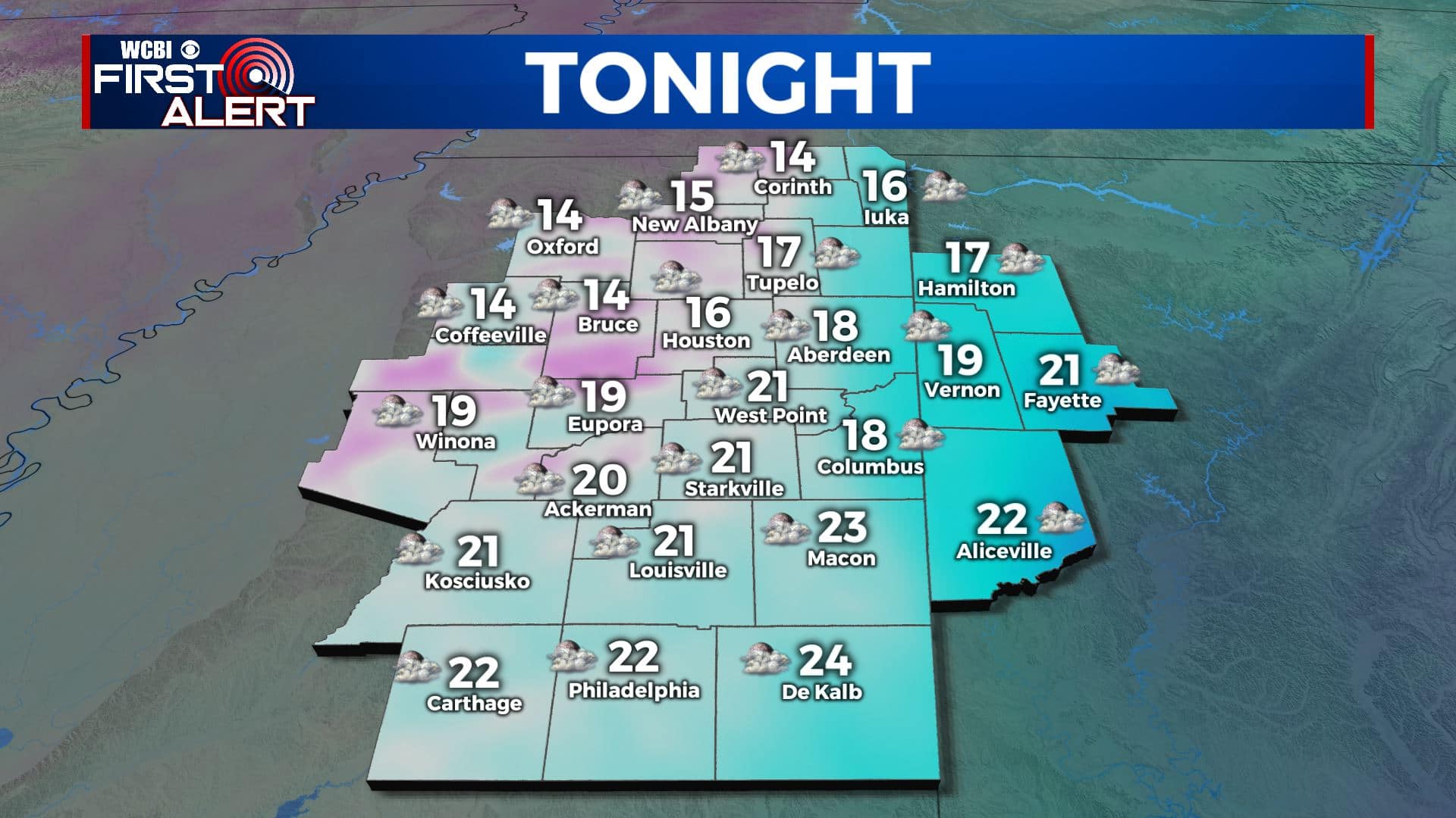
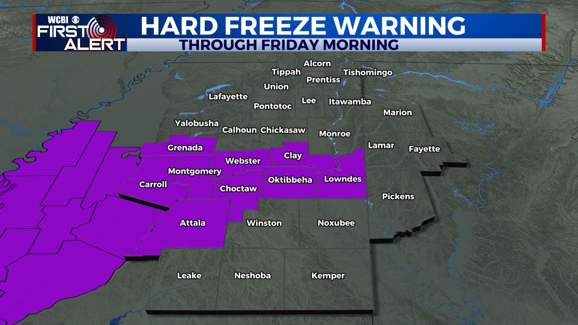
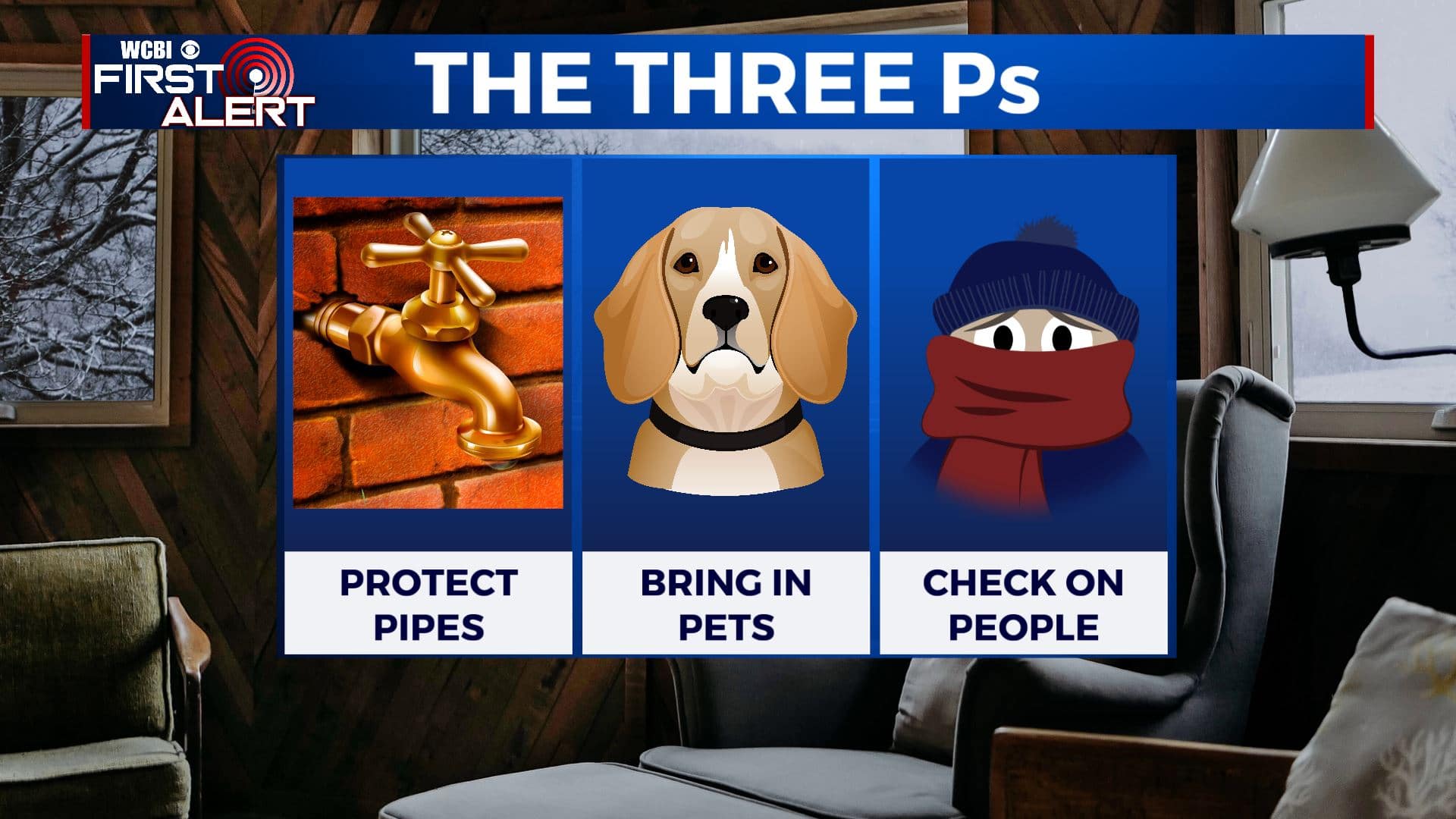
THURSDAY NIGHT: Mostly cloudy and cold. Overnight lows will fall into the upper teens. Any moisture will refreeze on area roads so continue to watch for slick spots or black ice. With these sub-freezing temperatures, a Hard Freeze Warning will go into effect from 6pm Thursday evening to noon Friday. Hard freeze conditions will result in damage to exposed pipes. Find ways to protect your pipes once again and keeping yourself, other people and your pets safe & warm.
FRIDAY: A mix of sun & clouds. Highs in the mid to upper 30s.
FRIDAY NIGHT: Mostly clear skies and cold. Overnight lows in the teens. Watch for slick spots on roads with moisture freezing up again.
SATURDAY: Mostly sunny. Highs in the mid to upper 40s.
SATURDAY NIGHT: Clear skies and cold. Lows in the mid 20s.
SUNDAY: Clouds increase with a few late evening showers possible. Highs in the mid to upper 50s.
SUNDAY NIGHT: Mostly cloudy with a few rain showers overnight. Overnight lows near 40 degrees.
MONDAY: Mostly cloudy. Showers are possible. Highs in the low 50s.
TUESDAY – WEDNESDAY: Mostly sunny skies. High warming back up and more spring-like in the lower to mid 60s.
Stay connected with @WCBIWEATHER on Facebook, Twitter, Instagram, and the WCBI News App


Leave a Reply