Morning fog then clouds moving back in for Tuesday
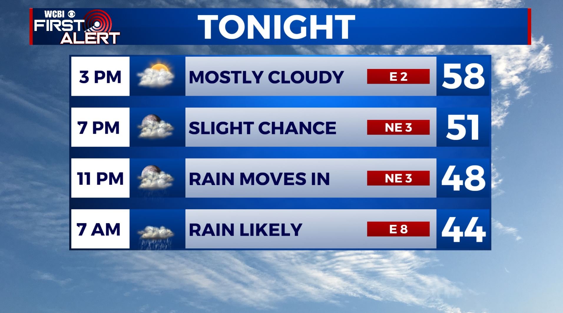
TUESDAY: Morning fog followed by clouds increasing throughout the day. We’re staying dry though during the day. Highs in the lower to middle 60s. Winds E light.
TUESDAY NIGHT: Cloudy skies with showers developing overnight. Lows in the mid 40s. NE light winds.
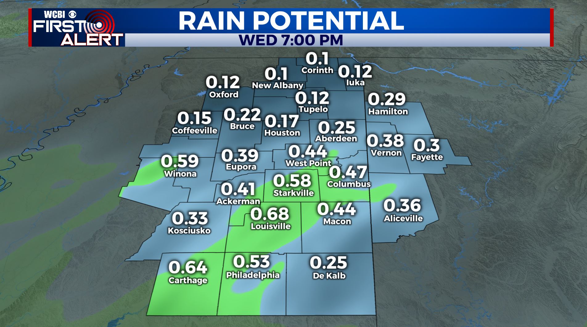
WEDNESDAY: Areas of rain likely. Generally light amounts between a quarter to three quarters of an inch of rain is expected. Highs in the lower to middle 50s.
WEDNESDAY NIGHT: Cloudy with lingering showers possible. Lows in the upper 30s to lower 40s.
THURSDAY: A mix of sun & clouds. Highs in the lower 50s. Lows in the upper 30s to lower 40s Thursday night.
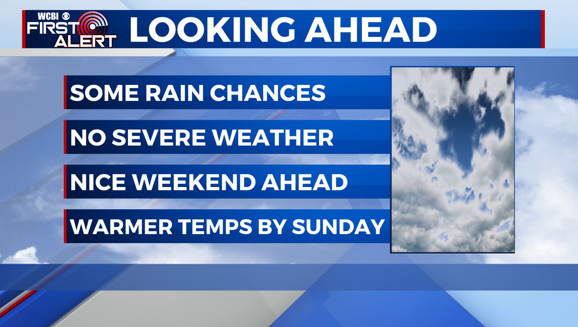
FRIDAY: Mostly cloudy with another chance of scattered showers. Highs in the lower to mid 50s. Upper 30s for overnight lows Friday night.
SATURDAY: Becoming sunny. Highs in the middle 50s. Upper 30s to around 40 Saturday night under mainly clear skies.
SUNDAY: Sunny skies and mild. High temperatures warming up in the mid to possibly upper 60s.
MONDAY: A mix of sun & clouds with a slight chance of rain. Highs remaining in the mid 60s.
SUMMARY: We are waking up once again to areas of fog this Tuesday morning. Clouds will once again increase Tuesday afternoon before more rain chances move in Tuesday evening through Wednesday. Another slight chance of rain on Friday before a sunny & slightly warmer weekend ahead.
Stay connected with @WCBIWEATHER on Facebook, Twitter, Instagram and the WCBI News App.


Leave a Reply