Nice Stretch of Weather Coming
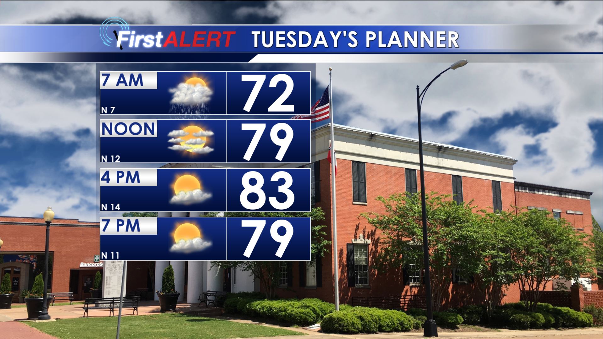
Tuesday’s Planner
SUMMARY: Drier and more comfortable air is going to return for the middle of the week. It may be the best stretch of days all summer with plenty of sun, warm days, and cool nights.
MONDAY NIGHT: Areas of rain and storms continue. Lows in the low 70s. There is a 70% chance of rain.
TUESDAY: The highest odds of rain and a few storms will be during the morning We expect clearing skies from north to south during the afternoon. Highs should top out in the low 80s with northerly winds developing between 10 and 15 mph.
TUESDAY NIGHT: Clear, quiet, and comfortable. Look for lows in the lower 60s.
WEDNESDAY: Sunny and warm. Highs in the mid 80s. The air will be unusually dry for July so it won’t feel too bad outside of the sun.
WEDNESDAY NIGHT: Clear, quiet, and comfy. Another night in the low 60s is likely.
THURSDAY-FRIDAY: Mostly sunny. Reasonably dry air should hang around so even with highs in the mid to upper 80s it won’t feel oppressively humid like it has over the last few weeks.
WEEKEND: Typical late summer weather sets up. Highs are going to be around 90 with a 30% chance of pop-up showers and storms both days. Lows dip to around 70.
Stay connected with @WCBIWEATHER on Facebook, Twitter, and Instagram


Leave a Reply