Nicer & more pleasant weather on the way
SUMMARY: After an unsettled Monday, our area will enjoy some cooler, drier and nice weather for the middle part of the workweek. Some lows may be down into the upper 50s Wednesday morning. Don’t get too comfortable because the summer heat and humidity will return along with chances of showers and storms heading into the weekend.
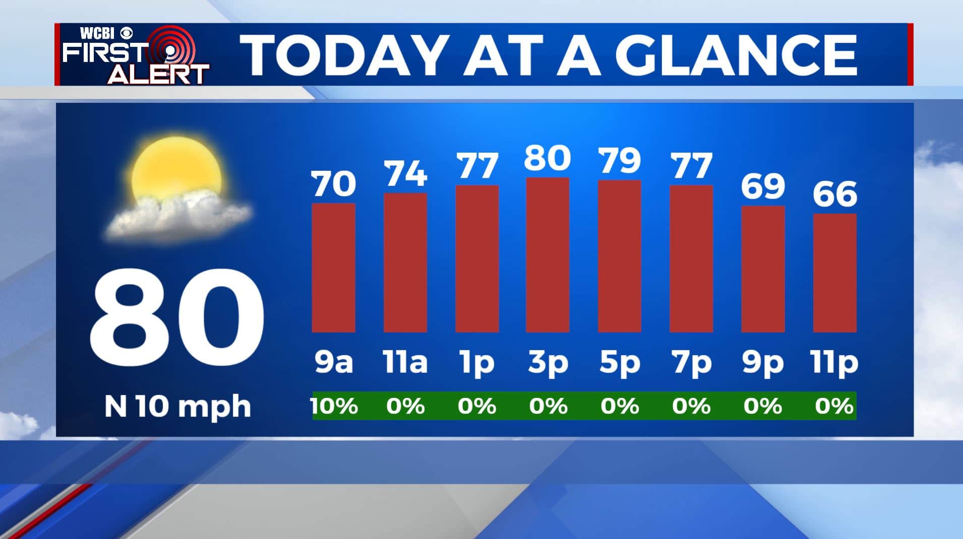
TUESDAY: Mostly cloudy with lingering showers during the morning as our cold front pushes through. Gradual clearing and drying out into the afternoon. Highs slightly cooler and less humid in the upper 70s to around 80. Winds N 10-15 mph.
TUESDAY NIGHT: Clear, quiet and cool for a summer night. Overnight lows in the upper 50s.
WEDNESDAY: Pretty nice with mostly sunny skies. Highs in the mid 80s with lots of sunshine.
WEDNESDAY NIGHT: Partly cloudy skies. Lows in the mid 60s.
THURSDAY: A stray shower or storm is possible. The summer humidity makes a return with highs in the upper 80s to near 90 degrees. Lows around 70 degrees.
FRIDAY-MONDAY: A chance of summertime afternoon showers and storms each day. Warm and humid. Highs in the mid to upper 80s. Overnight lows in the lower 70s.
Stay connected with @WCBIWEATHER on Facebook, Twitter, Instagram and the WCBI News App


Leave a Reply