Not as cold but a bit breezy for your Tuesday
SUMMARY: A dry and cool weather pattern continues through Wednesday. Another storm system will pass through the region Thursday and Friday. No severe weather is expected with this next system but anywhere from 1/2” to 1” of rain may fall. Nice and seasonable weather moves back in for the weekend.
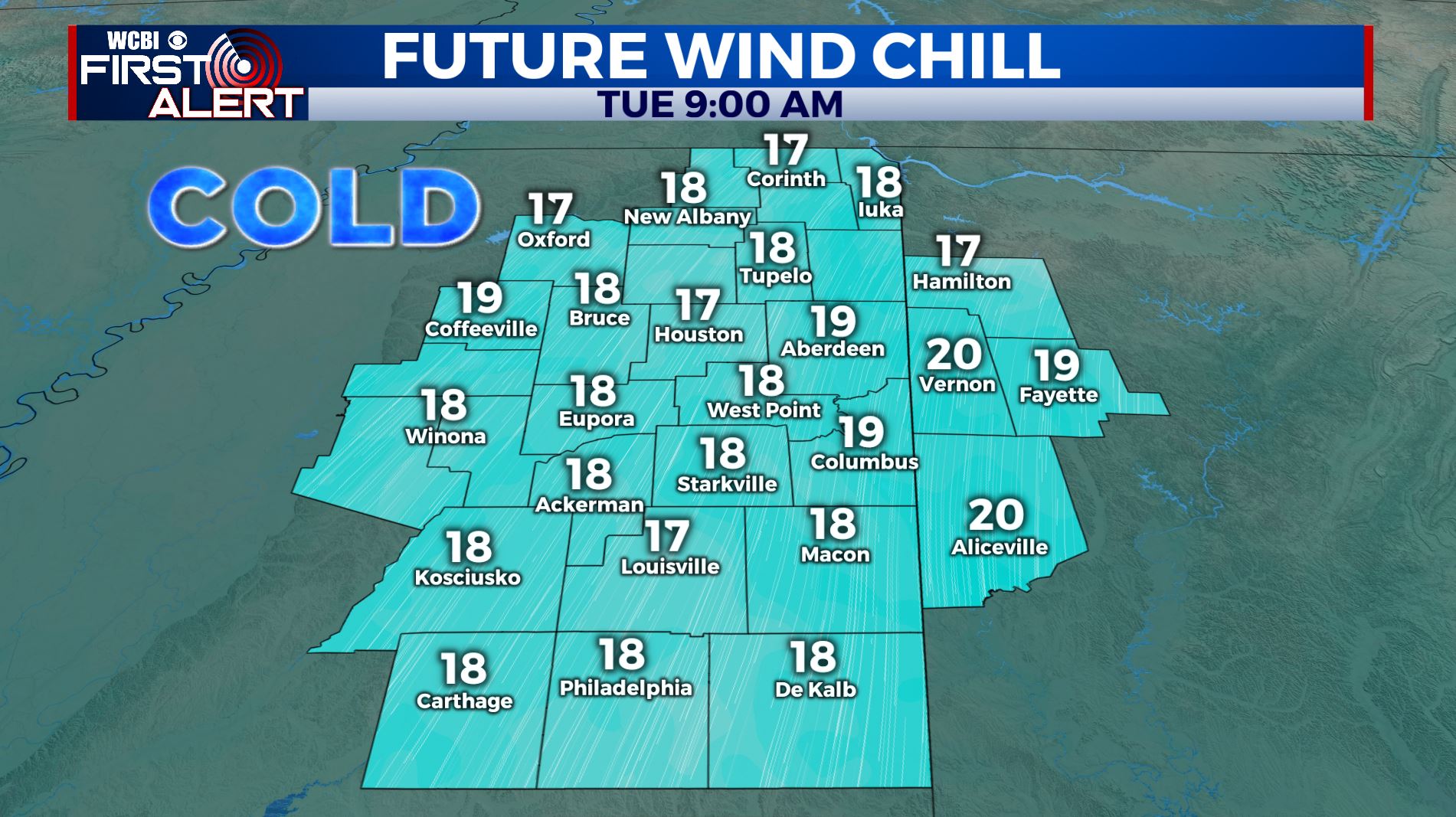
TUESDAY: We’re waking up this morning to temperatures in the 20s with wind chills in the teens so bundle up as you’re heading out. We have a few high clouds this morning, but lots of sunshine and another clear blue sky day is ahead. Highs still below average & cool in the low 40s. Winds from the north between 5 and 15 mph will keep a chill going all day long.
TUESDAY NIGHT: Mostly clear and cold. Overnight lows cold in the lower 20s. Fairly light NE winds.
WEDNESDAY: Increasing clouds. Highs warming up to the upper 40s. SE winds 5-10.
WEDNESDAY NIGHT: Cloudy skies. Lows in the lower 30s.
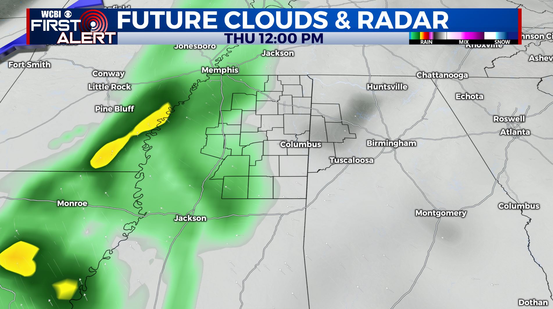
THURSDAY-FRIDAY: Thursday will start off dry, but areas of rain will develop through the afternoon and evening. It’s looking like the best chance for rain will be overnight Thursday, but it’s likely that we see some showers linger into Friday. While some of us could hear a rumble of thunder or two, we’re not expecting any strong to severe storms and rainfall amounts should generally be about an inch. Highs will be in the lower to mid 50s.
THIS WEEKEND: As of now, it looks like any rain and storm activity will exit by Saturday, but a few clouds could linger. A sunny but chilly weekend is ahead with temperatures near average with highs in the 50s and overnight lows in the 30s.
MONDAY: Mostly sunny skies to start the new work week. Highs a few degrees above average in the upper 50s.
FOLLOW @WCBIWEATHER ON FACEBOOK, INSTAGRAM, TWITTER AND ON THE WCBI MOBILE APP.


Leave a Reply