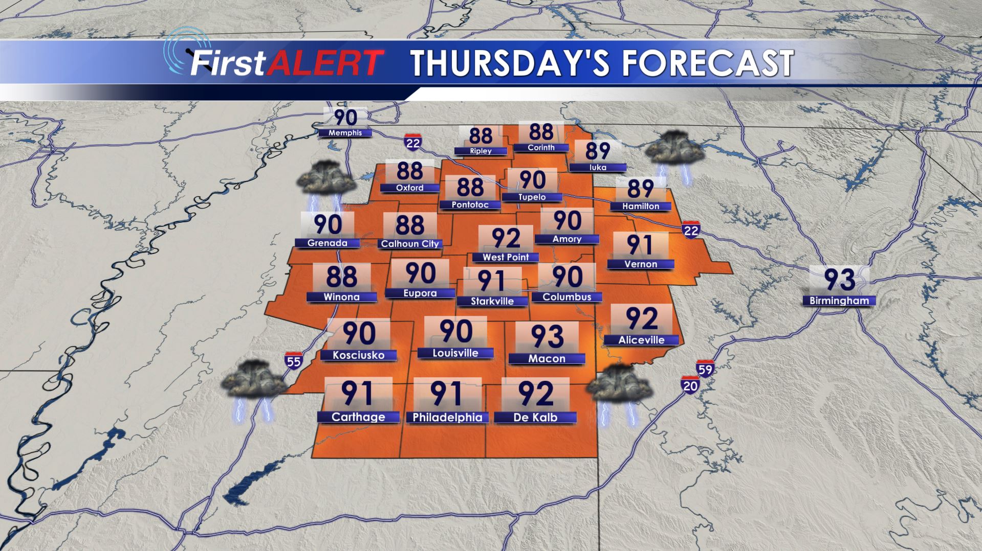
Not As Hot, More Rain & Storms
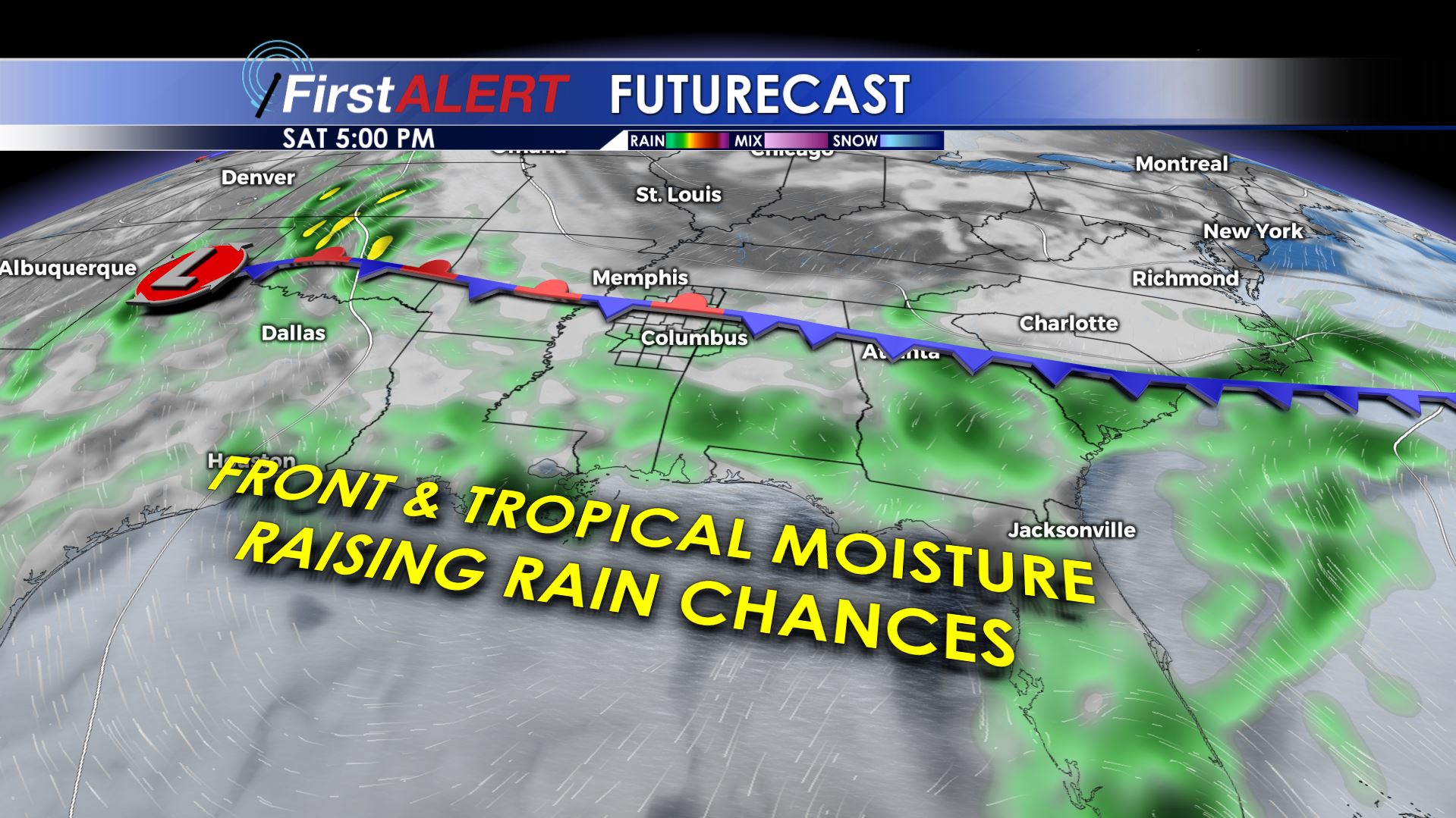
SUMMARY: A weak cold front and deep tropical moisture will team up to produce numerous showers and storms in the region from today through the weekend. Several inches of rain could fall in some locations while other spots miss out on the heaviest activity. Temperatures will not be as hot but it’s going to remain very muggy.
TODAY: A mix of clouds and sun is expected during the morning with odds of scattered storms going up during the afternoon and early evening. The overall rain chance is somewhere in the 40-50% range. Highs should top out around 90. Winds will be from the SSW between 4-8 mph.
THURSDAY NIGHT: Most of the showers and storms should weaken and fade away during the evening but a few may linger during the night. Lows stay in the low 70s. Some low clouds and fog may redevelop.
FRIDAY: Numerous showers and storms are likely during the day, keeping highs in the upper 80s to around 90. Locally heavy downpours are possible in addition to some refreshing breezes and lightning. Some of the storms will carryover into the evening so be prepared for at least some rain and possible lightning delays if you are heading to high school football. Winds will be variable between 3-7 during the day.
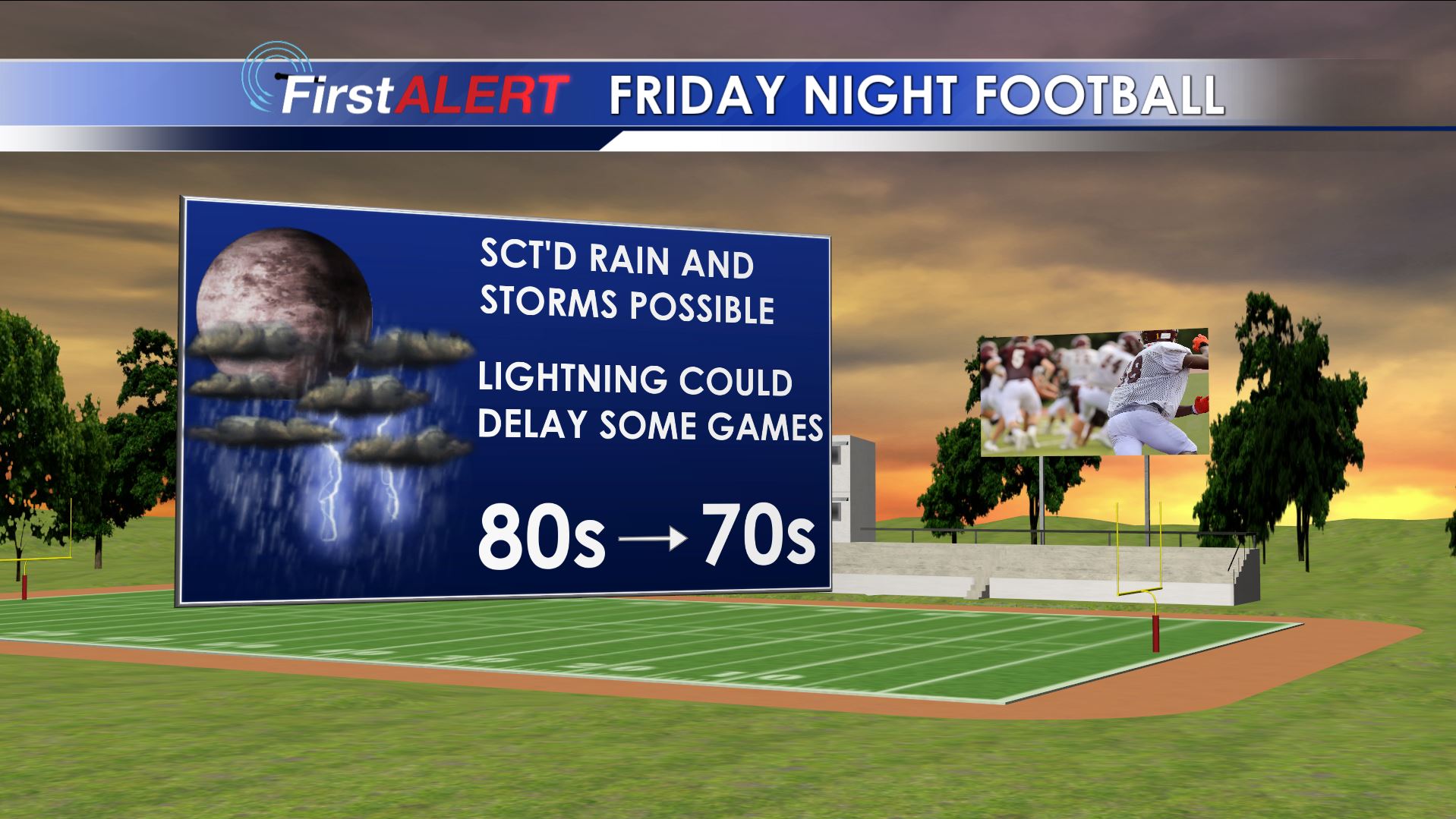
FRIDAY NIGHT: A few lingering showers and storms are possible. Look for lows in the low 70s.
WEEKEND: A stalled front will keep elevated rain and storm chances going both Saturday and Sunday. We’re going to keep odds in the 50-70% range. Highs should top out mainly in the 80s with lows remaining in the low 70s.
EARLY NEXT WEEK: Daily rain and storm chances look to continue through at least Tuesday. Look for seasonable temperatures in the upper 80s to around 90 during with overnight lows in the low 70s or upper 60s. Some drier air may return by the middle of the week.
Follow @WCBIWEATHER on Facebook, Twitter, and Instagram


Leave a Reply