More Heat, Humidity, & Storm Chances
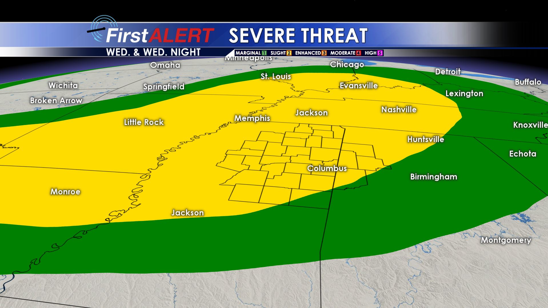
Wednesday Storm Threat
TUESDAY NIGHT: A chance for a shower or thunderstorm this evening with variably cloudy skies overnight. Lows in the low 70s. Wind will be out of the south around 5 mph becoming calm by the overnight hours. Chance of precipitation this evening is 40%
WEDNESDAY: Fairly typical summer storms are possible during the day. One difference will be the opportunity for a batch of gusty storms at some point later in the day Wednesday into Wednesday night. If this batch moves through as some of the model data suggest there could be a damaging wind threat. It’s something we’ll keep on watching. Highs will be in the low 90s with heat index values near 100. Wind will be out of the southwest around 5-15.
THURSDAY: More storms are in the forecast for Thursday. This won’t be anything out of the ordinary for this time of year, just your standard summer storms. High temperatures will be in the upper 80s. However, it will feel more like the upper 90s and low triple digits thanks to oppressive humidity. Overnight lows will drop into the low 70s.
FRI/SAT/SUN: We round out this week on a hotter and drier note. Temperatures top out in the low 90s each day, with the heat index climbing into the 100s each afternoon. A couple of isolated pop up storms will be possible each afternoon, but the pattern will trend a bit drier than the middle of the week.


Leave a Reply