One more pleasant summer day before the heat & humidity returns
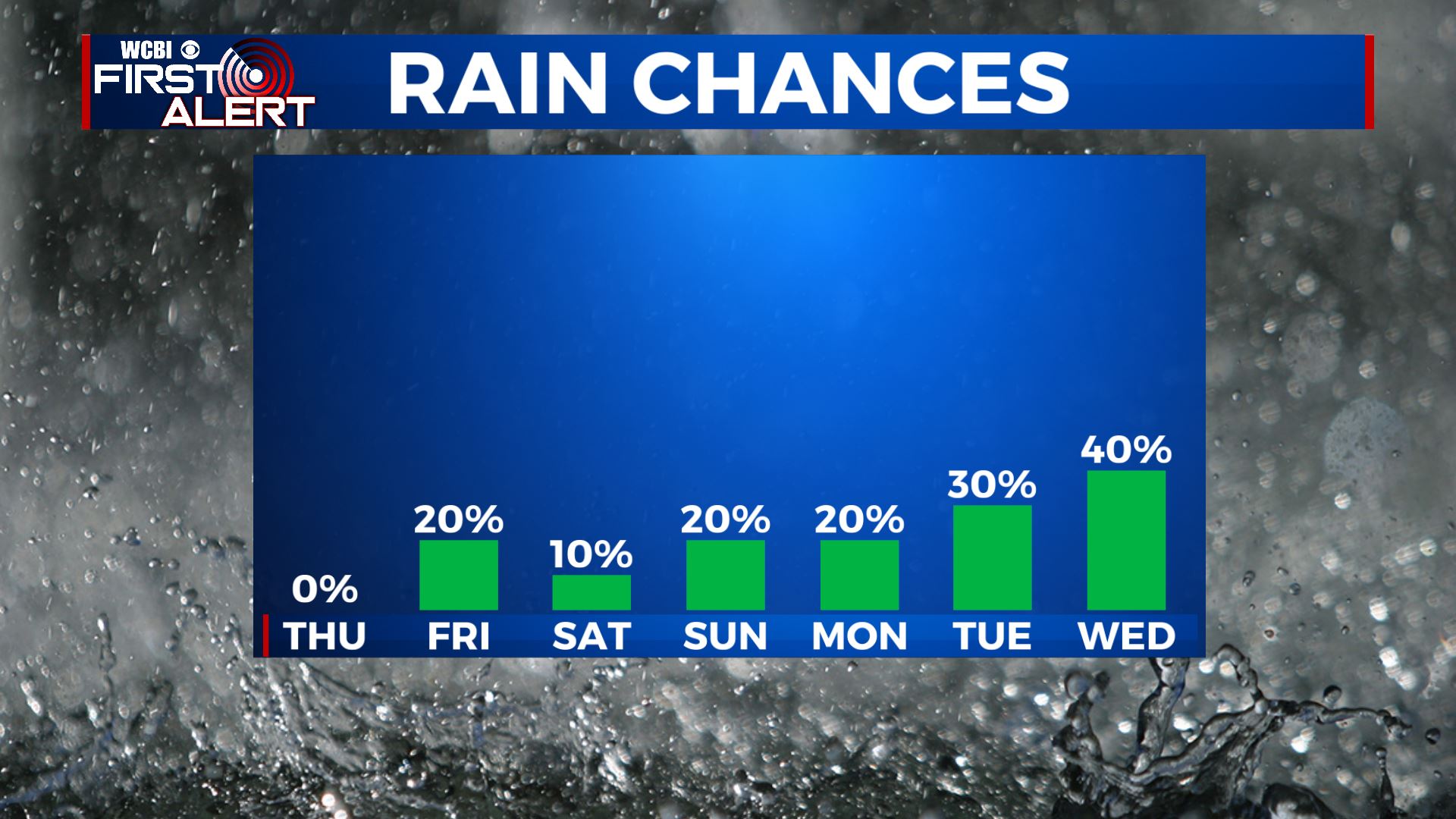
SUMMARY: The summer heat and humidity will be making its return as we head into the weekend as temperatures are set to climb back up into the 90s. No major systems are going to affect the region anytime soon, but those chances for afternoon summertime showers & storms will return as well heading into next week. 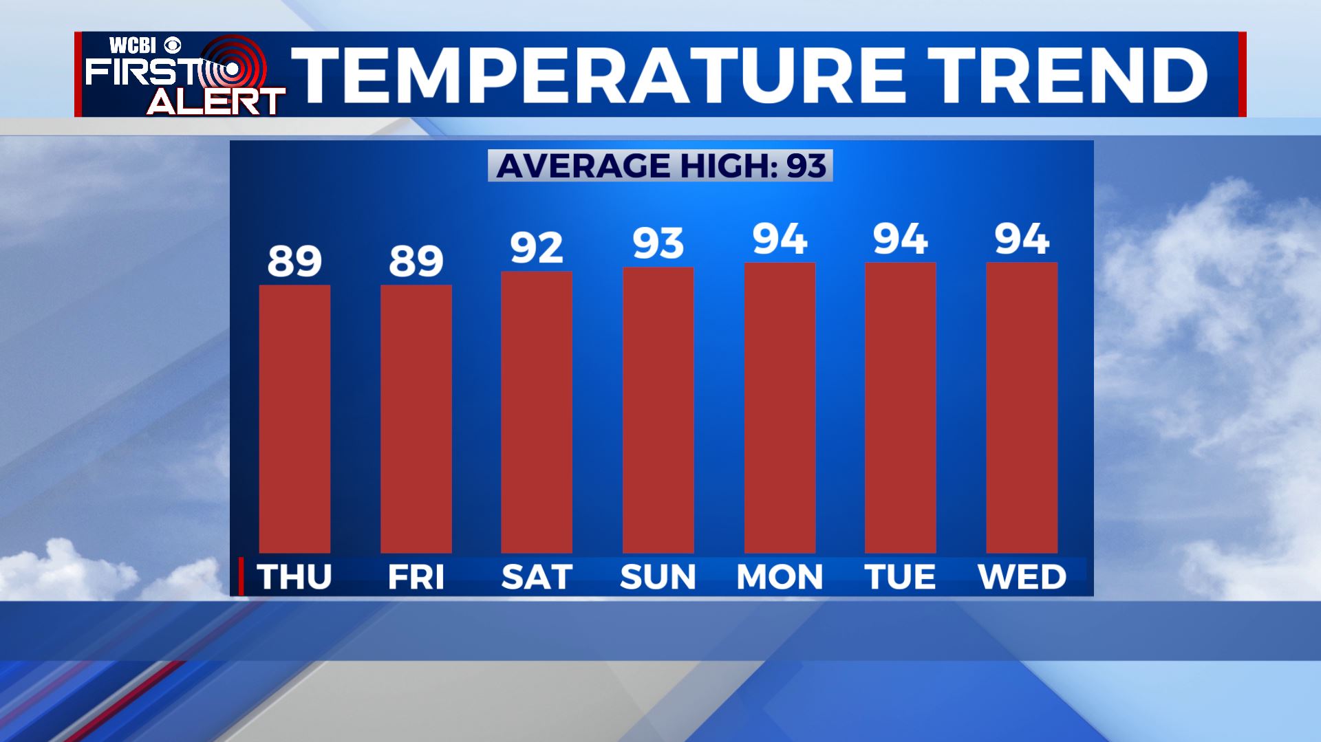
 THURSDAY: We’re waking up to mostly clear skies this Thursday morning with cool & comfortable temperatures in the 60s. Expect mostly sunny skies once again today with some haze in the sky due to wildfires. Temperatures a bit warmer in the upper 80s, but still nice. Winds NE 5-10 mph.
 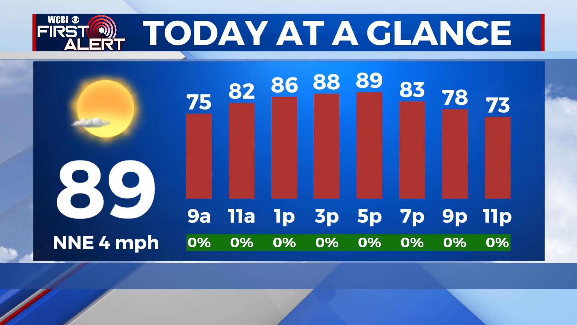 THURSDAY NIGHT: A few clouds overnight. Lows in the mid to upper 60s with a light wind. FRIDAY: A mix of sun and clouds with a stray shower or pop-up storm possible in the afternoon. The summer heat and the humidity makes a comeback. Highs near 90 degrees. Overnight lows in the upper 60s. WEEKEND & NEXT WEEK: Temperatures will gradually warm back into the lower to mid 90s with overnight lows climbing back into the 70s. Stray afternoon summertime storms will become the rule with a standard late summer weather pattern developing. Stay connected with @WCBIWEATHER on Facebook, Twitter, Instagram and the WCBI News App


Leave a Reply