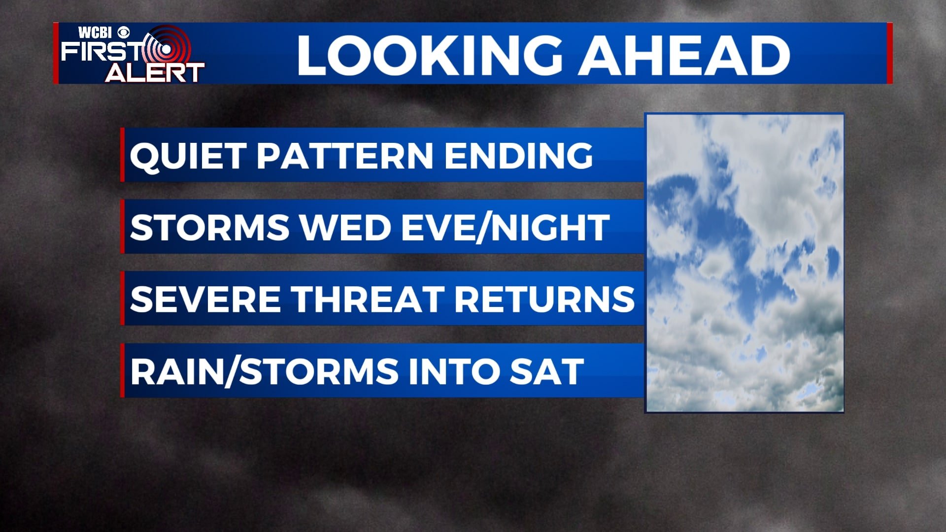
One more quiet day for your Tuesday before storms return midweek
SUMMARY: Temperatures will continue to warm up and staying dry for our Tuesday. Showers and thunderstorms will return into the area late Wednesday night into early Thursday morning. Some of those storms will be strong to possibly severe. We’ll keep you updated! Additional rain and storms could linger through the end of the week and into the start of the weekend.
TUESDAY: Sunshine with a few clouds trying to move in. A chance of a stray afternoon shower or sprinkle is possible, but overall we’ll stay dry. Highs in the upper 70s to near 80 degrees. Southerly winds 10-15 mph.
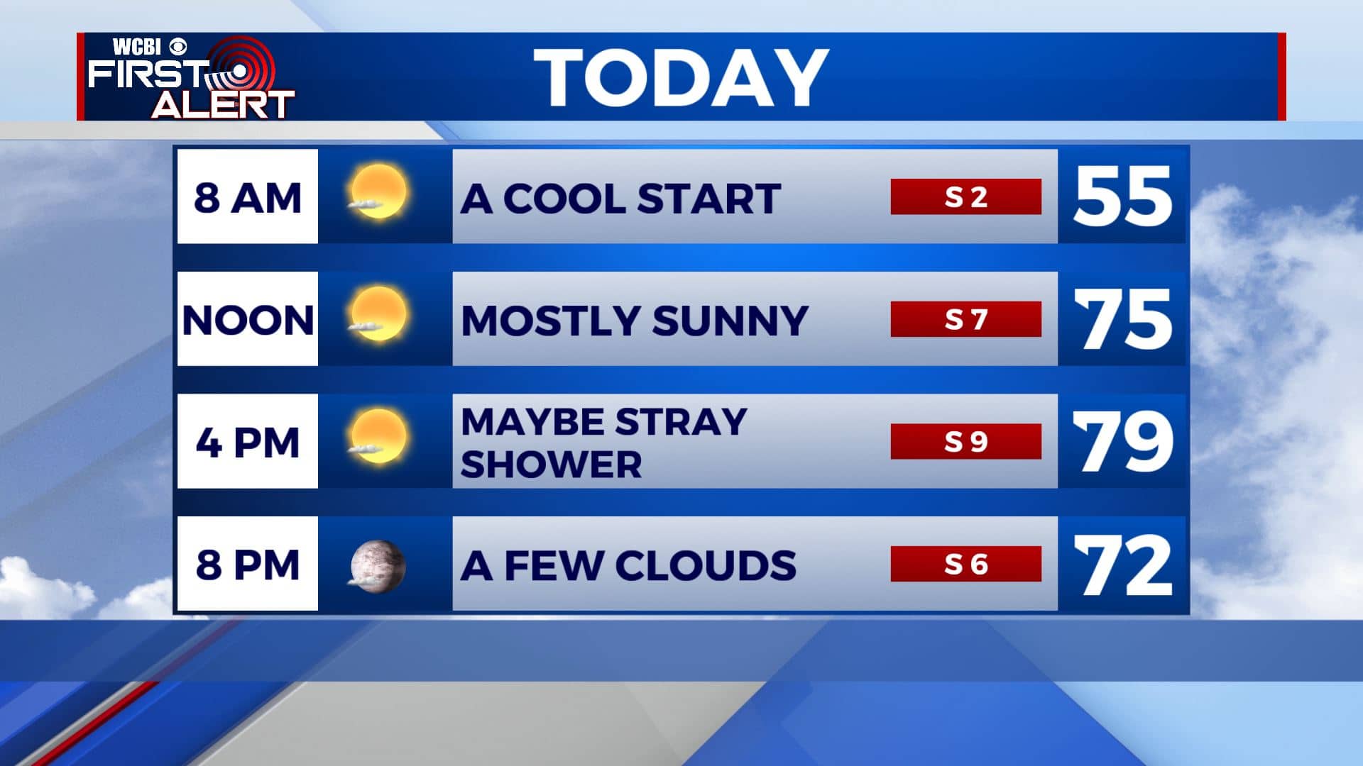
TUESDAY NIGHT: Increasing clouds and milder. Overnight lows in the upper 50s.
WEDNESDAY: Breezy and warm. Highs around 80. South winds 10-20 mph, gusts to 25 mph.
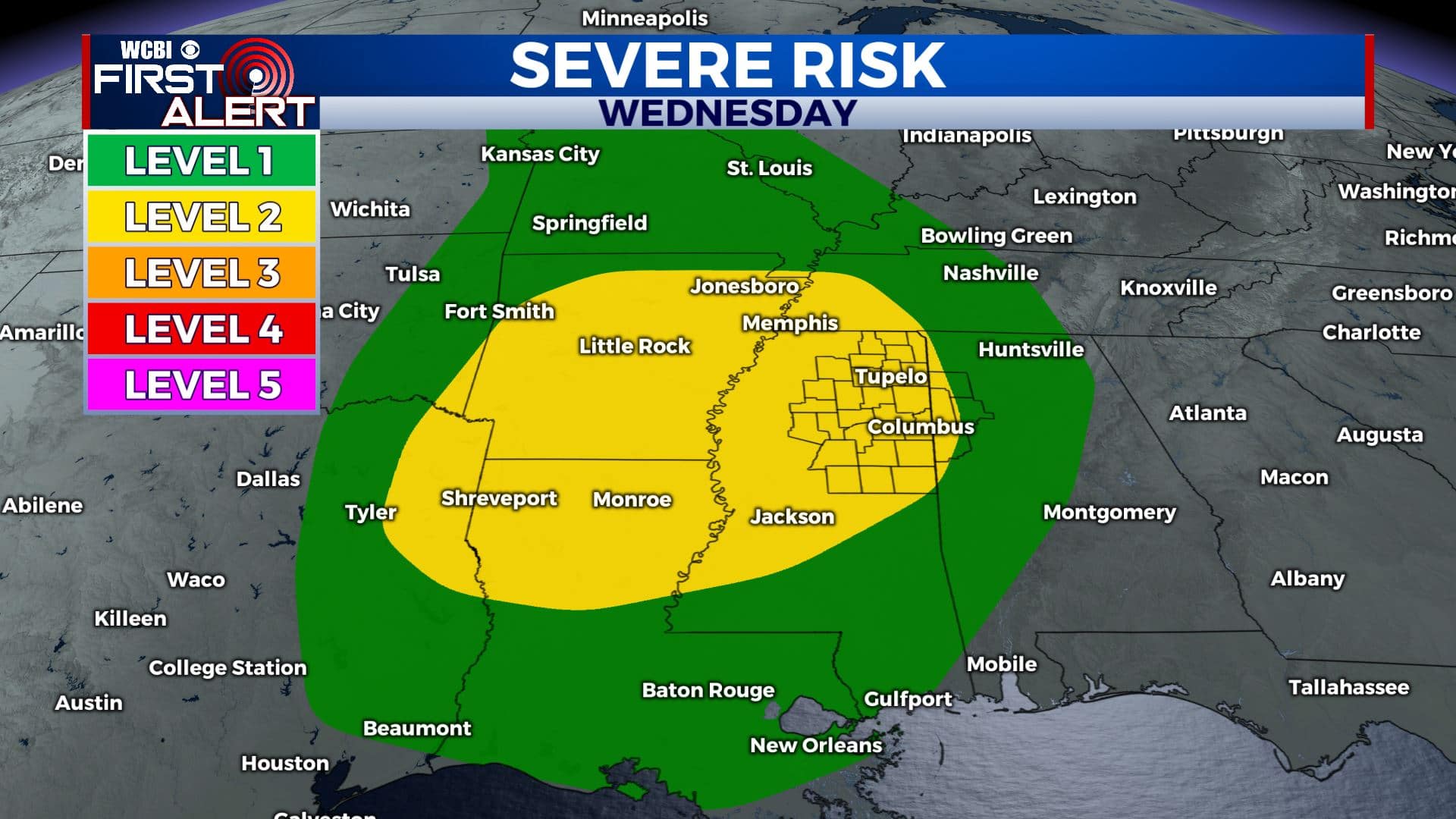
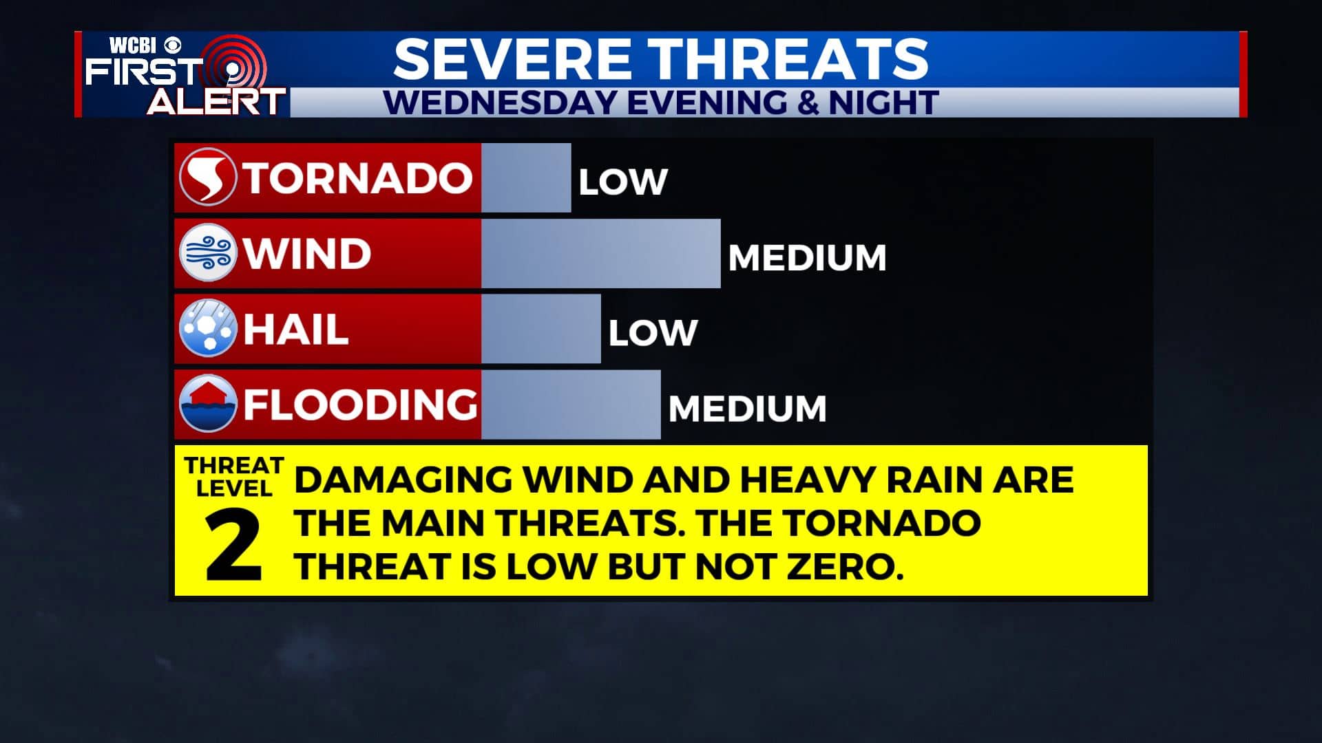
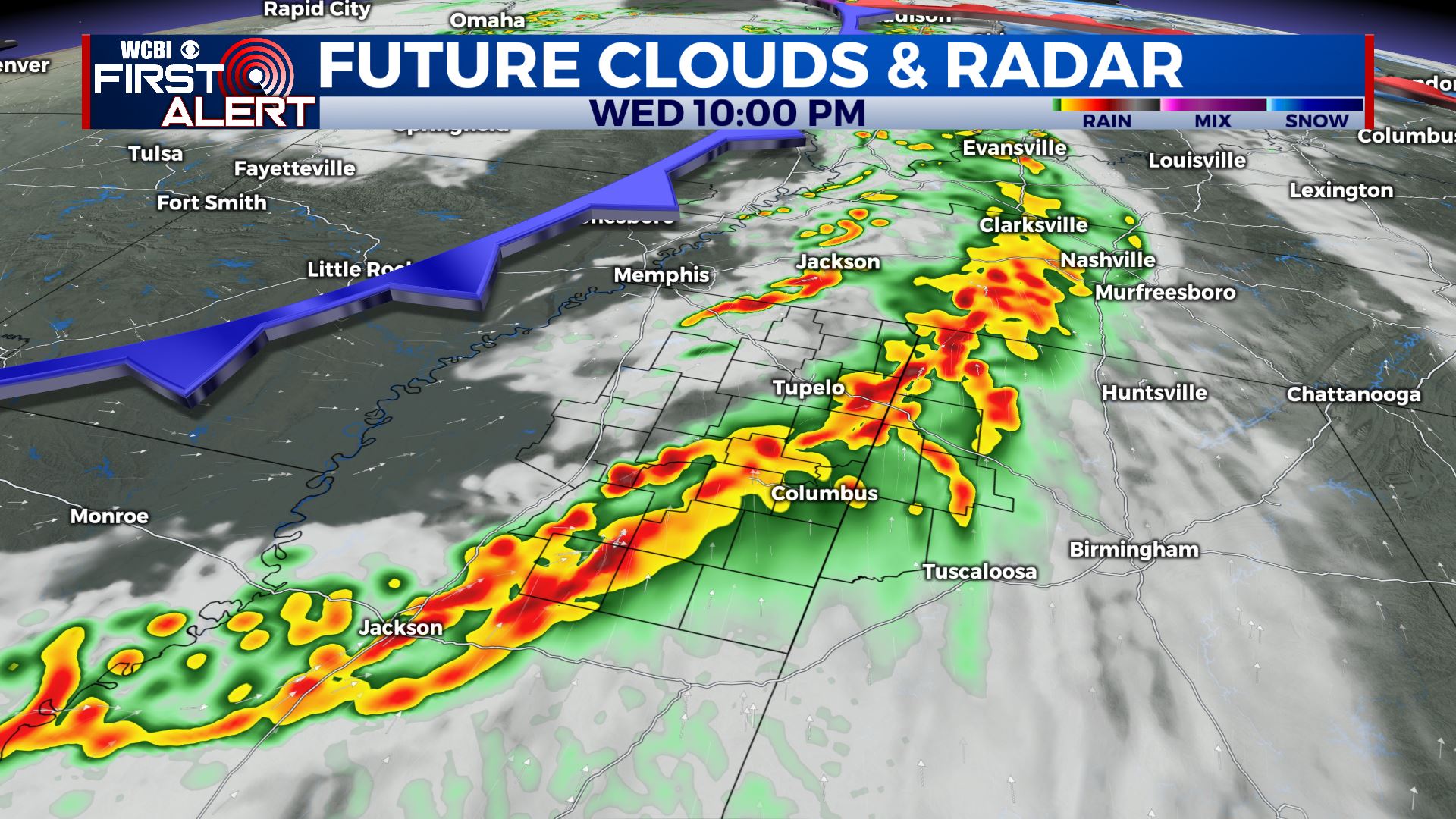
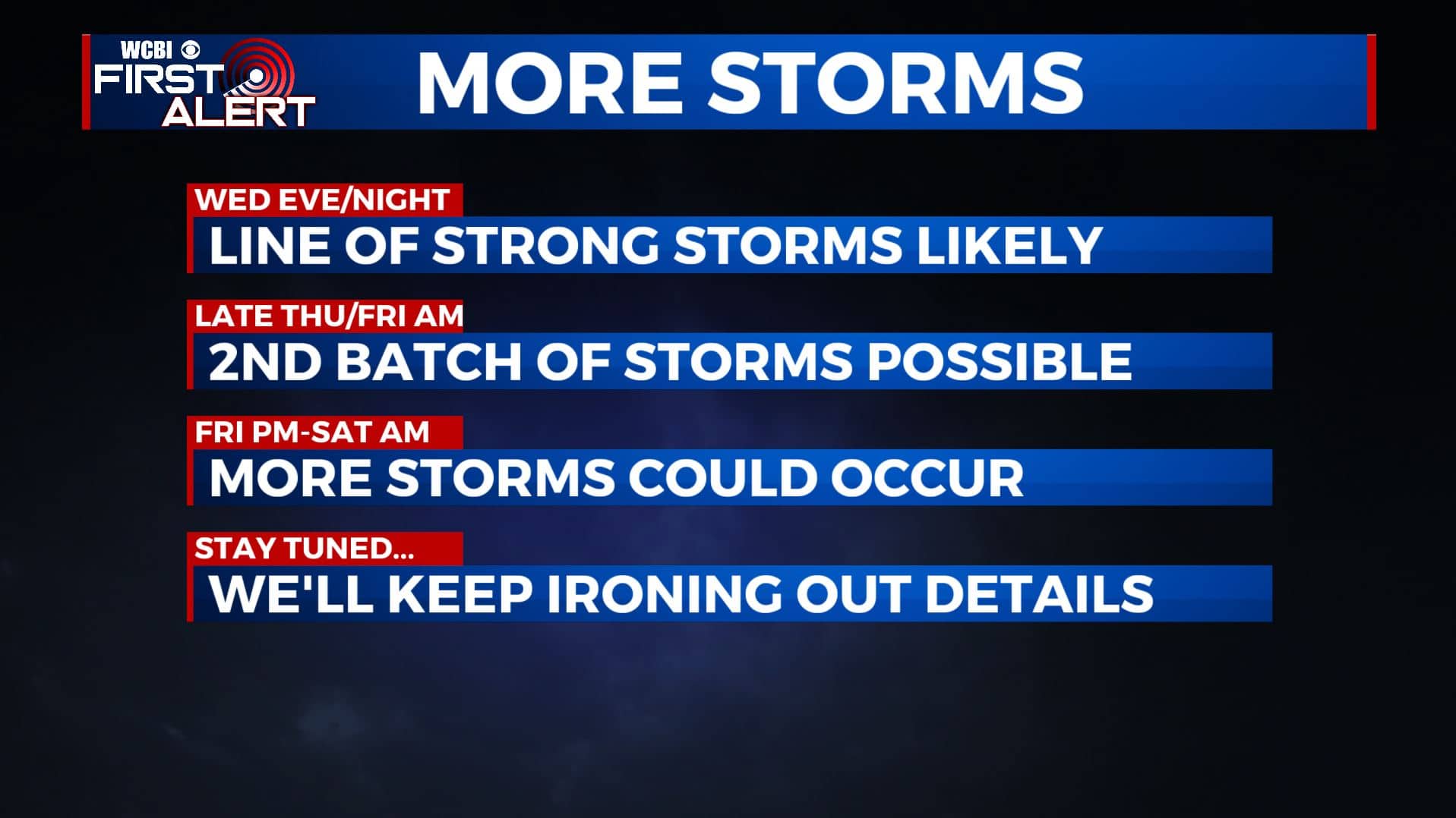
WEDNESDAY EVENING/NIGHT: A line of strong to severe storms could push across our area. Right now we are under a Level 2 for damaging wind gusts, large hail and heavy rain to be the main concerns. The tornado threat in this setup is low but not zero so we’ll continue to monitor. Some flooding in possible, especially in areas that had all the heavy rain last week. Lows in the 50s.
THURSDAY: A mix of sun and clouds. Highs in the upper 70s to lower 80s.
THURSDAY NIGHT: Another chance of rain and storms. Still some uncertainty of how strong this round will be. We’ll keep you posted! Overnight lows in the upper 50s to around 60.
FRIDAY: Chance of scattered showers and storms continue. Highs in the upper 70s.
FRIDAY NIGHT: Chance of rain and storms. Overnight lows around 60.
SATURDAY: Some showers and storms are possible during the morning. We’ll be drying out during the afternoon. Highs in the mid 70s.
SUNDAY: Mostly sunny skies. Highs in the mid 70s.
MONDAY: A slight chance of showers with a mix of sun and clouds. Highs in the upper 70s.
Stay connected with @WCBIWEATHER on Facebook, Twitter, Instagram, and the WCBI News App.


Leave a Reply