One more warm day for Tuesday before cool down arrives
SUMMARY:
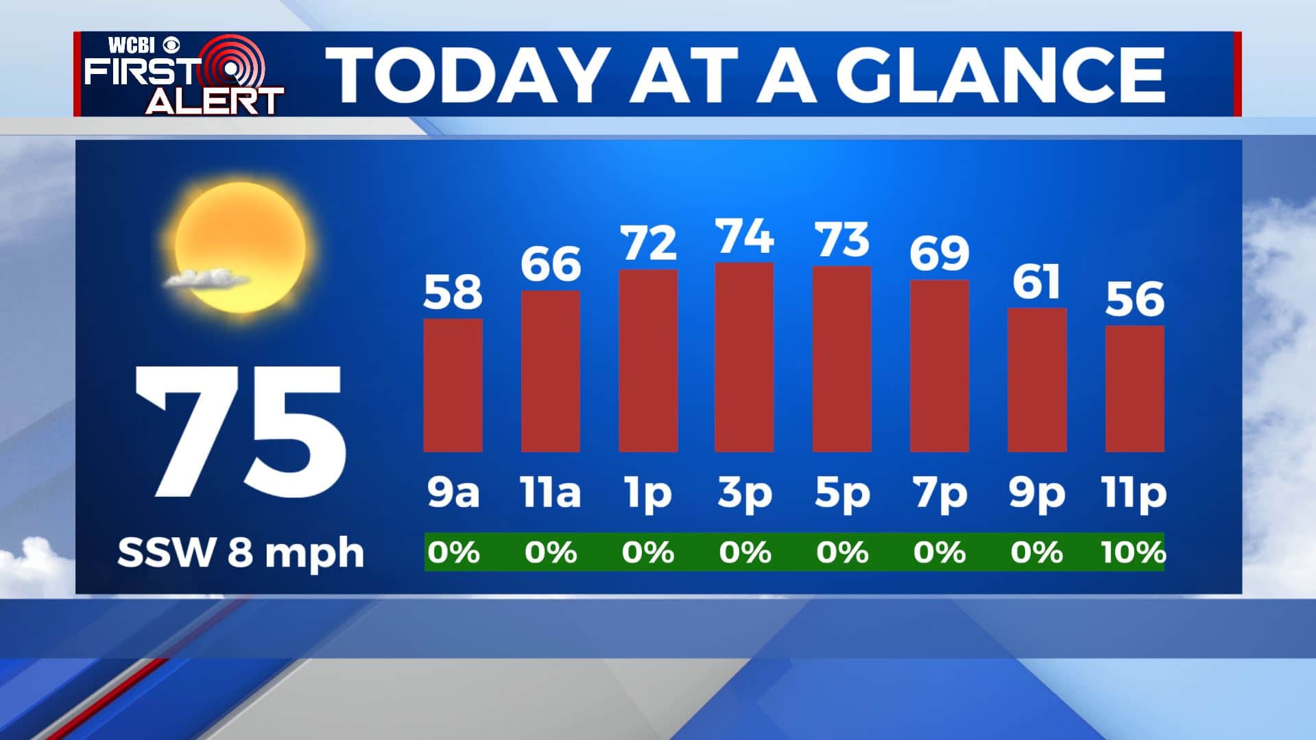
TUESDAY: Staying warm with high temperatures in the lower to mid 70s. We’ll have mostly sunny skies, but some more clouds will move in by late afternoon. SW winds 5-10 mph.
TUESDAY NIGHT: Another cold front swings over the area bringing cloud cover and a few stray showers with it. Overnight lows will be chilly in the upper 30s.
WEDNESDAY: Cooler temps behind the cold front with highs only reaching the lower 60s. Some morning clouds will make way for more sunshine by the afternoon. NW winds 5-15 mph.
WEDNESDAY NIGHT: Mostly clear skies with areas of frost developing by morning so cover up or bring in that sensitive vegetation. Overnight lows in the mid to upper 30s.
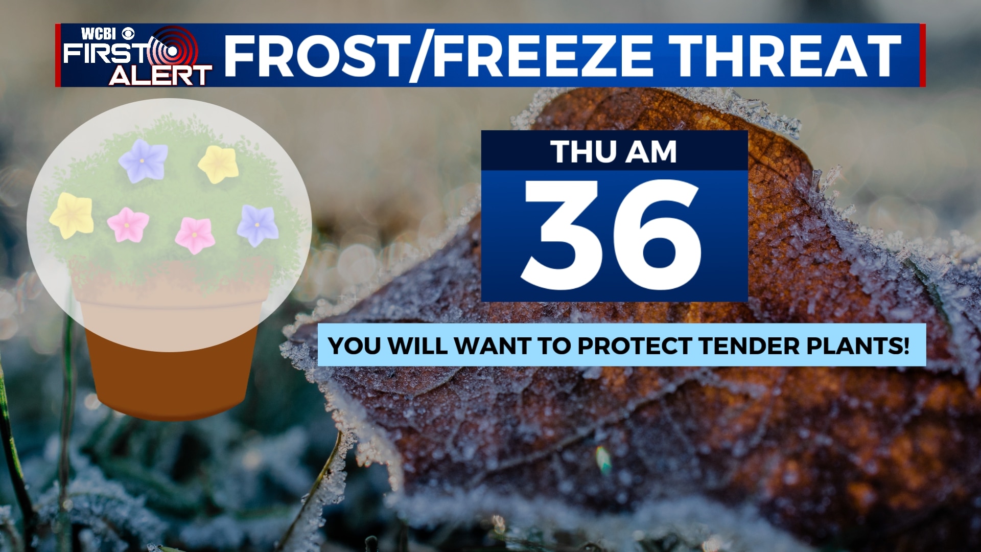
THURSDAY: A mix of sun and clouds with highs in the mid to upper 60s. Overnight lows in the mid 40s.
FRIDAY: Mostly cloudy skies Friday with the chance of isolated showers with highs in the upper 60s.
SATURDAY: Some showers and thundershowers are likely on Saturday. It appears the severe weather threat will remain to our south. However, we could see some heavy rain at times. Highs will be in the lower 70s.
SUNDAY: Rain will exit by Sunday morning, leaving us dry for Sunday. We’ll see a mix of sun and clouds in the afternoon with highs in the mid 70s. Overnight lows in the upper 40s.
MONDAY: We’ll see mostly sunny skies with highs continuing to warm up to near 80 degrees.
Stay connected with @WCBIWEATHER on Facebook, Twitter, Instagram, and the WCBI News App.


Leave a Reply