One more warm day for Tuesday before rain & cooler temperatures move in
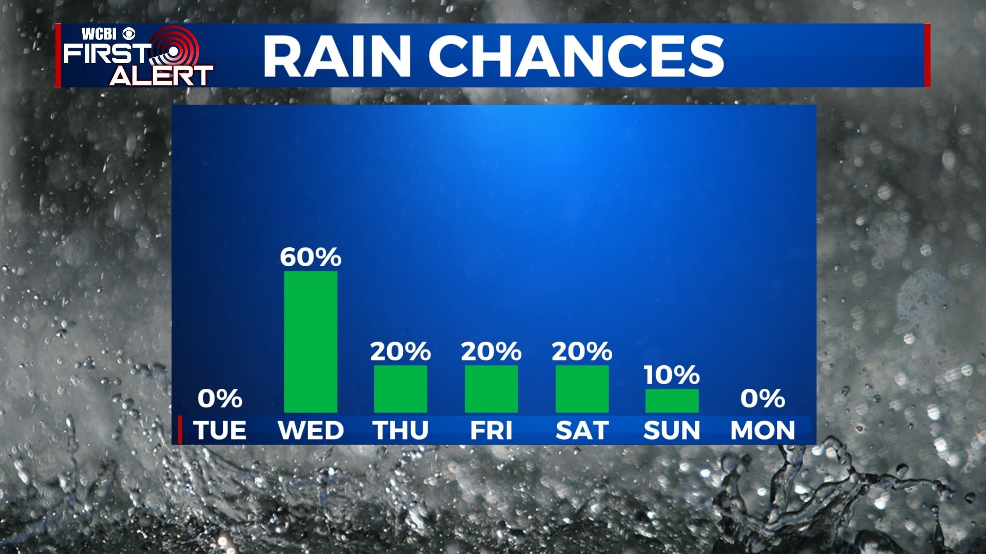
SUMMARY: One more warm above average day is expected for Tuesday with highs in the 80s. Another cold front Wednesday will bring us the return of some showers to the area. The unsettled weather pattern of on & off again rain chances will continue through the weekend. The great news is that our severe weather threat will be low for the next 7-10 days. Below average temperatures will also stick around.
TUESDAY: We’ll have a mix of clouds with some sunshine throughout the day. Staying warm with highs in the low 80s. SW winds 5-10 mph.
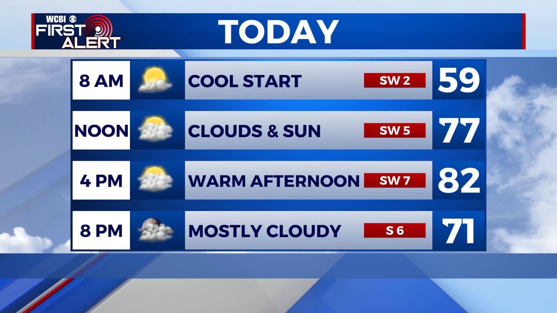
TUESDAY NIGHT: Mostly cloudy with some rain developing. Lows in the mid to upper 50s.
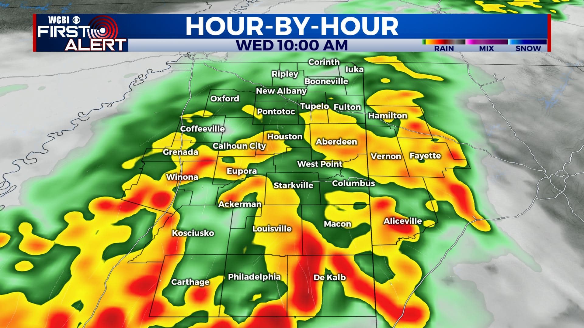
WEDNESDAY: Rain showers will be possible anytime on Wednesday. A rumble of thunder or two is even possible as our cold front pushes through. Highs will be much cooler in the upper 60s. The heaviest rain and stormy activity looks like it will be confined to areas south of I-20.
WEDNESDAY NIGHT: Mostly cloudy with some rain possible. Lows in the upper 40s.
THURSDAY: Mostly cloudy. A few early day showers could occur. Highs mid to upper 60s.
FRIDAY-SATURDAY: A mix of sun and clouds just a very slight chance of showers. Staying cool with highs mainly in the mid to upper 60s. Overnight lows in the 40s.
SUNDAY-MONDAY: More sunshine will return to the forecast as we end the weekend and start a new workweek. Highs in the upper 60s to near 70 degrees. Overnight lows in the 40s.
Stay connected with @WCBIWEATHER on Facebook, Twitter, Instagram, and the WCBI News App.


Leave a Reply