Quiet Friday, storms next week
SUMMARY: Reasonably quiet and dry weather is going to hold on through the end of the work week and the upcoming weekend. A big storm system is expected to affect the region Monday through Wednesday. Flooding rain and the chance of severe weather are back in the forecast for early next week.
THURSDAY NIGHT: Partly to mostly cloudy. An isolated sprinkle or flurry is possible. Lows around freezing. Light SW winds 2-5 mph.
FRIDAY: Sun & clouds. Cool highs in the mid 50s. A few isolated evening showers may occur. Winds WNW 10-15 mph.
FRIDAY NIGHT: Variably cloudy with the chance of a few isolated showers. Lows in the mid 30s.
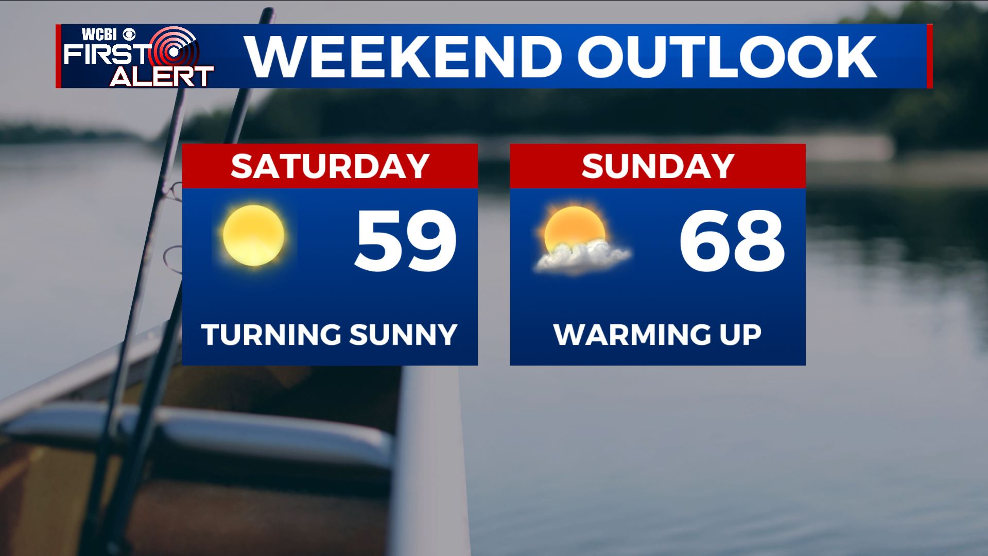
SATURDAY: Becoming mostly sunny. Highs in the upper 50s.
SATURDAY NIGHT: Mainly clear. Lows in the upper 30s.
SUNDAY: Partly cloudy and warmer. Highs in the upper 60s.
MONDAY: Mostly cloudy with a 50% chance of rain showers. Milder highs around 70.
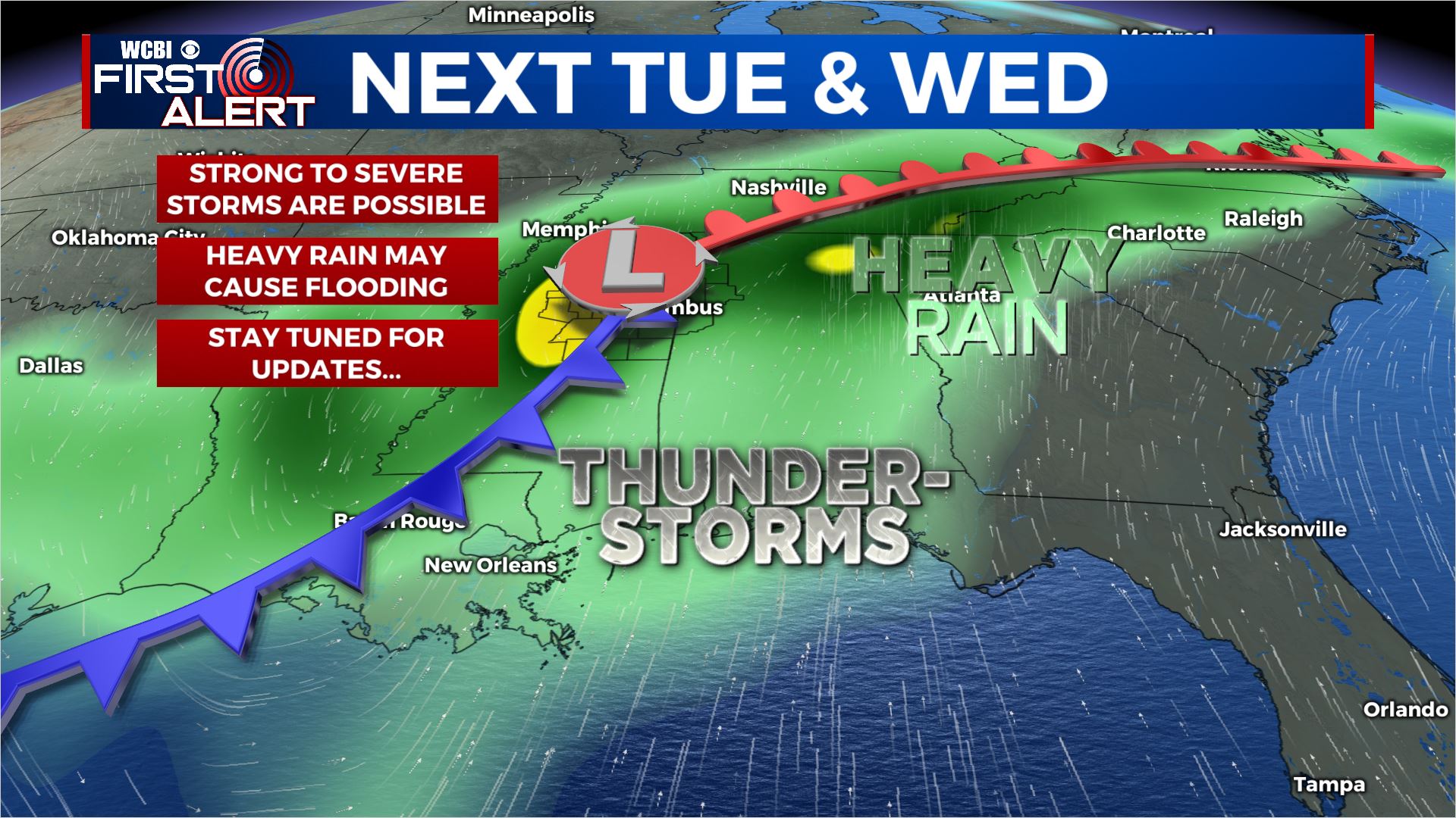
TUESDAY-WEDNESDAY: Rain and storms are likely. A batch of strong to severe storms is possible Tuesday night into Wednesday morning. All modes of severe weather remain possible so stay tuned for details. Total rainfall between Monday and Wednesday may end up being 2″ to over 5″ and that could easily cause more flooding issues around the region.
Stay connected with @WCBIWEATHER on Facebook, Twitter, Instagram, and the WCBI News App


Leave a Reply