Quiet & cooler weather to end the week; Stormy weather for Easter
SUMMARY: A strong cold front is pushing through this Thursday morning. Expect quiet & cooler weather Thursday afternoon through Saturday afternoon. Another storm system is expected to move through the region late Saturday into Sunday. Additional strong to severe storms and heavy rain may occur with that one so we’ll keep on watching it.
THURSDAY: A continuing chance of rain & storms, especially during the first half of the day. Partly sunny skies in the afternoon. Highs much cooler in the lower 70s. Breezy behind the front with a NW wind 10-20 mph.
THURSDAY NIGHT: Partly cloudy and chilly. Lows in the mid to upper 40s.
FRIDAY: A mix of sun & clouds. Cooler with highs in the 60s.
FRIDAY NIGHT: Chilly with a few clouds. Lows in the upper 30s to lower 40s.
SATURDAY: Increasing clouds. Some showers are possible late in the evening. Highs in the upper 60s to lower 70s.
SATURDAY NIGHT: Rain & storms possible. Lows in the mid to upper 50s.
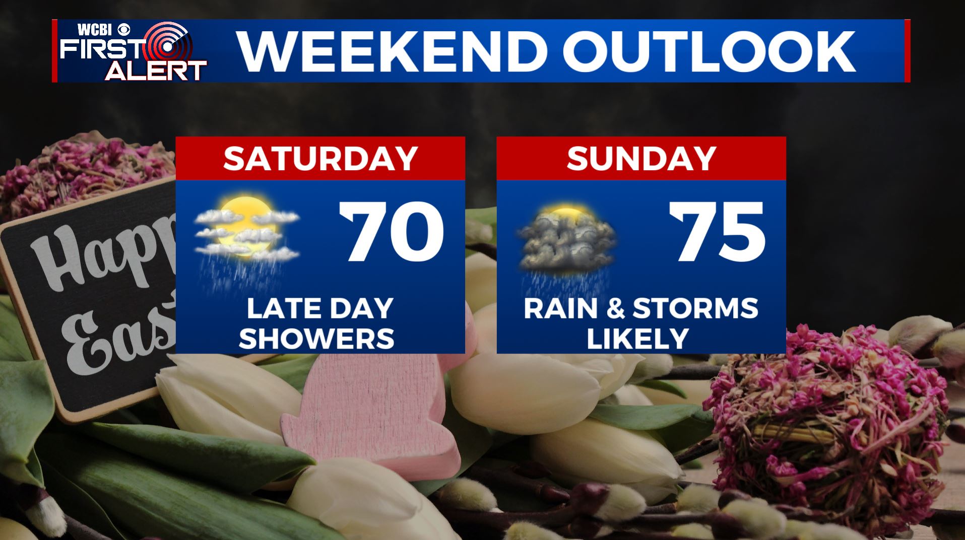
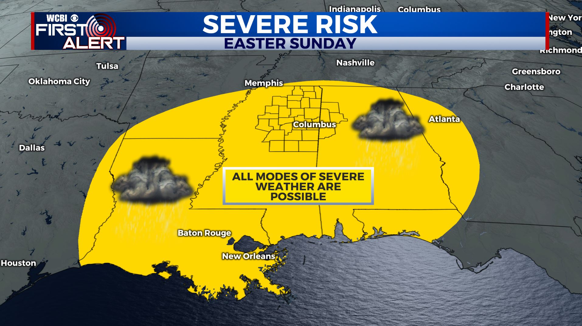
EASTER SUNDAY: Areas of rain and storms are likely as a strong storm system is forecast to move through. The risk for severe weather continues to increase across the Deep South. All modes of severe weather are likely including tornadoes, damaging winds & large hail. Something else we will need to continue to monitor heading into the weekend. Highs in the mid 70s.
EARLY NEXT WEEK: Drier and cooler weather moves in for Monday into Wednesday. Mostly sunny with highs only in the mid 60s to near 70 degrees.
Stay connected with @WCBIWEATHER on Facebook, Twitter, Instagram, and the WCBI News App


Leave a Reply