Rain and storm chances return Tuesday; Severe weather threat increases for Thursday
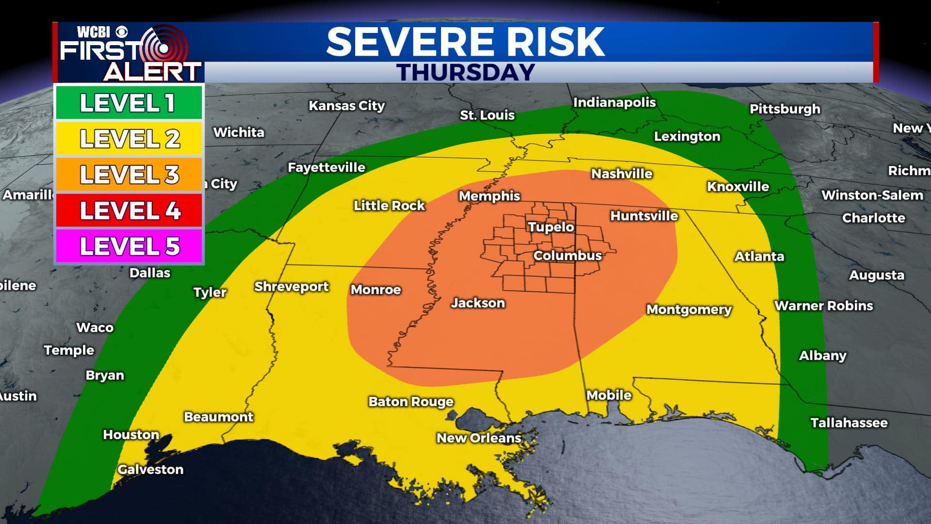
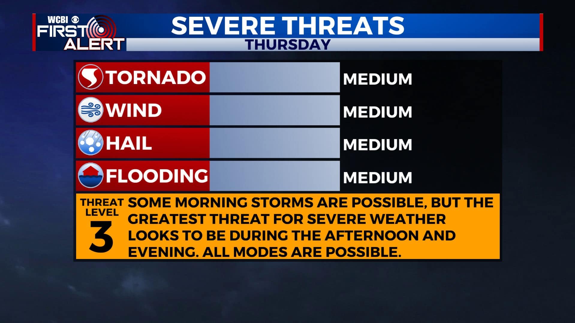
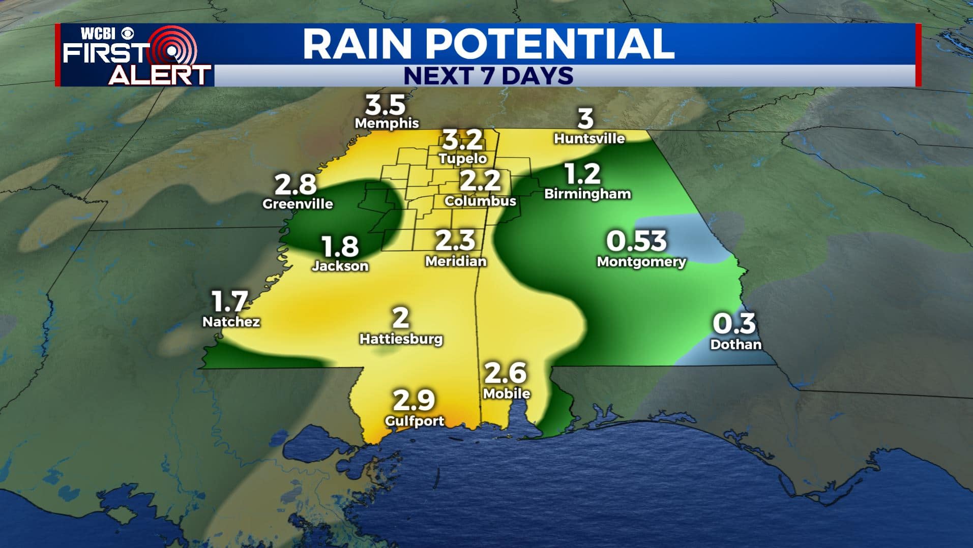
SUMMARY: Showers & storms return to the Deep South today. The severe weather threat will mainly stay to our south and west through Wednesday. Severe weather threat continues to increase for Thursday as now we are under a Level 3 Risk with all modes possible, especially Thursday afternoon and evening. Heavy rain will also be a concern late Wednesday, Wednesday night and Thursday that could lead to flooding. Stay tuned!
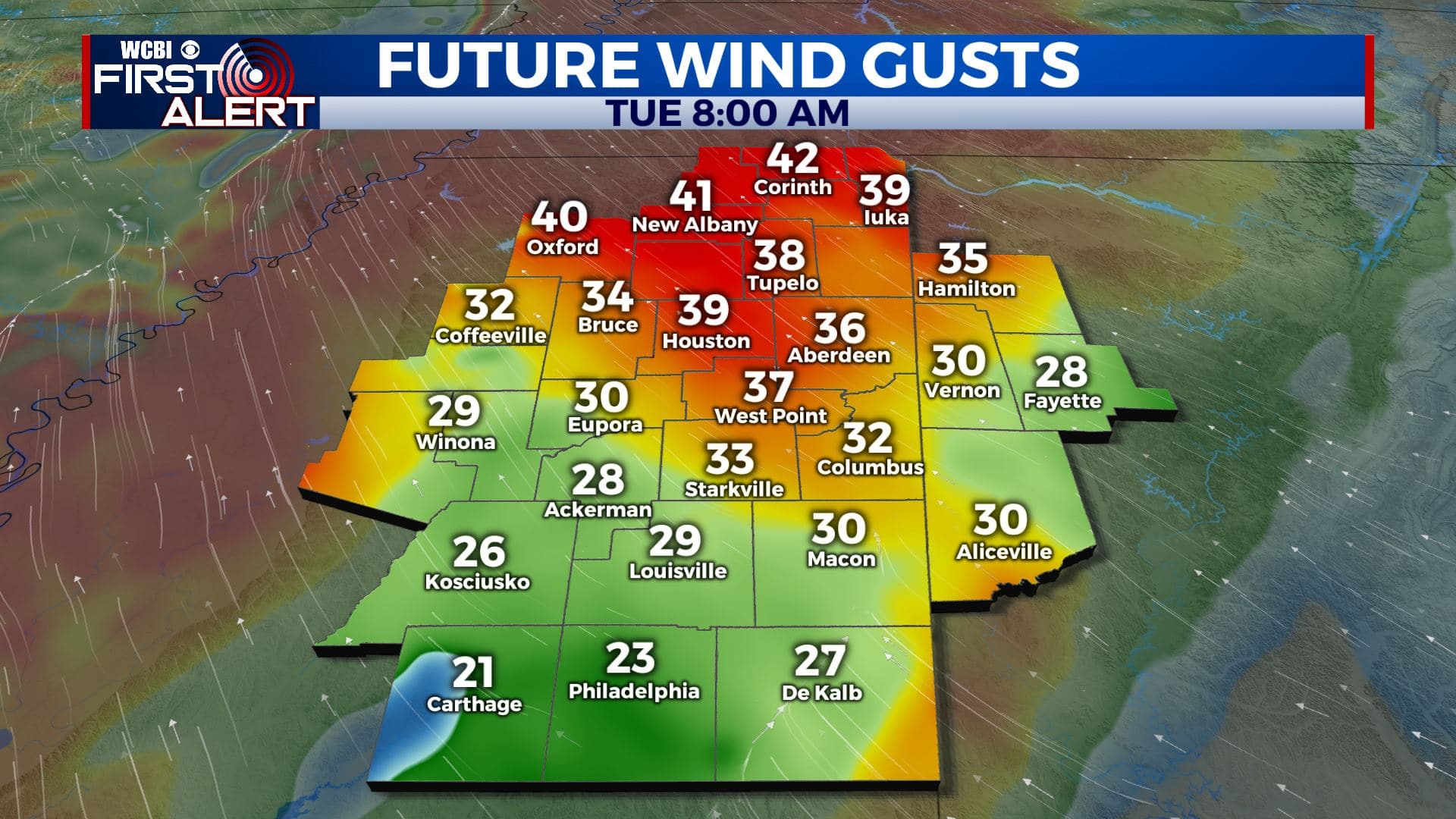
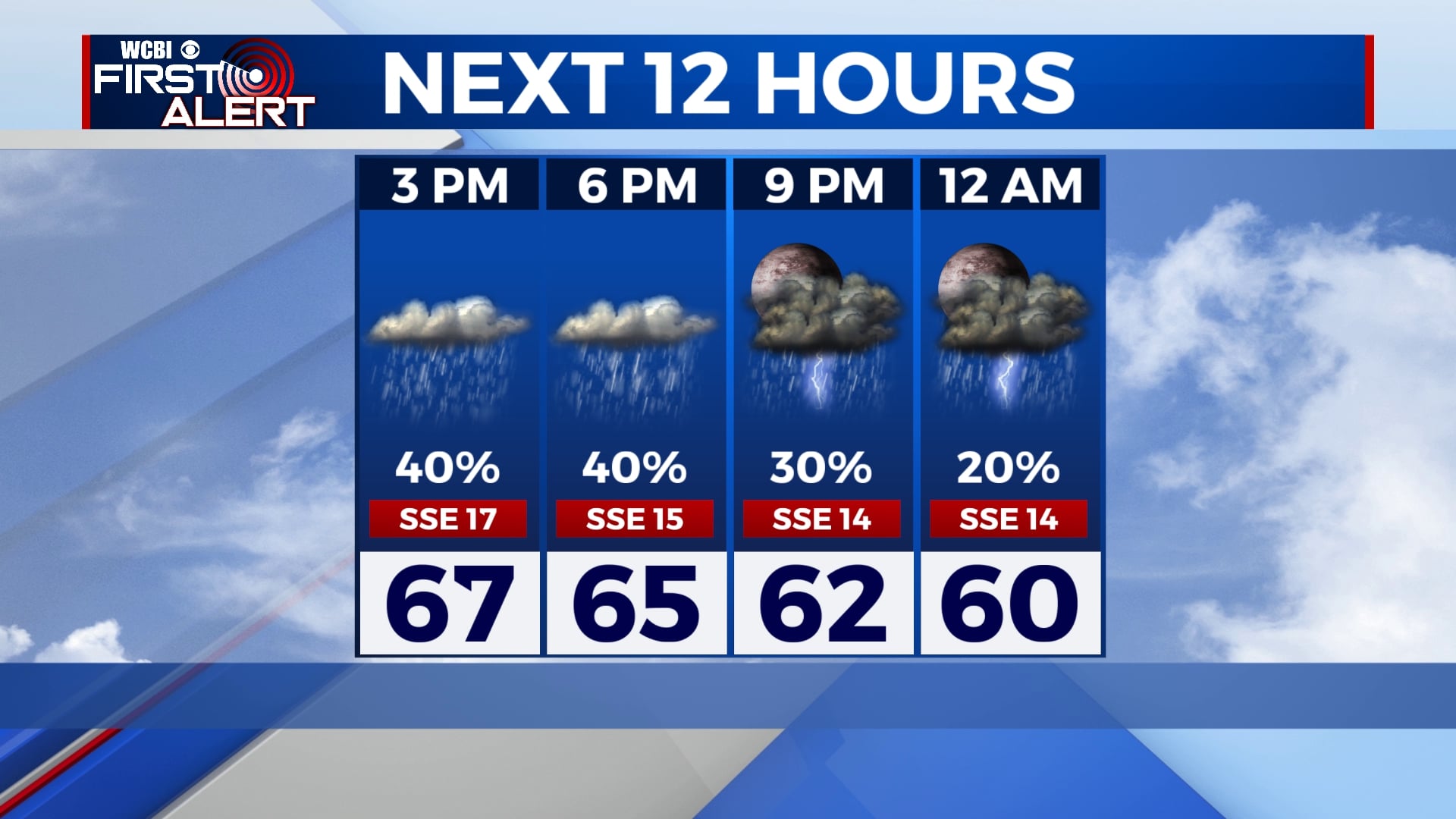
TUESDAY: Mostly cloudy with a chance of rain and storms. While some gusty winds are possible during the day even outside of any shower or storm, the highest odds of severe weather will be to the south of us. Winds SE 15-25 mph with gusts over 35 mph possible. A Wind Advisory is in effect for our far northwestern and western counties.
TUESDAY NIGHT: Mostly cloudy and quiet. Lows in the mid 50s.
WEDNESDAY: Cloudy skies and seasonably mild for most of the day with highs in the 70s. Odds of rain and storms will go up by late afternoon and evening.
WEDNESDAY NIGHT: Areas of rain and storms. Some severe weather could occur as a warm front pushes from south to north across the region. Locally heavy rain may also develop.
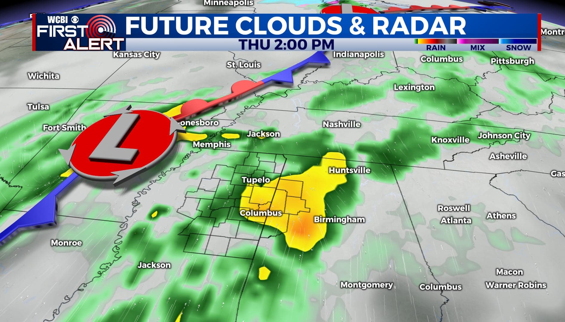
THURSDAY: Warm and humid with a likely chance of rain and storms during the day. Some storms may become severe with large hail, damaging wind gusts, isolated tornadoes, and heavy rainfall. The heaviest activity looks like it will be during the afternoon and evening hours.
THURSDAY NIGHT: Rain and storms exit by midnight or shortly thereafter. Cooler low 50s settle in by sunrise Friday.
FRIDAY: A mix of sun and clouds. Highs in the low to mid 70s. Low 50s for lows Friday night.
SATURDAY: Warm highs in the mid to upper 70s. More rain and storms could develop during the afternoon and evening hours. Lows around 60 Saturday night.
SUNDAY: Cooler highs in the upper 60s. Some rain and clouds may linger.
Stay connected with @WCBIWEATHER on Facebook, Twitter, Instagram, and the WCBI News App


Leave a Reply