Rain chances are coming back
SUMMARY: Nice weather will hold for Wednesday and most of Thursday. Rain and a few storms are likely Friday and Friday night but most of the weekend is going to be pretty good. We’re closely monitoring the potential for a weather system during the middle of next week that, if it develops, could have some risk for strong storms somewhere in the region.
TUESDAY NIGHT: Clear, calm, and chilly. Lows in the upper 30s.
WEDNESDAY: Mostly sunny to partly cloudy. Continued mild with highs in the mid to upper 60s. Winds SE 5-10 mph.
WEDNESDAY NIGHT: Variably cloudy. Lows in the 40s.
THURSDAY: Partly to mostly cloudy. Some showers are possible but the chance of rain is just 20%. Look for milder highs around 70.
THURSDAY NIGHT: Mostly cloudy with the chance of showers. Lows in the 50s.
FRIDAY: Areas of rain and storms will develop with some locally heavy rain possible. A strong storm or two can’t be ruled out but no widespread severe weather is expected at this time. Highs should still top out in near 70.
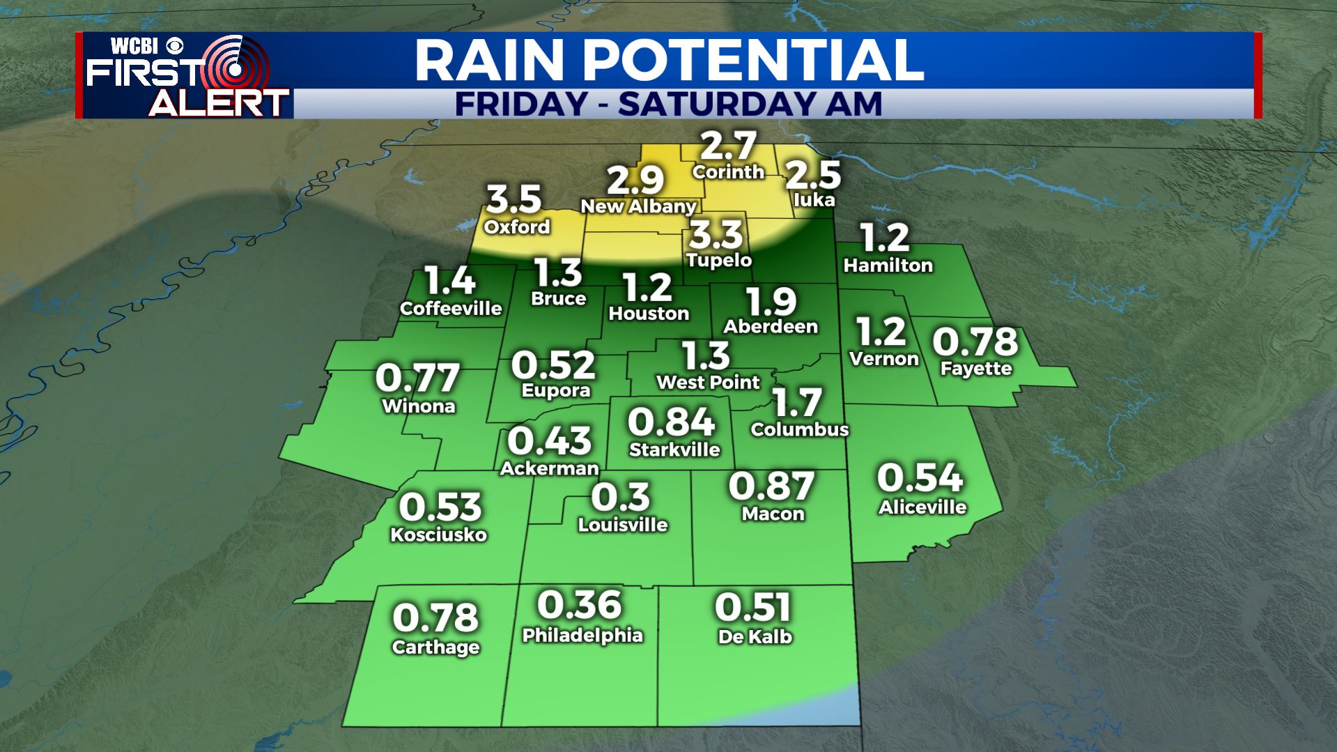
FRIDAY NIGHT: Rain showers continue. Lows in the 40s to low 50s.
SATURDAY: Morning clouds and showers will give way to clearing as the day wears on. Highs should remain in the 50s.
SATURDAY NIGHT: Mainly clear and cold. Lows near freezing.
SUNDAY: Sunny & seasonable. Highs in the upper 50s.
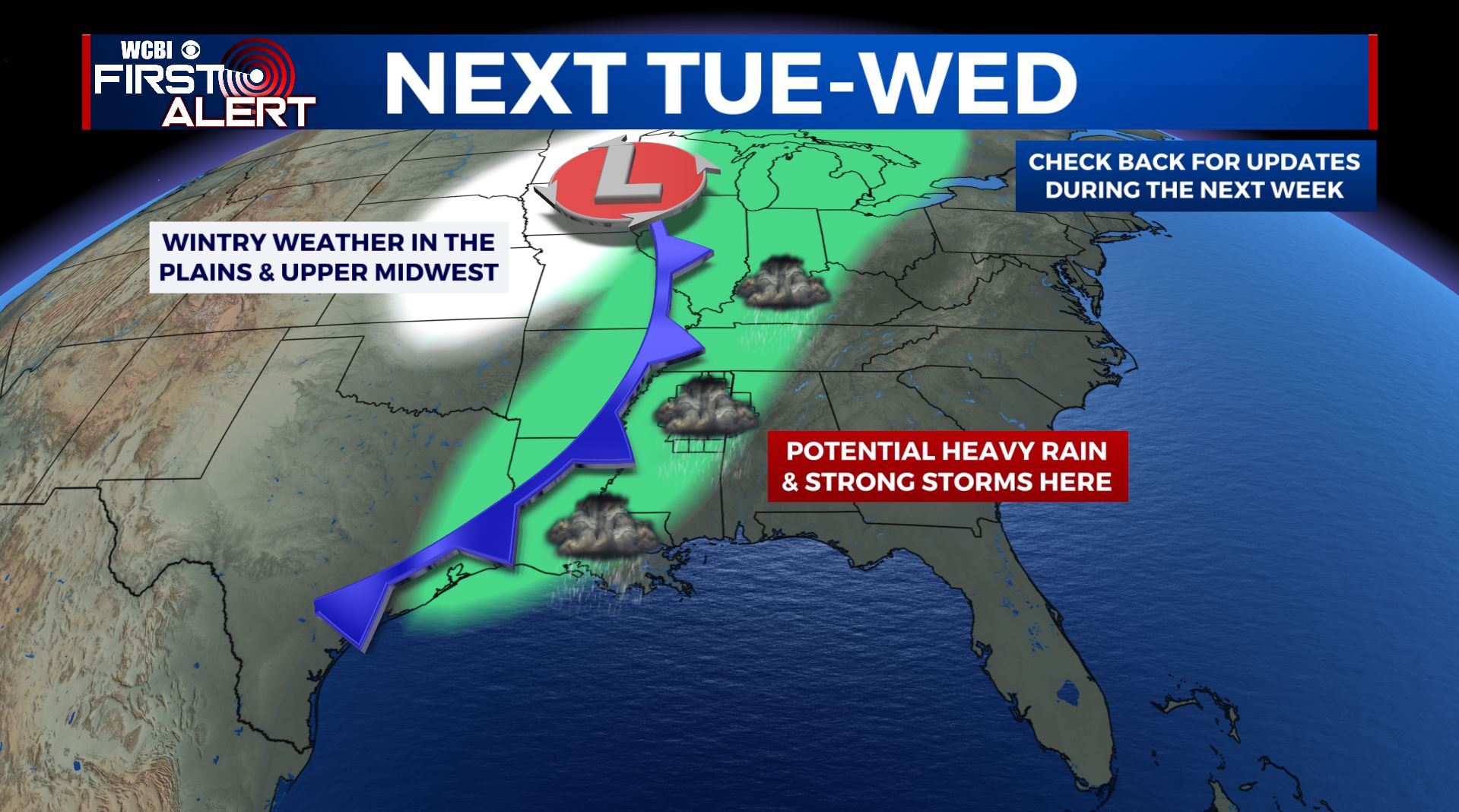
NEXT WEEK: Both the American GFS model and the European ECMWF model suggest that a potential storm system could develop in the Central Plains by Tuesday or Wednesday. The end result for us here in Mississippi and Alabama would be a batch of strong to severe storms out ahead of a cold front… assuming this actually develops. Your best bet now is to just stay with us here at WCBI for updates on things once we get into the upcoming weekend.
Follow @WCBIWEATHER on Facebook, Twitter, Instagram, and the WCBI News App


Leave a Reply