Rain chances for your Friday; A beautiful holiday weekend ahead
SUMMARY: Showers and storms for our Friday as a cold front pushes through. The long holiday weekend is looking great, pretty nice & dry. Heat and humidity quickly returns to start next week, with a typical summertime pattern returning. We’ll also be keeping an eye on the tropics.
FRIDAY: Rumor has it that a BIG celebration is taking place in Starkville today! It is a rainy start to our Friday as our cold front is about to push through. A widespread chance of showers and storms with cloudy skies.Should be out of here by this evening’s festivities for our MSU Bulldogs! Temperatures only in the mid 80s Winds SW changing to the NW behind the front 5-10 mph.
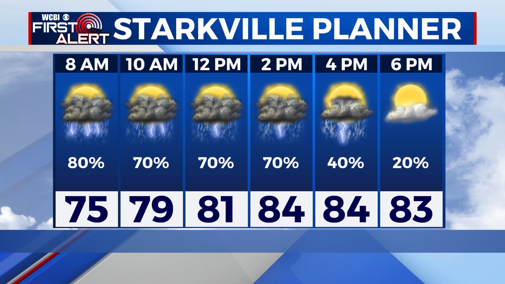
FRIDAY NIGHT: Clearing skies. Lows in the mid 60s.
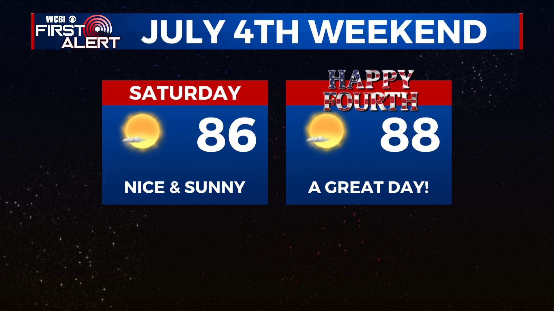
SATURDAY: Mostly sunny and much less humid for a change. Highs in the mid to upper 80s.
SATURDAY NIGHT: Clear and quiet. Lows in the low 60s.
4TH OF JULY: Mostly sunny. Warm. Highs in the upper 80s.
MONDAY: Humidity and heat returns as we start the new workweek. Highs will be rising back up to upper 80s to lower 90s.
TUESDAY-THURSDAY: Warm and muggy. Highs in the upper 80s to lower 90s. Scattered storm chances return for Tuesday. We’ll be watching the tropics closely next week to see where what Tropical Storm Elsa will go. Stay tuned!
Stay connected with @WCBIWEATHER on Facebook, Twitter, Instagram and the WCBI News App


Leave a Reply