Rain chances returning as we end the workweek
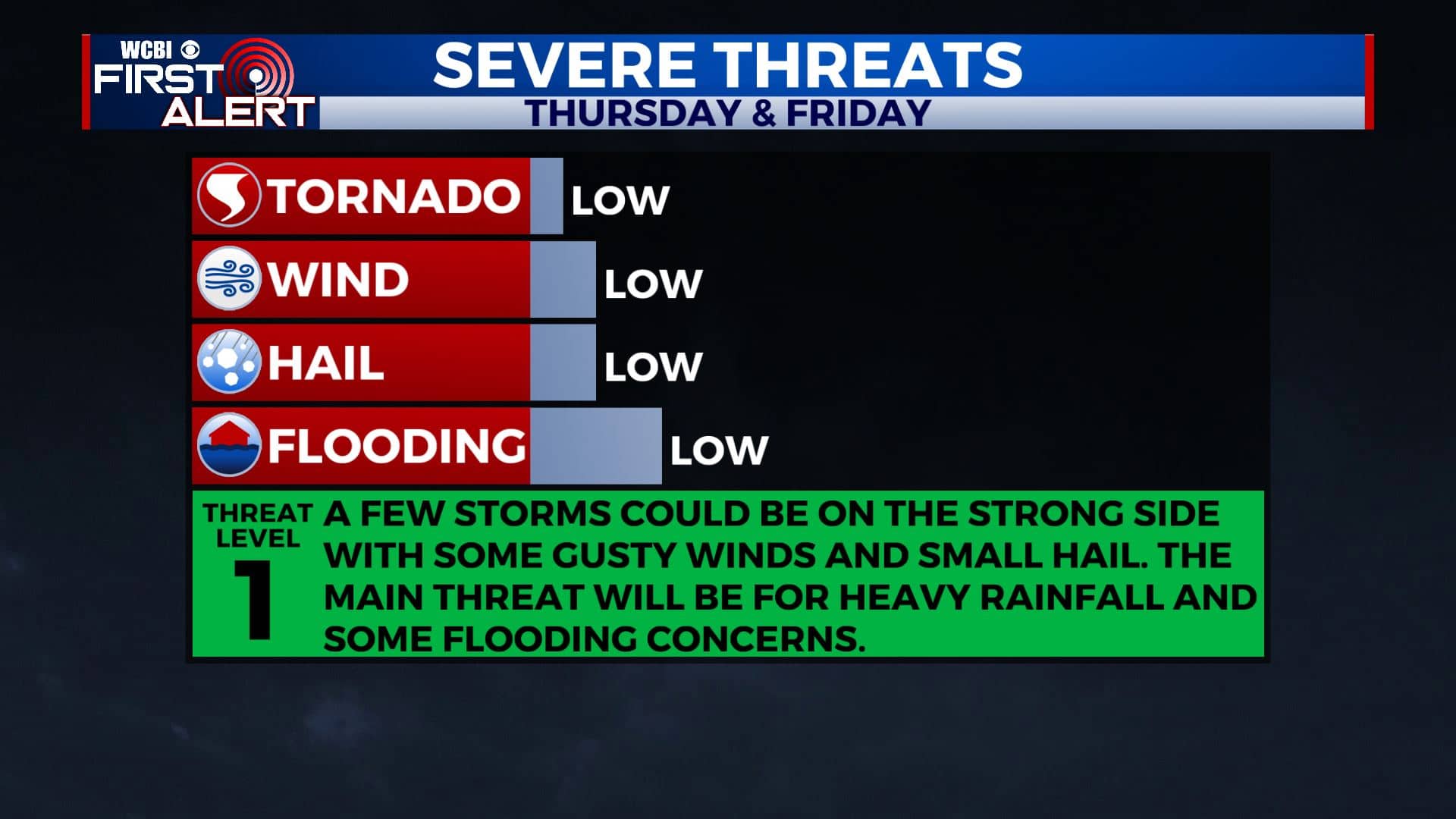
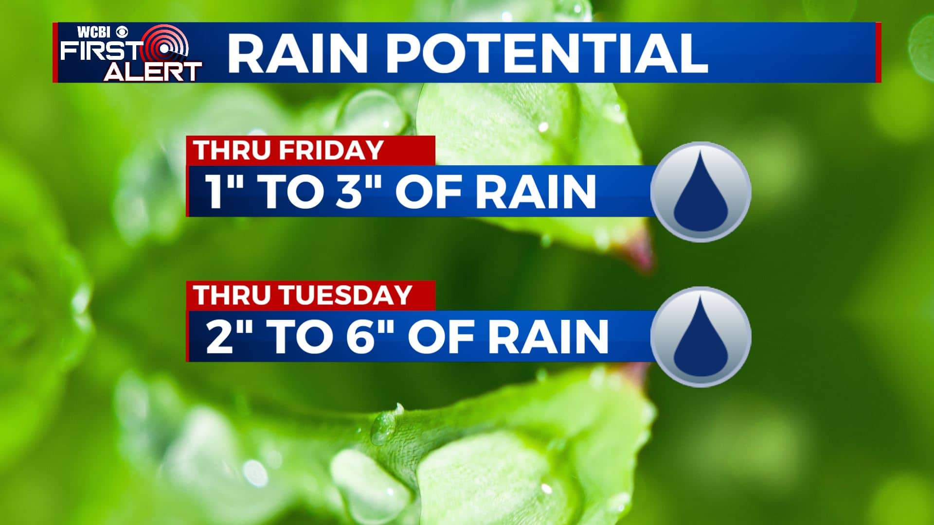
SUMMARY: Rain chances are back! We will be receiving multiple rounds as we head into the weekend and early next week. Heavy rain is possible Thursday night into Friday. Some thunderstorms with gusty winds are possible at times but no widespread severe weather is expected. Anywhere from 2″ to over 6″ could fall across the region and it may lead to some flooding concerns. Stay tuned!
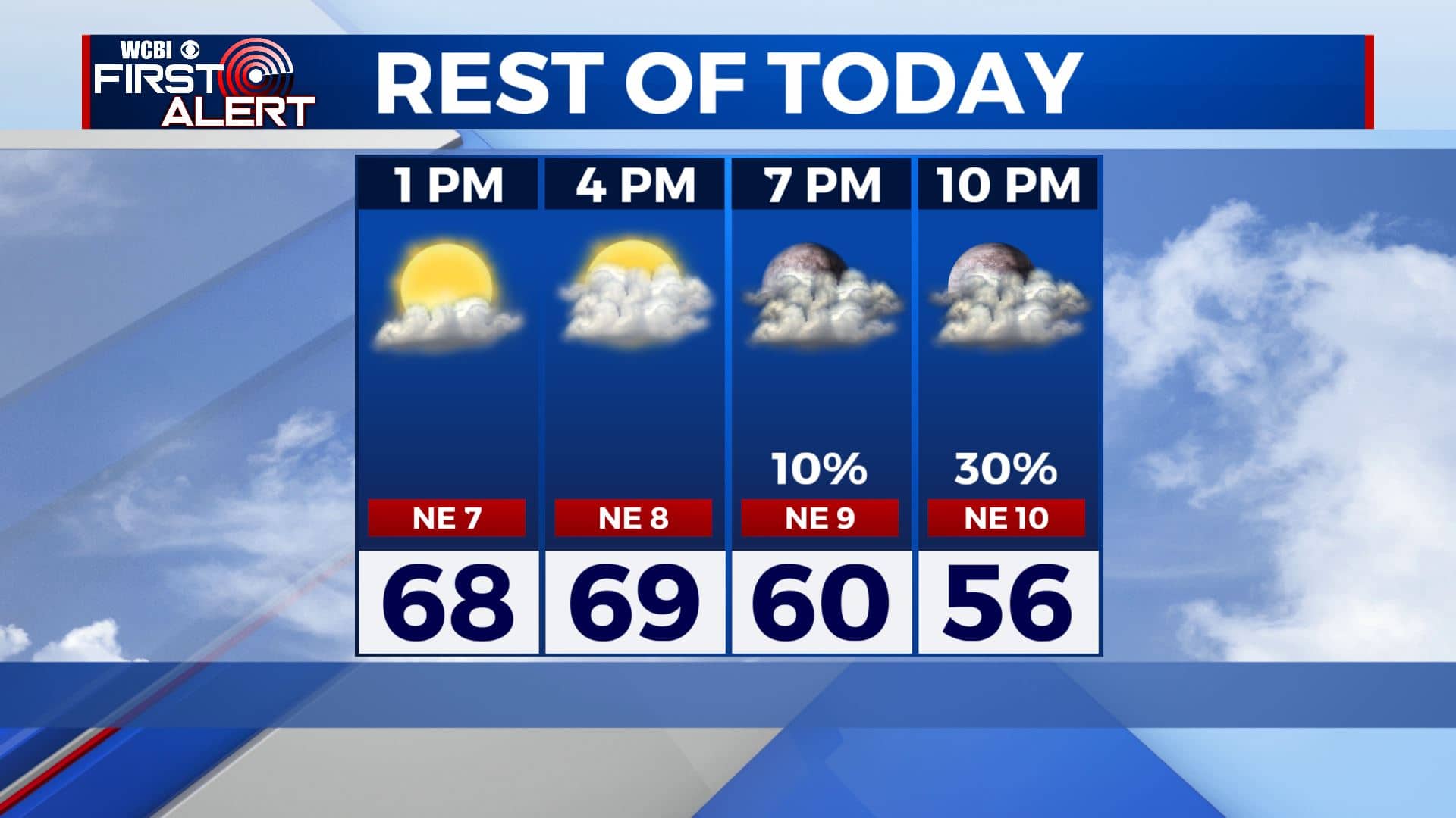
THURSDAY: A mix of clouds & sun throughout the day with a chance of late evening showers. Highs in the low to mid 60s in most spots. Winds N 10-15 mph.
THURSDAY NIGHT: Areas of rain are likely through Friday morning. A few rumbles of thunder, some gusty winds and small hail are possible in stronger storms. Overnight lows in the 40s.
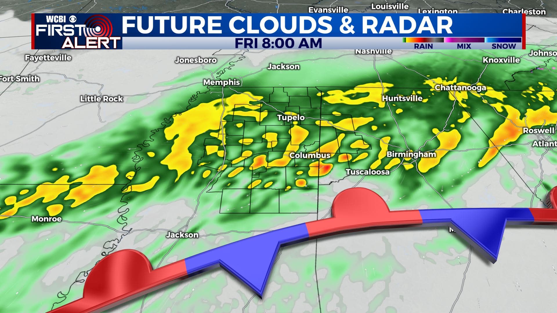
FRIDAY: Areas of rain, some locally heavy. Total rainfall by the end of the day in the 1-3″ range. Highs a few degrees cooler, but still near average in the upper 50s to near 60 degrees.
SATURDAY: Mostly cloudy with a chance of rain. Maybe a few rumbles of thunder. Highs in the upper 60s.
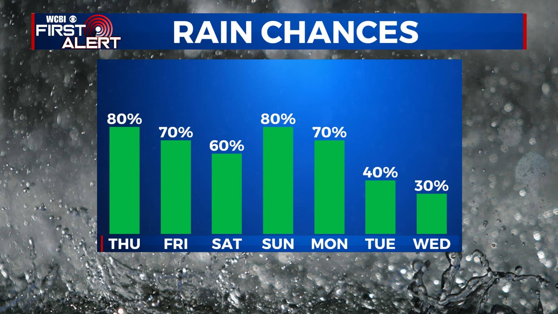
SUNDAY: Mostly cloudy. Showers and storms likely. Highs in the lower to mid 70s.
MONDAY – TUESDAY: Mostly cloudy. Areas of rain will remain possible. Highs in the lower 60s.
Stay connected with @WCBIWEATHER on Facebook, Twitter, Instagram, and the WCBI News App


Leave a Reply