Rain chances still linger as we begin a new workweek
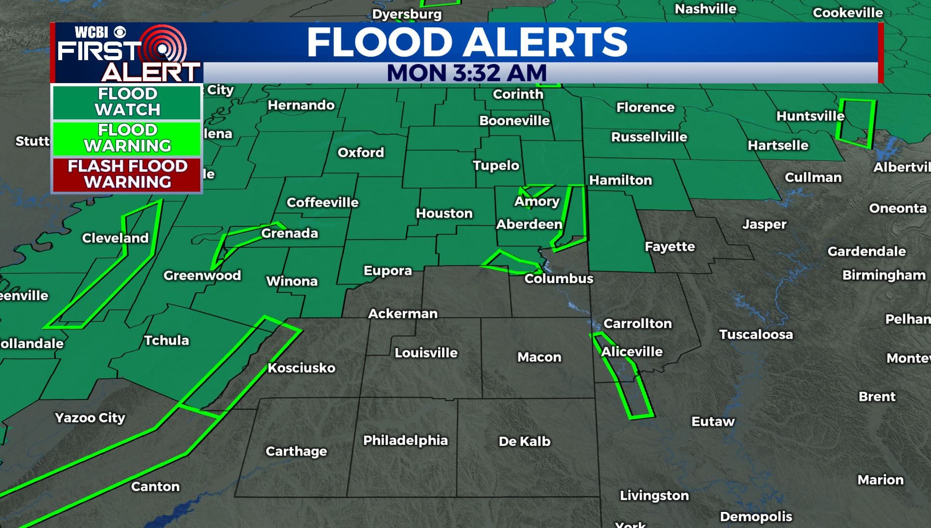
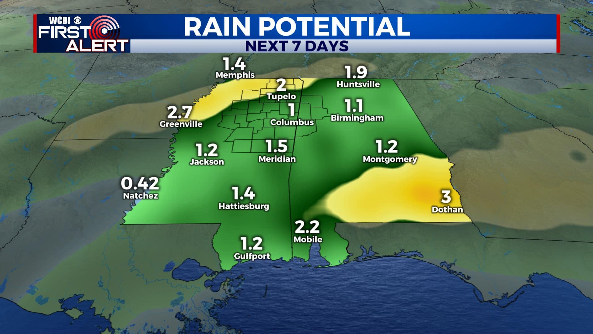
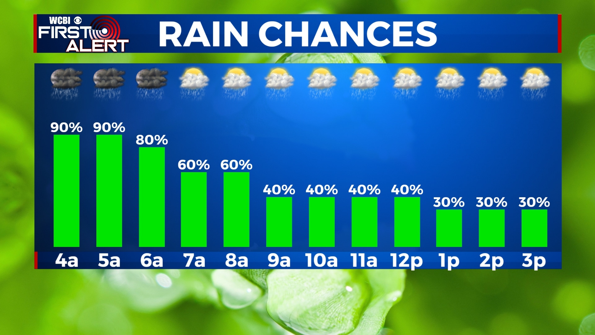
SUMMARY: After showers & storms Sunday night, rain & shower chances will continue to linger as we begin a new workweek, along with much cooler temperatures behind a cold front. Flood Watches and Flood Warnings remain in effect as we could get an additional 1-2″ that could cause some flooding issues, especially near creeks and rivers. Temperatures will go back up to near average with much drier conditions by the end of the week and into the weekend.
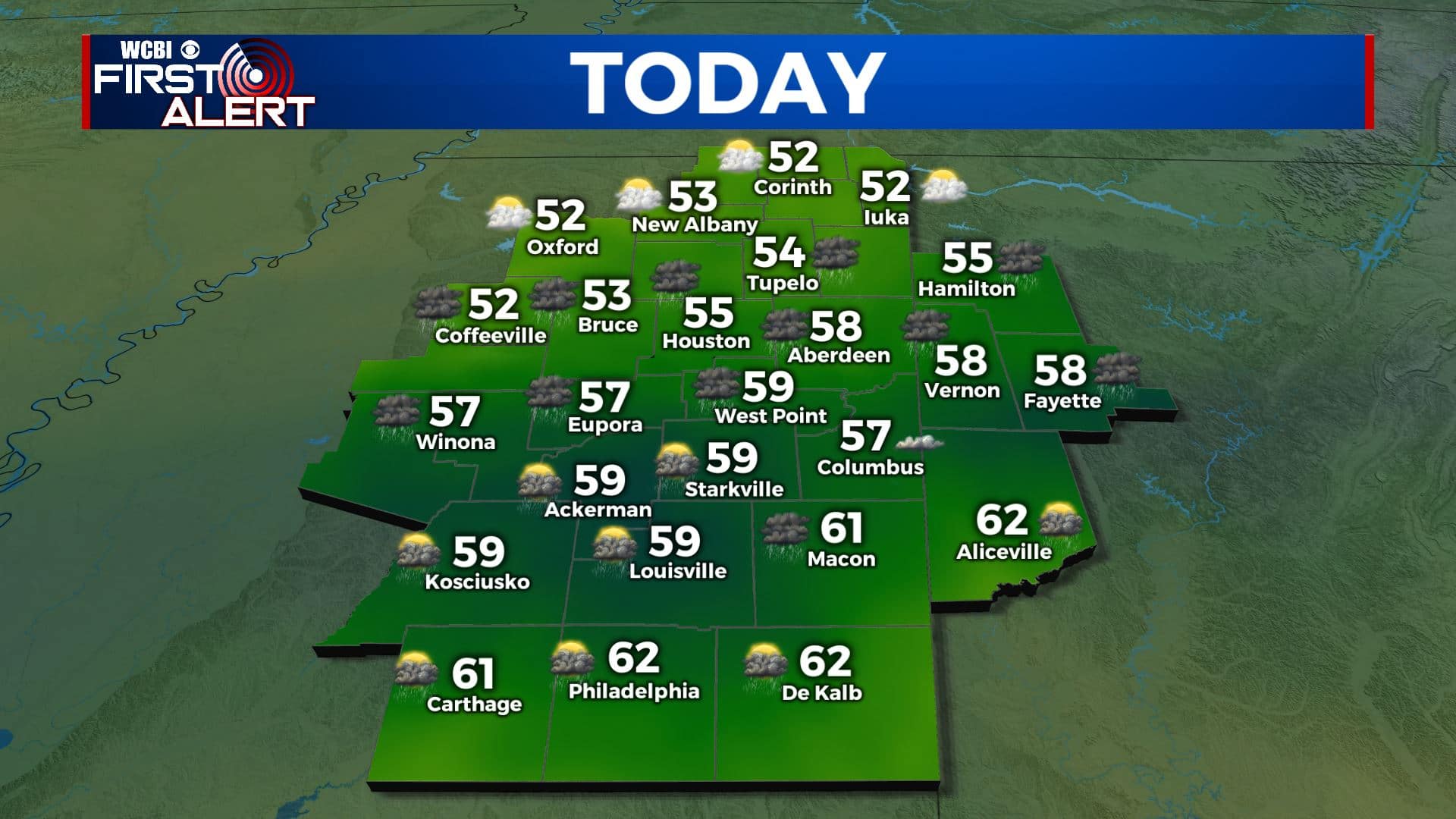
MONDAY: Mostly cloudy as rain chances will be slowly decreasing throughout the day, but keep the umbrella and rain gear handy as chances will still linger. Highs much cooler and back down to below average behind a cold front in the mid 50s. Winds N 5-15 mph.
MONDAY NIGHT: Cloudy skies with a chance of showers. Overnight lows near 40.
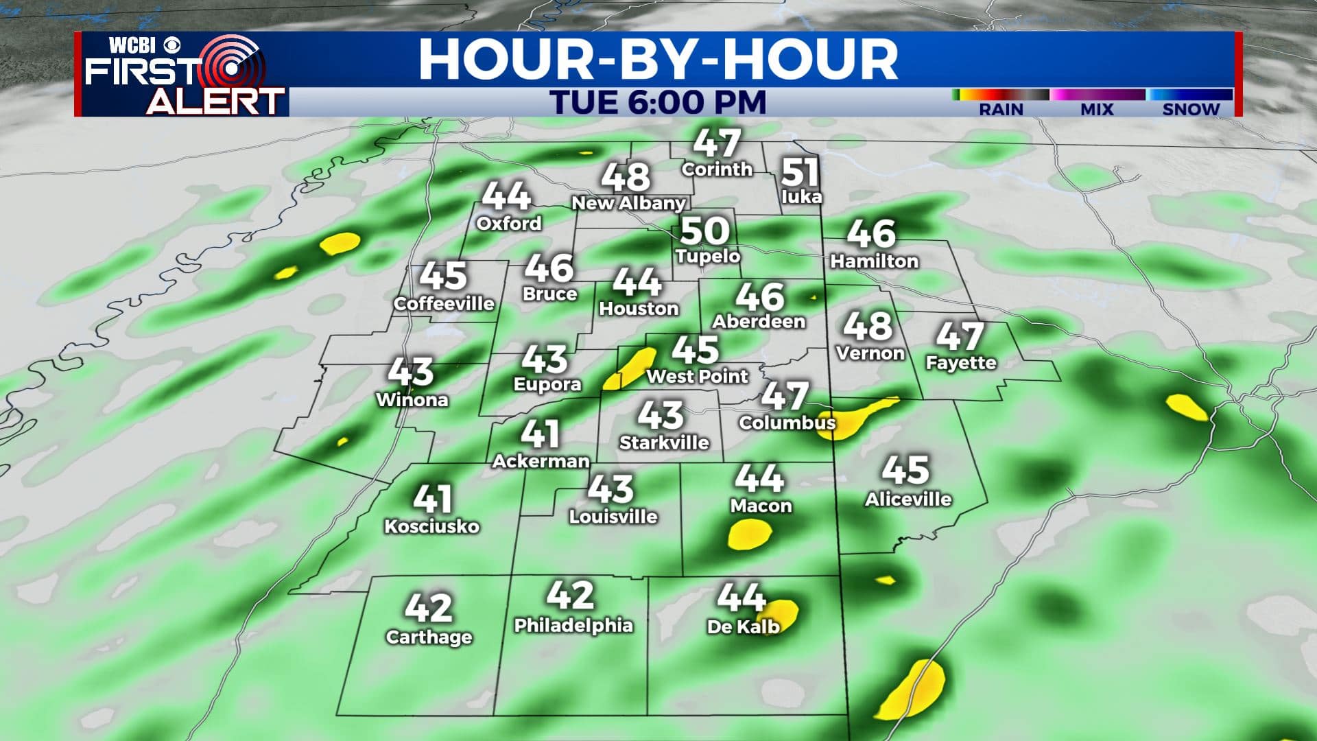
TUESDAY: Rain showers and cloudy skies are still likely on with cooler high temperatures in the upper 40s to lower 50s.
TUESDAY NIGHT: Mostly cloudy skies overnight as the last of our rain chances finally move out. Overnight lows in the upper 30s.
WEDNESDAY-THURSDAY: Temperatures will warm back up to near average midweek with highs in the lower to mid 60s with a mix of sun and clouds as we finally dry out. Mostly clear skies overnight with lows in the upper 30s.
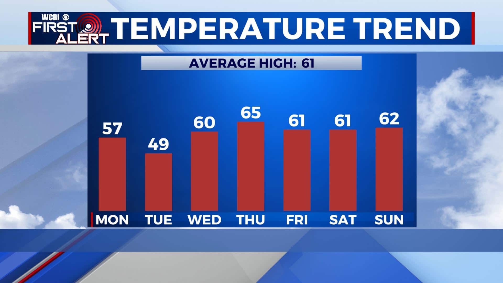
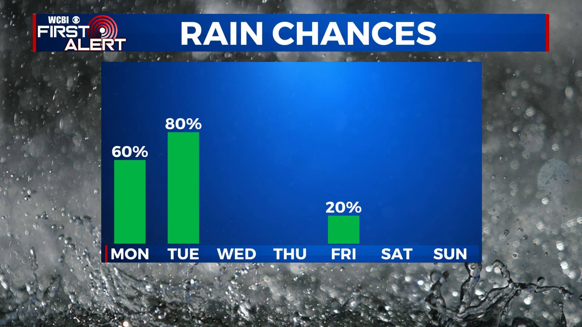
FRIDAY: There’s a slight chance of rain for Friday, but we’ll mostly stay dry with a mix of sun and clouds. High temperatures remain in the lower 60s with overnight lows in the upper 30s.
WEEKEND: Looks like both Saturday & Sunday will be quiet & seasonable. A few clouds on Saturday followed by mostly sunny skies on Sunday. Highs in the lower 60s with overnight lows in the mid to upper 30s.
Stay connected with @WCBIWEATHER on Facebook, Twitter, Instagram, and the WCBI News App


Leave a Reply