Rain moving in for Wednesday
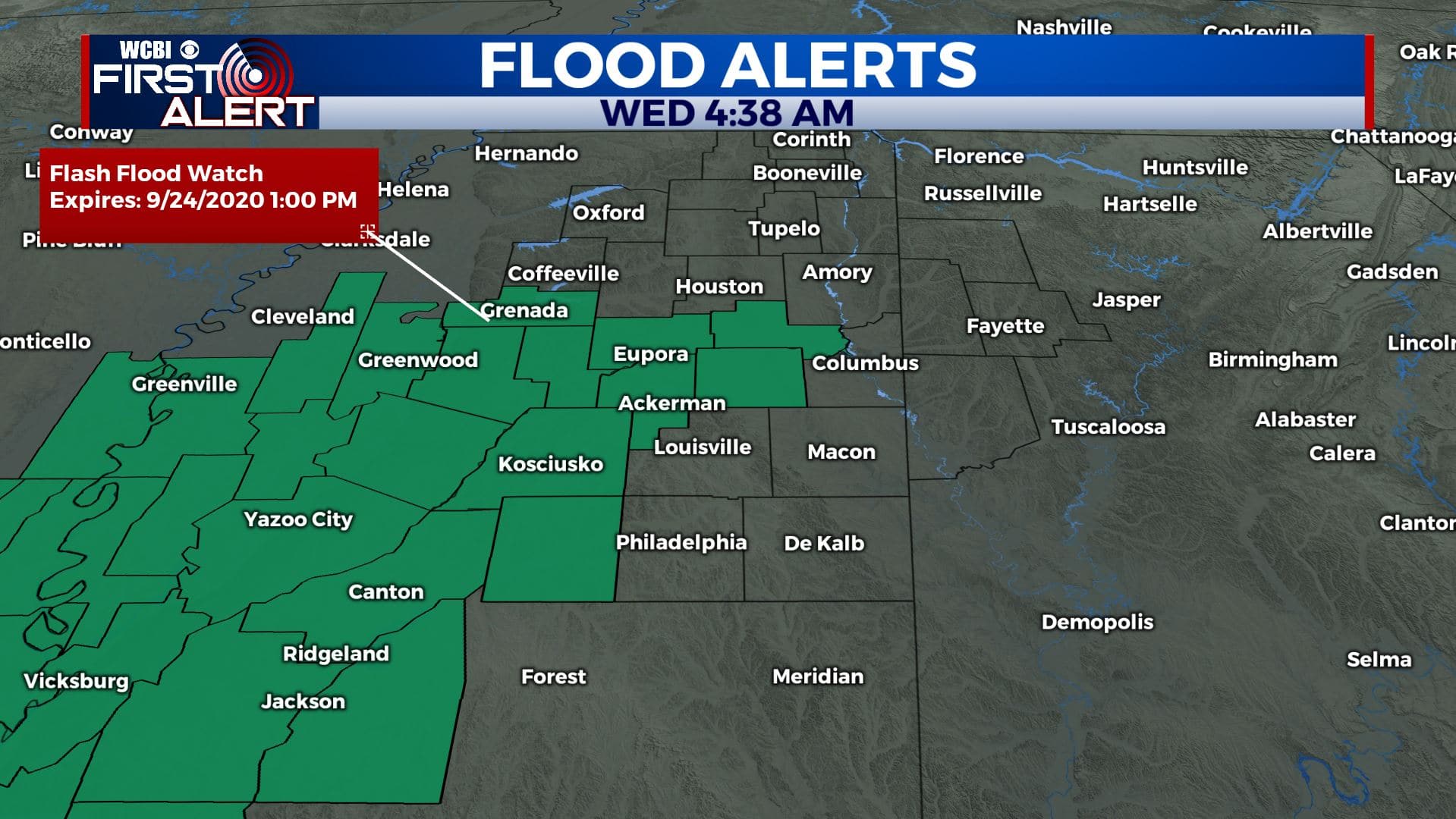
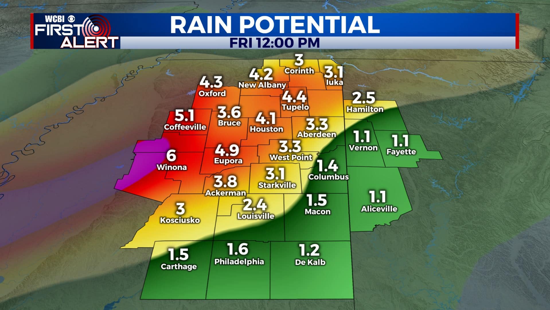
SUMMARY: The remnants of Tropical Storm Beta will move through the region over the next two days. A Flash Flood Watch is in effect for Grenada, Carroll, Montgomery, Webster, Clay, Choctaw, Oktibbeha and Attala Counties until 1pm Thursday. Recent model data suggest that between 1″ and 3″ of rain could fall before the end of the week. Some areas could get up to 4-6″ of rain. Rain chances lower dramatically Friday through the weekend as temperatures return to the 80s.
WEDNESDAY: Rain is already moving in this morning and will become more widespread by the afternoon. The cloud cover will help keep highs ranging from the upper 60s to lower 70s. Winds ENE 5-15 mph.

WEDNESDAY NIGHT: Cloudy skies with areas of showers likely as more widespread heavier rain moves in. Overnight lows in near 60.
THURSDAY: Cloudy skies with widespread rain likely. Rain could be heavy at times. High temperatures from the upper 60s to lower 70s.
THURSDAY NIGHT: Cloudy with lingering showers. Overnight lows in the 60s.
FRIDAY: Cloudy skies to start with some breaks developing. A few showers are possible but the rain chance lowers as the remnants of Beta move away. Weather for high school football is looking mainly dry at this point.
WEEKEND: A mix of sun & clouds. A few isolated showers or storms can’t be ruled out. Highs look to climb back into the mid 80s and that’s about where we should be this time of year.
Stay connected with @WCBIWEATHER on Facebook, Twitter, Instagram, and the WCBI News App


Leave a Reply