More rain & storms Friday
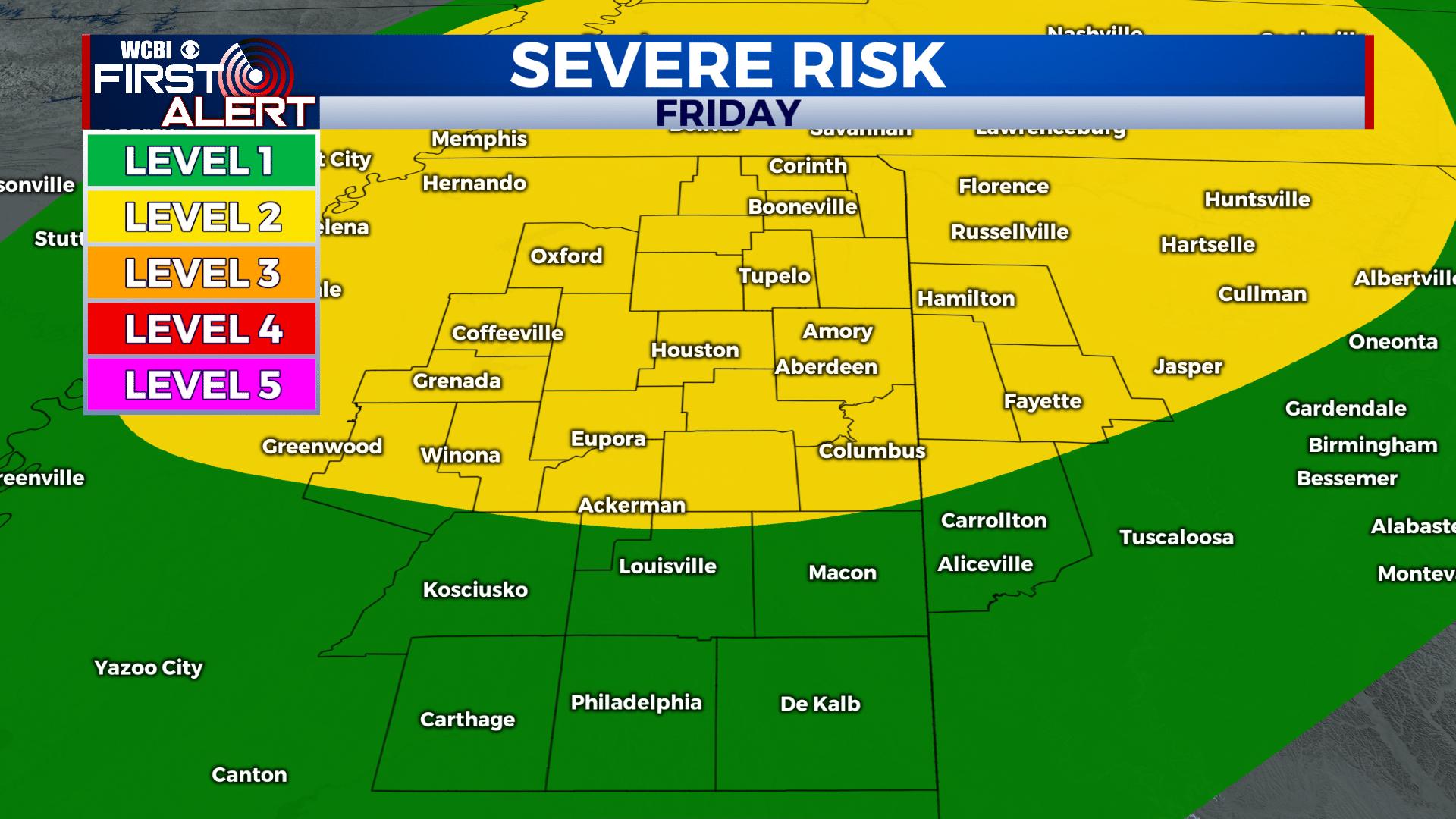
SUMMARY: The remnants of Laura will continue to spiral across the region through Friday night. A low end tornado threat will continue to be present into Friday evening. Locally heavy rainfall may also occur with the highest odds of flooding across the northern tier of Mississippi into Tennessee.
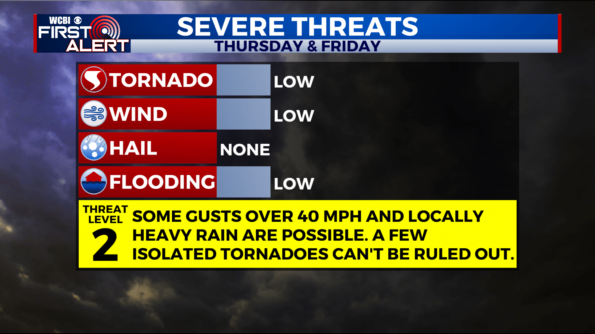
THURSDAY NIGHT: Mostly cloudy with a chance of a few showers and storms. The threat of an isolated tornado is low but not zero. Lows in the mid 70s with SSE winds 10-25 mph. Some higher gusts could occur.
FRIDAY: Areas of rain and storms will develop. Some storms may become strong to severe with damaging wind gusts and isolated tornadoes. Highs in the mid to upper 80s. Winds SSW 10-25 mph with higher gusts possible.
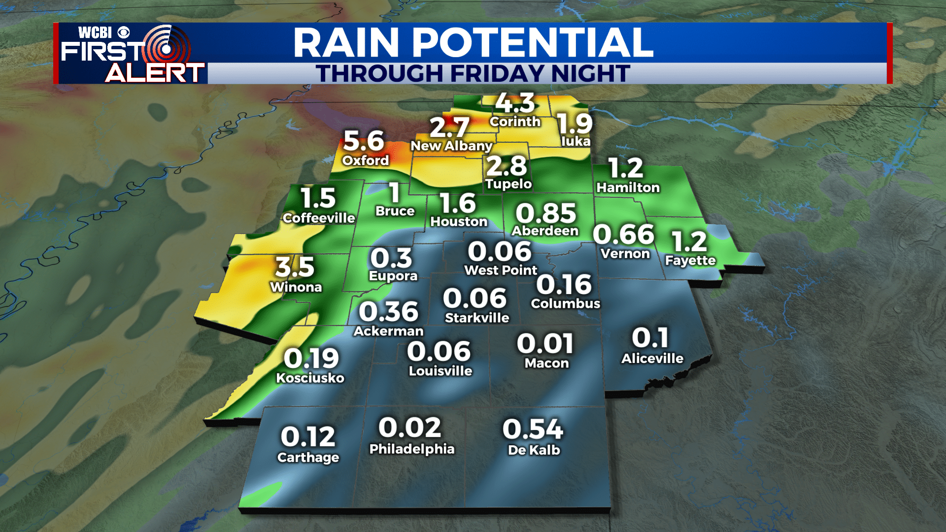
FRIDAY NIGHT: Lingering rain will gradually taper off. The severe threat will come to an end. Lows in the mid 70s.
SATURDAY: Variably cloudy and not as active. Some showers and storms are possible but we are lowering rain chances to 40%.
SUNDAY-WEDNESDAY: Scattered showers and storms are possible each day. Highs in the upper 80s and lows in the 70s.


Leave a Reply