Rain & storms tonight & Wednesday morning
SUMMARY: Rain and storms will be possible tonight and Wednesday morning with a cold front moving across the region. The strongest cells could contain hail and gusty winds in addition to heavy rain. The tornado threat is low but we’ll watch it. Quiet weather builds back in Thursday and it’ll continue through Easter weekend.
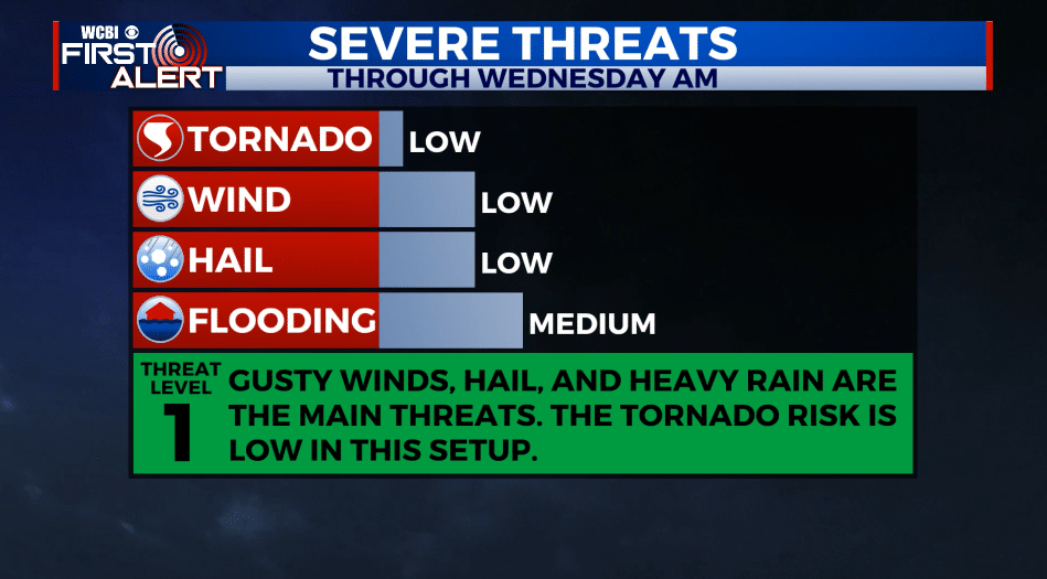
TUESDAY NIGHT: Rain and storms. Some could be locally strong or severe with gusty winds and hail. Locally heavy rain is also possible. Temperatures hold in the 60s all night long with southerly winds about 10 mph.
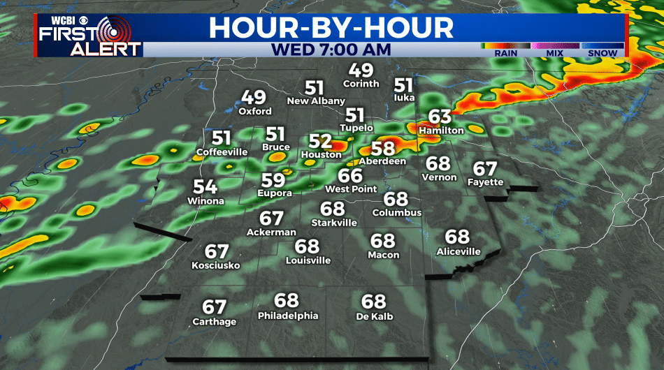
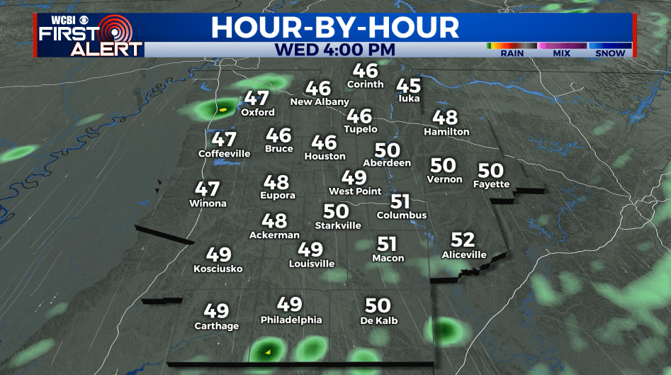
WEDNESDAY: Rain and storms mainly during the morning with drier conditions returning by the afternoon. Highs in the 60s early with afternoon temperatures tumbling back into the 50s and 40s. Strong NW winds develop between 15 and 25 mph. Some gusts could be over 30 mph. Total rainfall will range from 1/2” to over 2” with this system.
WEDNESDAY NIGHT: Clearing skies, breezy, and much colder. Lows in the mid to low 30s. Some patchy frost is possible in any spot that is sheltered from the wind.
THURSDAY: Sunny and cool. Still breezy with NW winds 10-25 mph. Highs only in the mid 50s.
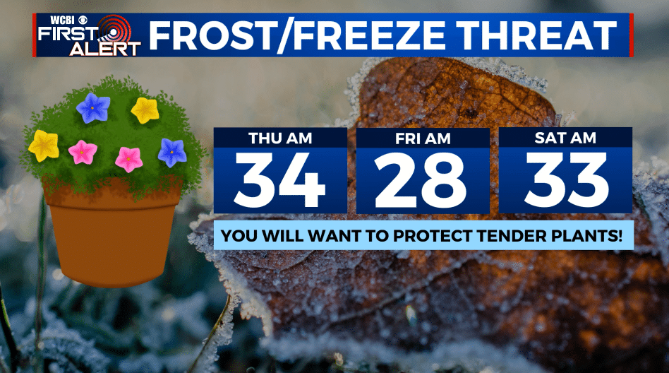
THURSDAY NIGHT: A widespread freeze is expected with lows in the upper 20s. Cover any tender plants you care about. Nearly calm winds.
FRIDAY: Sunny and cool. Highs in the upper 50s.
FRIDAY NIGHT: Clear and chilly. Lows in the mid to low 30s. Areas of frost are possible again.
SATURDAY: Mostly sunny. Highs in the mid 60s. Low 40s Saturday night.
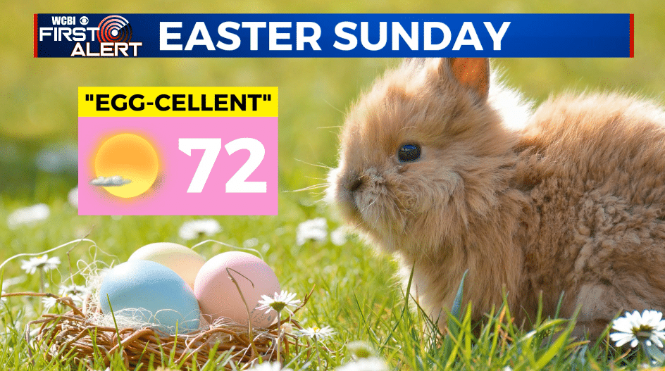
EASTER SUNDAY: Mostly sunny. Highs in the low 70s.
Follow @WCBIWEATHER on Facebook, Twitter, Instagram, and the WCBI News App


Leave a Reply