Record cold tonight, another system by late Wed
SUMMARY: The big story in the wake of the major winter storm will be dangerous cold. New record lows are expected Tuesday morning with actual air temperatures into the single digits. Wind chill values look to get below zero. Icy roads will continue to be a concern into Wednesday until the area can get back above freezing. More winter weather is possible late Wednesday into Thursday.
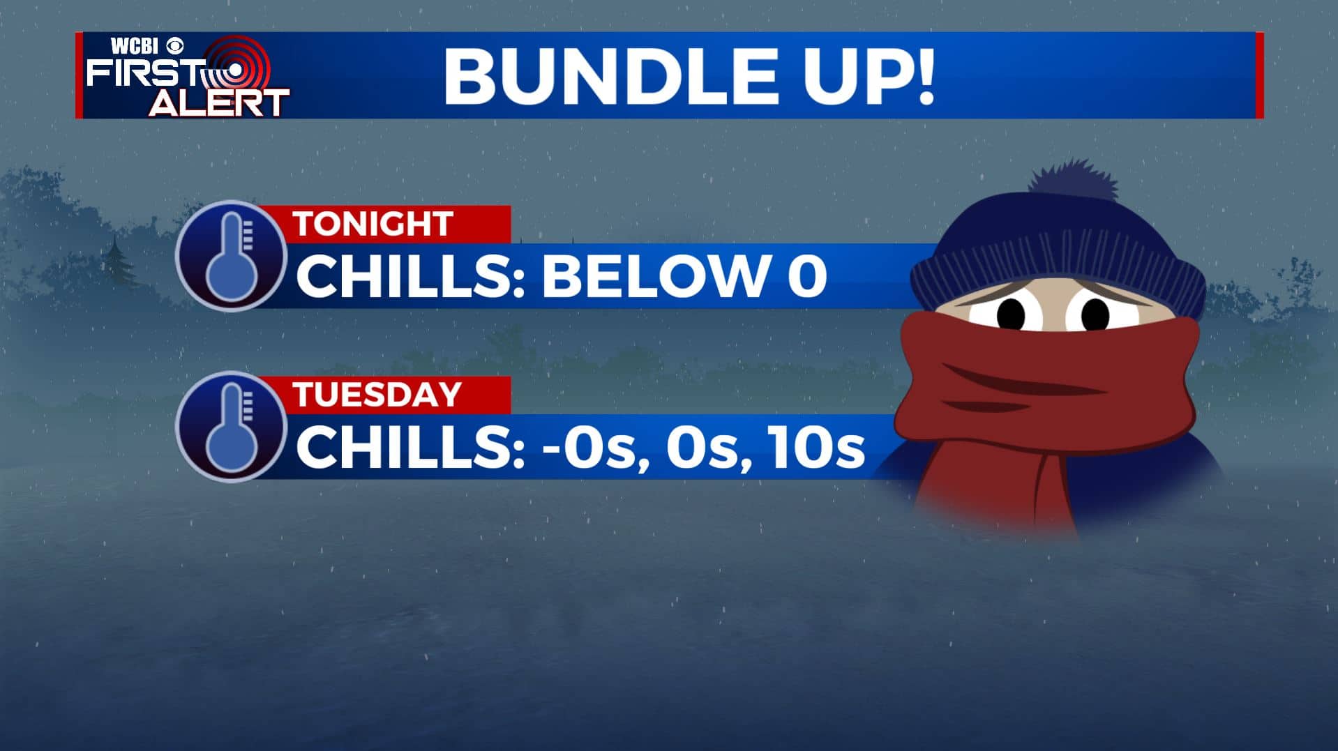
MONDAY NIGHT: Mostly cloudy and cold. Lows in the single digits will likely smash the old record lows for the date. Gusty NW winds will continue to produce dangerous wind chills, perhaps as cold as the single digits below zero. Roads will freeze over so travel is not advised at all across the entire region.
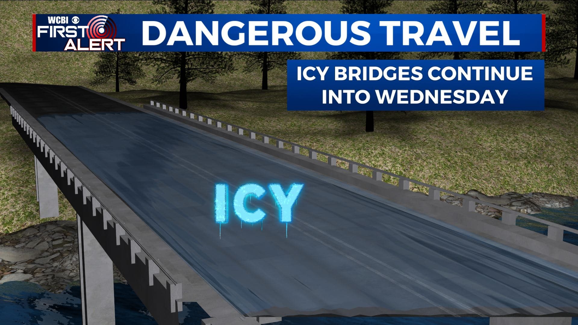
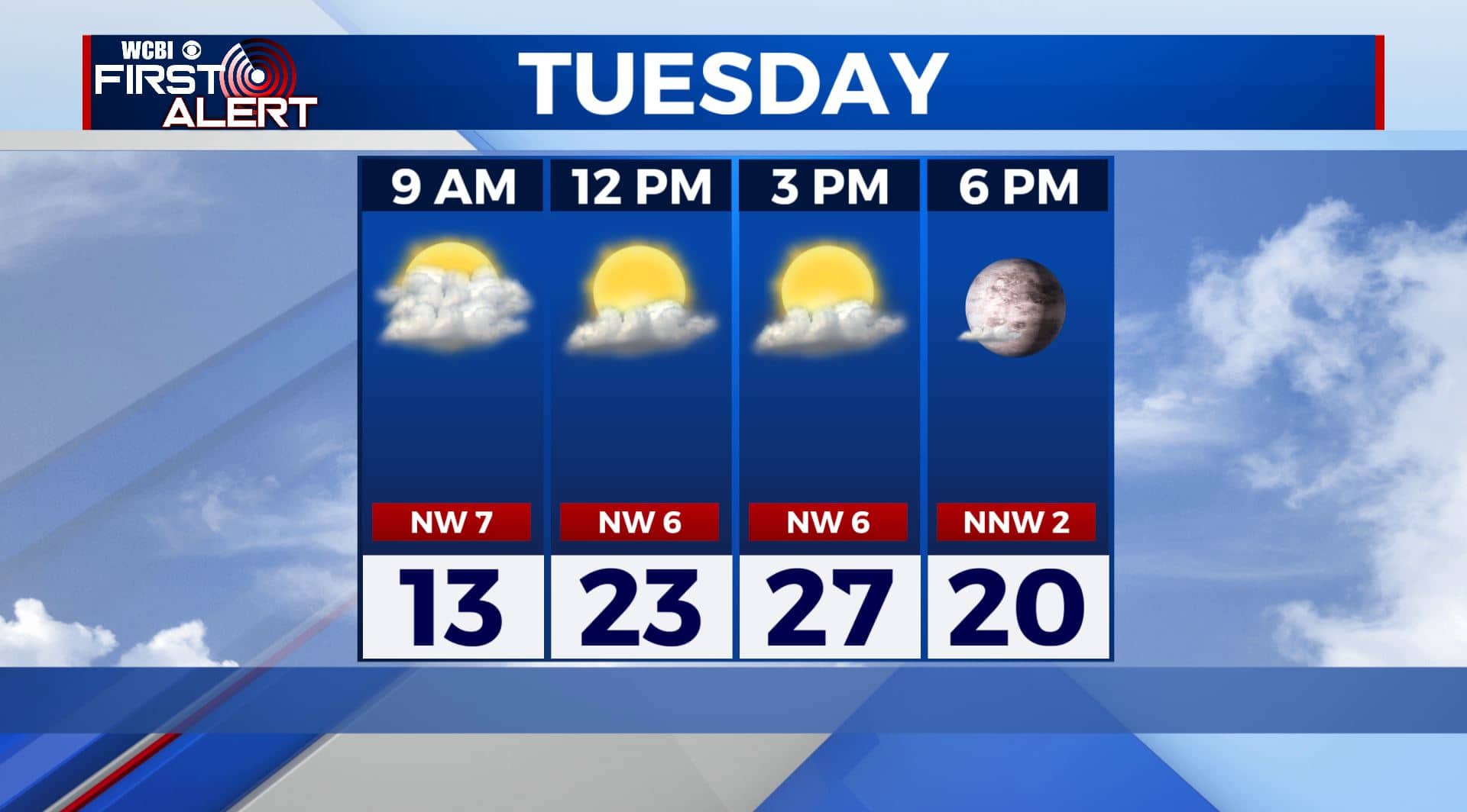
TUESDAY: Some sun will mix in during the day but highs should remain only in the mid to upper 20s. Wind chill values will peak in the teens. We expect icy roads to continue so be careful.
TUESDAY NIGHT: Partly cloudy and cold. Lows in the mid teens. Icy roads will continue to be a problem.
WEDNESDAY: Increasing clouds with a chance of afternoon rain, sleet, freezing rain, or snow depending on how fast the region can warm up. Highs should be in the upper 30s at some point.
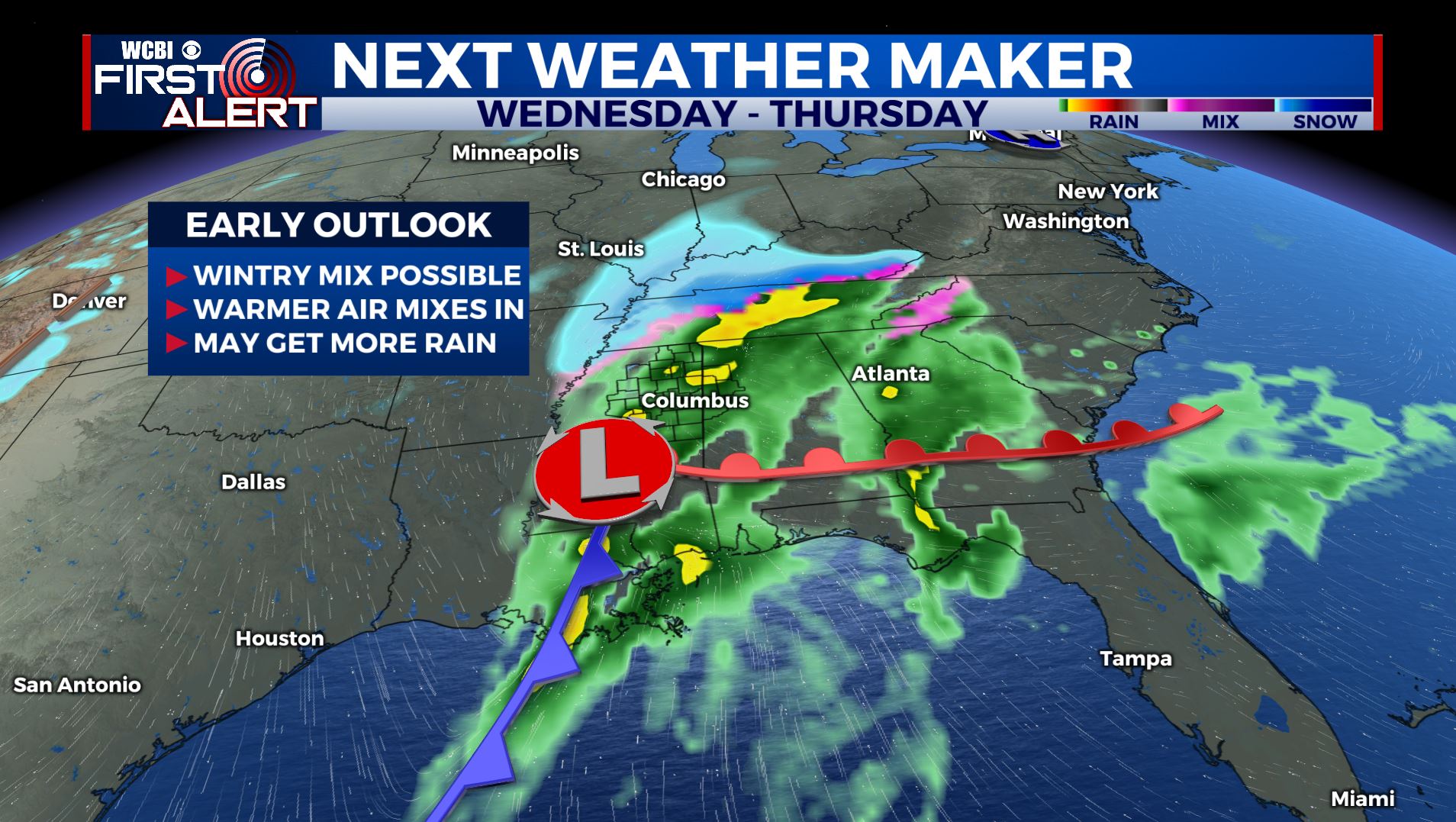
WEDNESDAY NIGHT/THURSDAY: More rain and/or wintry precipitation is expected. We’ll fine tune any accumulations by Tuesday evening so stay with us for updates. Highs in the 30s are expected to continue into Thursday. Colder lows in the low 20s Thursday night.
FRIDAY: Partly cloudy & chilly. Highs in the upper 30s. Lows in the 20s.
SATURDAY: Mostly sunny. Highs in the low 50s.
Follow @WCBIWEATHER on Facebook, Twitter, Instagram, and the WCBI News App


Leave a Reply