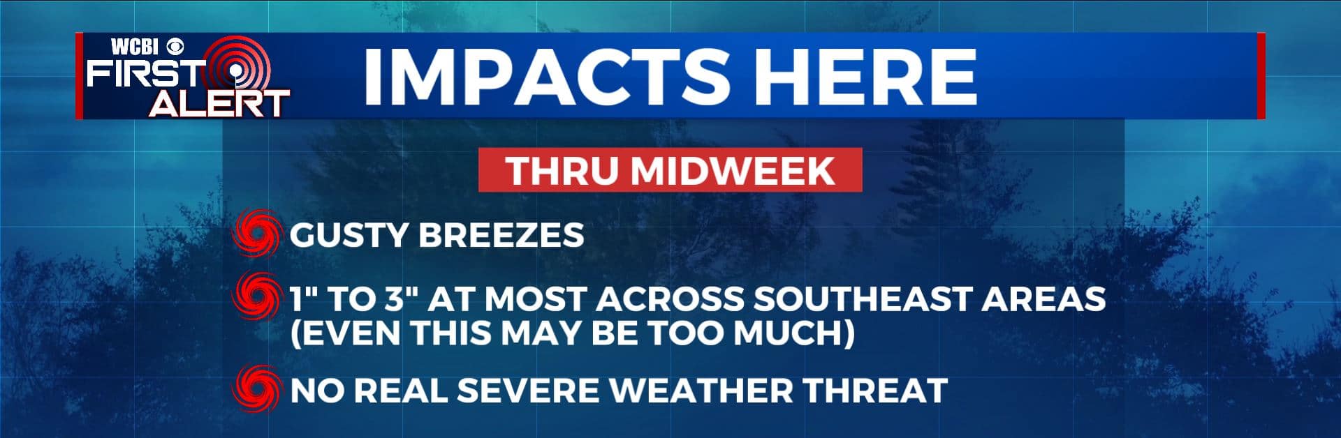
Sally’s main impacts stay away from here
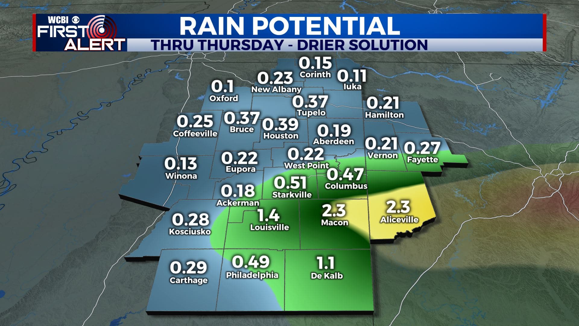
HURRICANE SALLY: The storm will come ashore late Tuesday or early Wednesday morning somewhere along the MS or AL coast. The remnant low is expected to slowly move north into Wednesday southeast of the I-20/59 corridor. The heaviest rain, flooding, and tornado threat should stay well southeast of the WCBI coverage area. There is still the potential for 1-3” of rain across our far southeastern areas including parts of Noxubee, Lowndes, and Pickens Counties Wednesday into Thursday (but that could even be generous if a more eastward track verifies). In general, no significant weather issues are expected at this time in our area due to Sally.
MONDAY NIGHT: Variably cloudy with a few isolated showers possible. Lows in the lower 70s. Winds NE 5-15 mph.
TUESDAY: A quiet morning with some passing showers and storms during the afternoon and evening. Breezy ENE winds 10-20 mph. Highs in the mid to upper 80s.
TUESDAY NIGHT: Partly to mostly cloudy with rain possible. Lows in the lower 70s. Breezy winds continue.
WEDNESDAY-THURSDAY: Partly to most cloudy with areas of rain, especially across the southeastern part of the area. The amounts will all depend on where the remnants of Sally go. Breezy NE winds 10-25 mph. Highs ranging from the upper 70s to middle 80s.
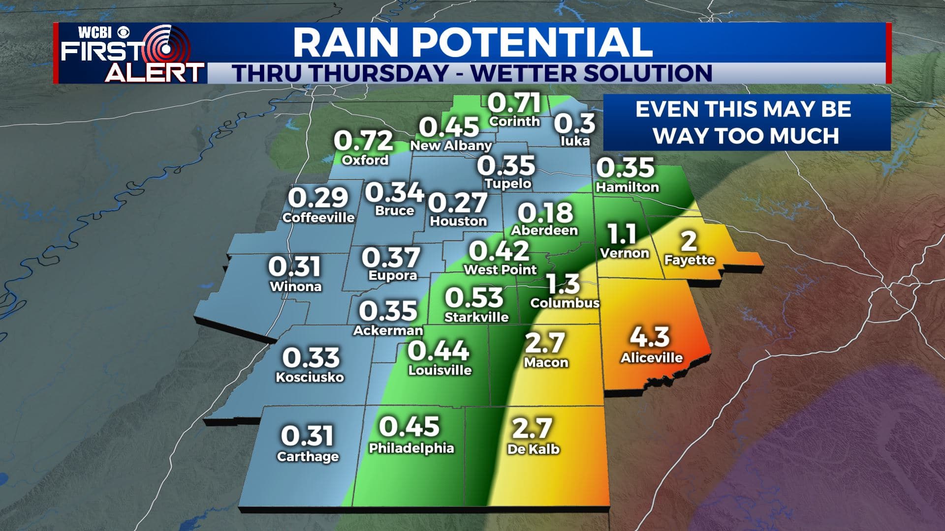
Wetter Solution
FRIDAY: Turning partly cloudy. Highs in the 80s. Friday night football weather is looking great!
WEEKEND: Mainly clear and much more fall-like. Highs in the 80s are still likely but lower humidity should allow overnight lows to tumble well into the 60s if not upper 50s.
Follow @WCBIWEATHER on Facebook, Twitter, Instagram, and the WCBI News App


Leave a Reply