Severe Storms Possible on Sunday
WATCH THE LATEST WEBCAST DISCUSSION HERE
BUILD A SAFETY PLAN AND FIND LOCAL COMMUNITY SHELTERS HERE
TONIGHT: Scattered showers remain possible, and a few thunderstorms are possible after midnight. Our cold front continues to suggest a slower progression east which means most of the night may end up being quiet. Lows won’t drop much, down only into the 60s with a mostly cloudy sky and south and east winds 10-25 mph with higher gusts. Strong storms will hold off until after sunrise.
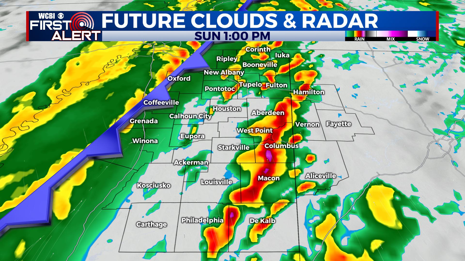
SUNDAY: Look for a mostly cloudy day with blustery south and east winds. A cold front looks to slide across the area starting Sunday morning into the afternoon and evening Along the front, showers and thunderstorms are anticipated, approaching I-55 around sunrise and slowly moving to the east. With a slow movement, there may very well be some redevelopment by late morning into the afternoon and evening ahead of it with a better environment for severe weather. Ahead of the front, temperatures climb into the upper 60s and even low 70s in spots.
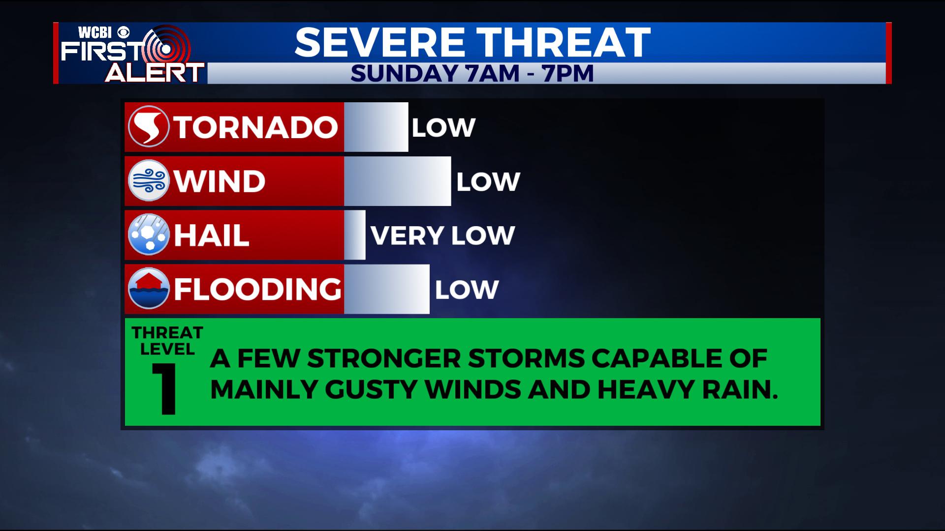
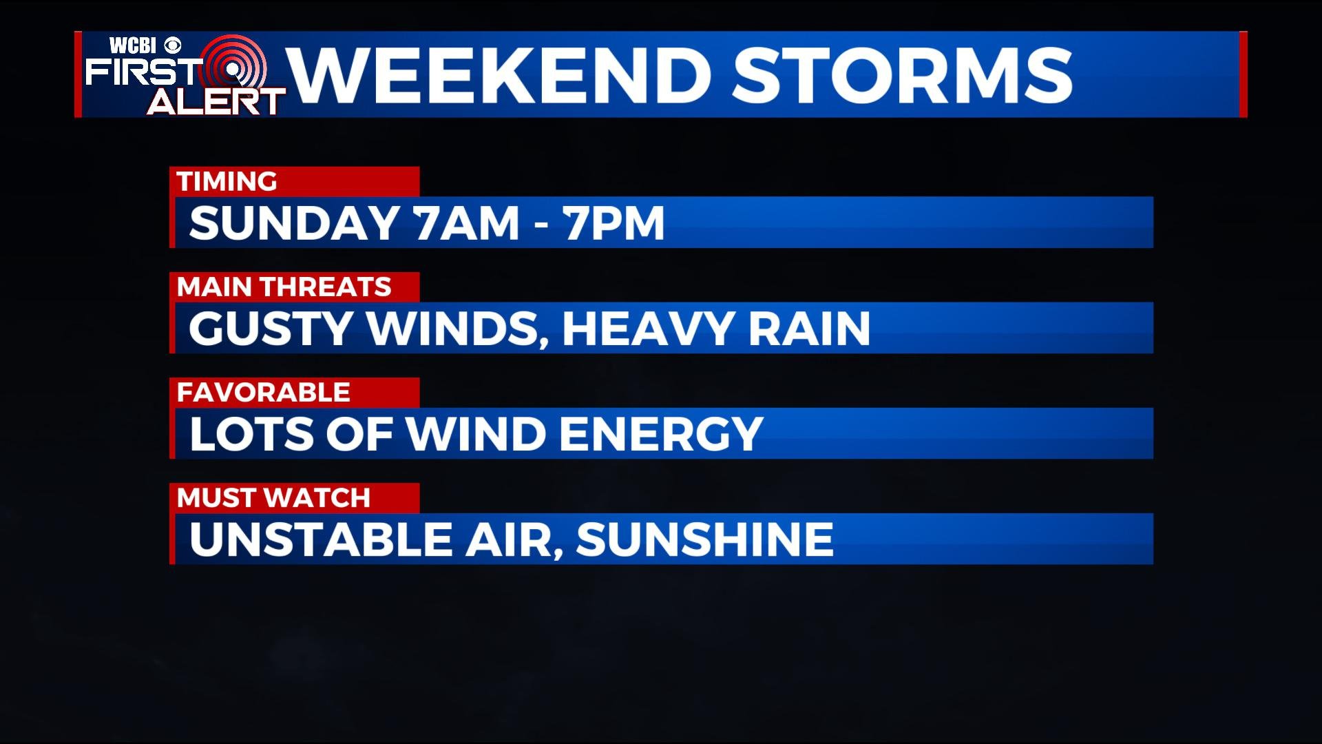
As of now, we do believe the chance remains for some stronger storms during the daylight hours Sunday. While overall the threat is low, we can’t rule out a few strong storms with gusty winds and heavy rain. The tornado threat looks to also be low and conditional on how things evolve. At the most, a few circulations capable of a tornado or two embedded in the line can’t be ruled out.
 With a later trend, it’s possible that ahead of the line, we can get some increased instability in the area, meaning the threat could rise for areas particularly east of the Natchez Trace during the late morning into the afternoon and evening. That instability would couple with lots of wind energy and would have to be watched. This remains uncertain but is a possibility.
Once the front passes, temperatures start dropping with lingering showers. Sunday Night, lows fall into the mid to upper 30s, with a few remaining in the low 40s.
MONDAY – WEDNESDAY: Look for lots of sunshine with highs more seasonal in the low to mid 50s. Lows at night are down into the 30s. By Wednesday, clouds will build back in the region, but rain would hold off until after sunset.
THURSDAY – FRIDAY: We’ll watch for another area of low pressure to move in from the south. This could be another heavy rain and strong storm producer in the area, though timing and impacts still remain uncertain. Right now, the best chance for rain and storms would be on Thursday, with some lingering areas of rain into Friday.
NEXT WEEKEND: We’d anticipate things to remain quiet and mild, but a burst of arctic air looks to swing our way by early next week. We’ll monitor.
STAY WITH @WCBIWEATHER ON FACEBOOK, INSTAGRAM, TWITTER AND ON THE WCBI MOBILE APP.


Leave a Reply