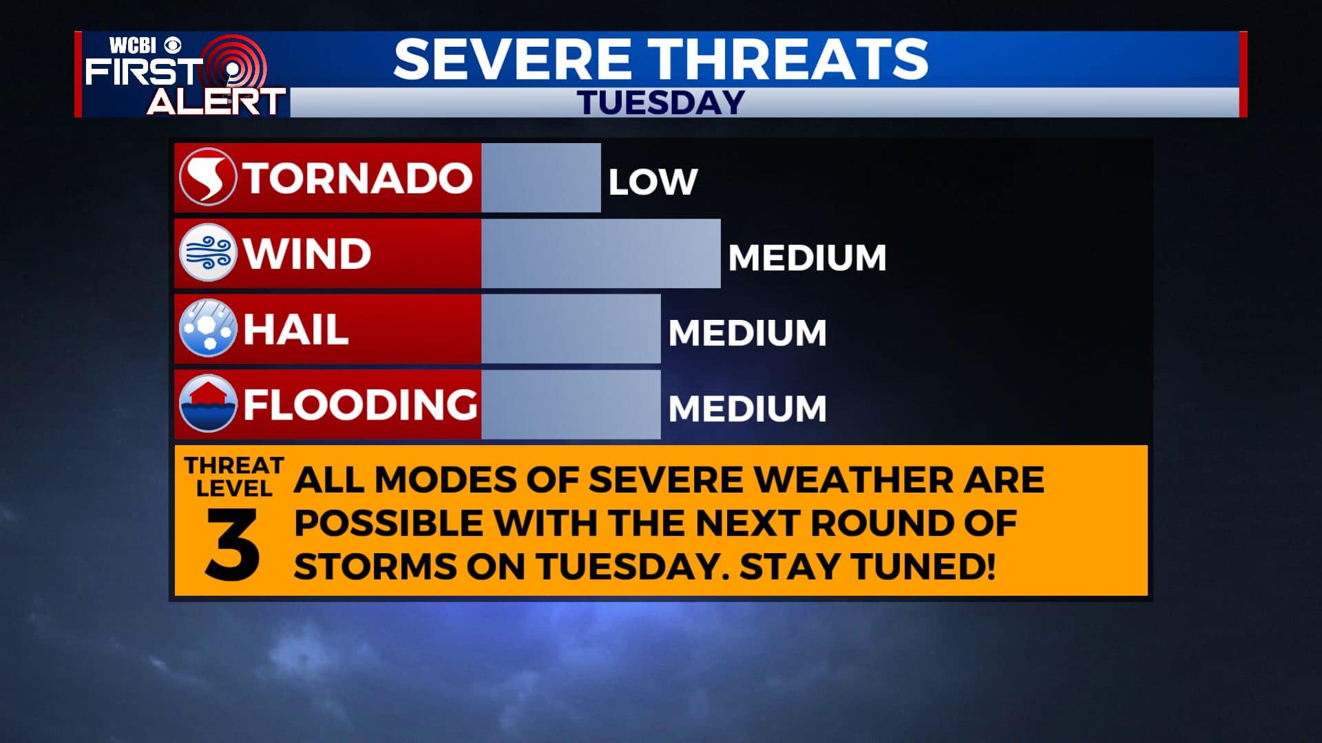
Severe storms possible Tuesday
SUMMARY: Another round of strong to severe storms with heavy rain is likely on Tuesday. Much cooler and less humid air is going to build in for a few days starting Wednesday. More storms could return to the region by the end of the weekend early next week.
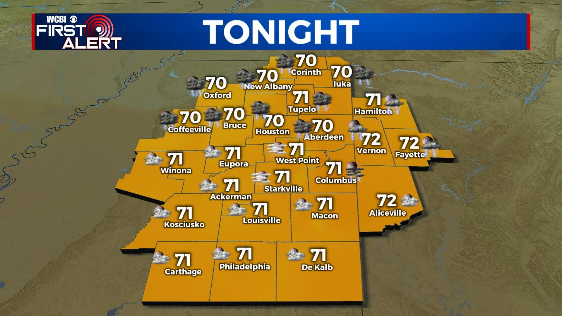
MONDAY NIGHT: Variably cloudy during the evening with a few isolated shower or storms possible. Becoming clouds later tonight with additional shower or storms possible. Lows in the lower 70s. Winds S 5-15 mph.
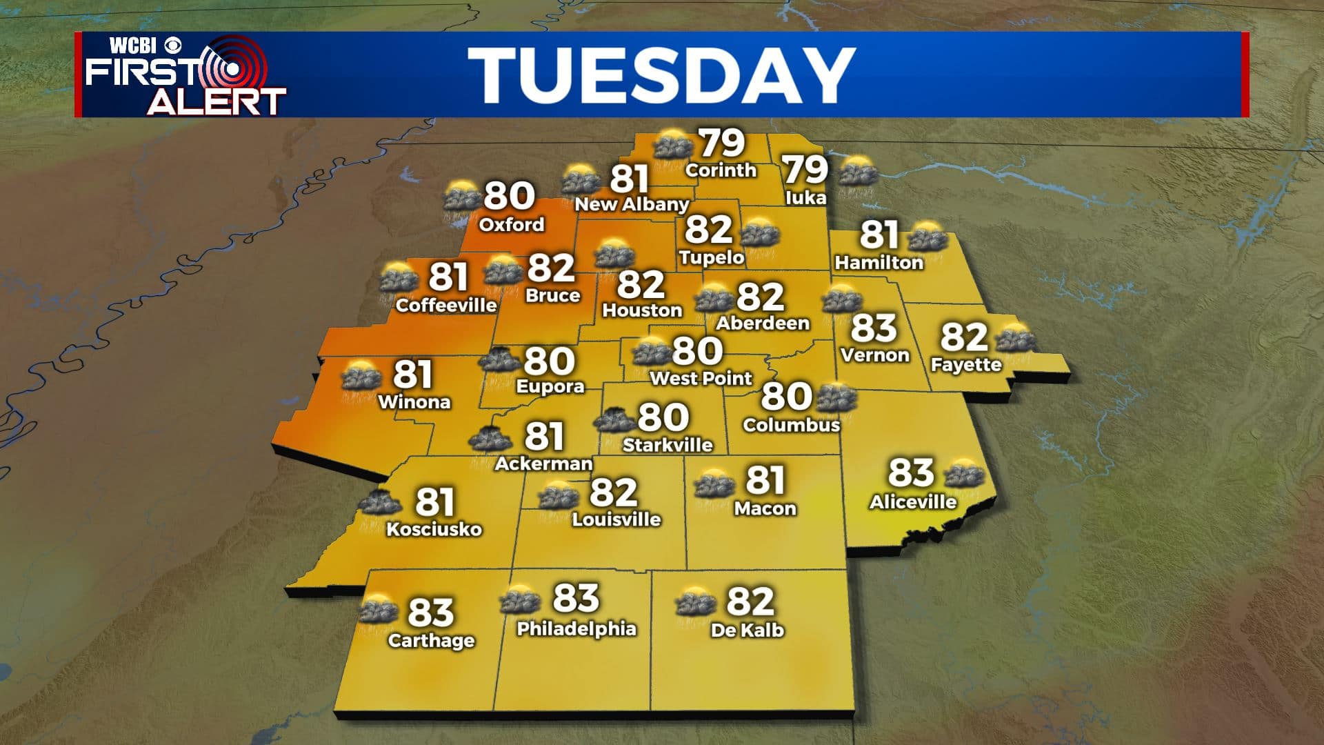
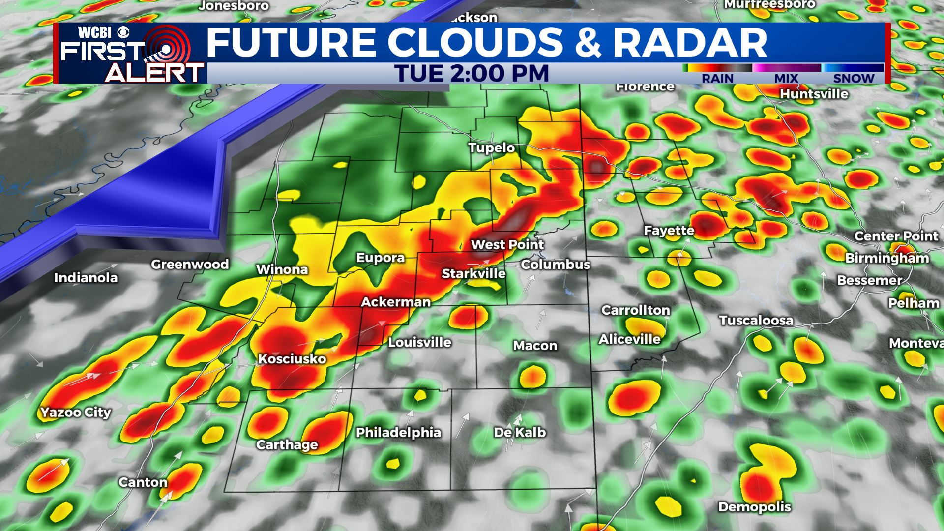
TUESDAY: Mostly cloudy with showers and storms likely. Some storms could be severe with large hail, damaging wind gusts, heavy rain, and perhaps a few isolated tornadoes. The most organized activity is likely from late morning through the afternoon into the early evening hours. Highs from the upper 70s to lower 80s. Winds SSW 10-20 mph.
TUESDAY NIGHT: Showers and storms end but clouds hang on. Lows in the upper 50s.
WEDNESDAY: Cloudy to start with sunshine developing during the day. Cooler and less humid with highs in the middle 70s.
WEDNESDAY NIGHT: Mainly clear and cool. Lows around 50.
THURSDAY: Partly cloudy. Just a slight chance of a late day shower. Highs in the middle 70s. Lows around 50 Thursday night.
FRIDAY: Partly cloudy and pleasant. Highs in the middle 70s. Lows in the lower 50s Friday night.
SATURDAY: Sun & clouds. Warmer highs in the lower 80s.
SUNDAY: Chance of showers and storms. Highs in the middle 80s.
Follow @WCBIWEATHER on Facebook, Twitter, Instagram, and the WCBI News App


Leave a Reply