A Few Severe Storms Tonight, Quiet Until the Weekend
WATCH THE LATEST AND FULL WEB DISCUSSION ON WCBI.COM/WEATHER.
TODAY: We’ll look for a mostly cloudy day with some isolated showers/drizzle/mist in the region. Look for highs to climb into the mid to upper 60s with gusty south winds 10-25 mph. By Tuesday Afternoon, a few thunderstorms are anticipated, though we’ll likely hold off on most of those until after the dinner hour.
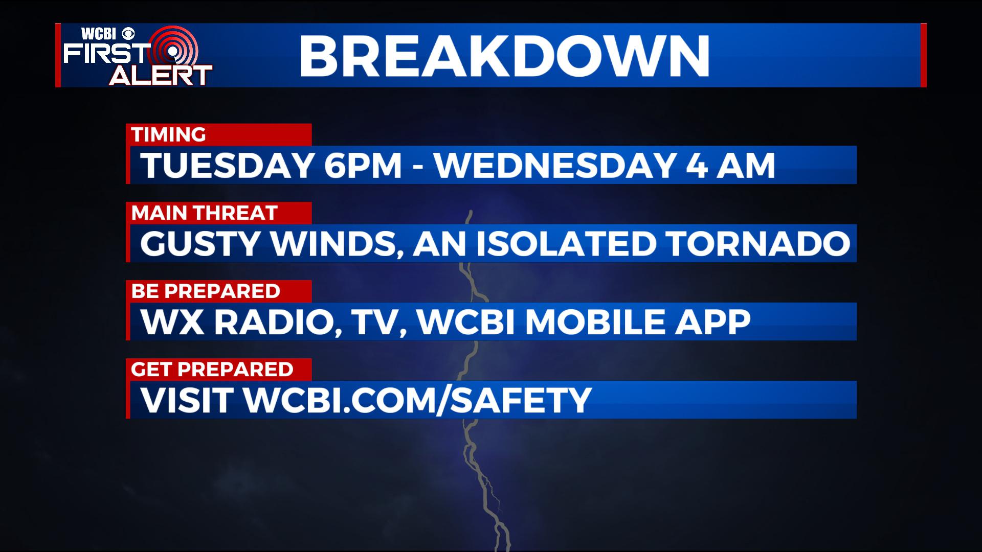
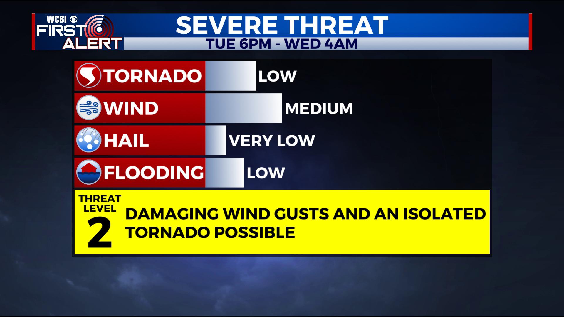
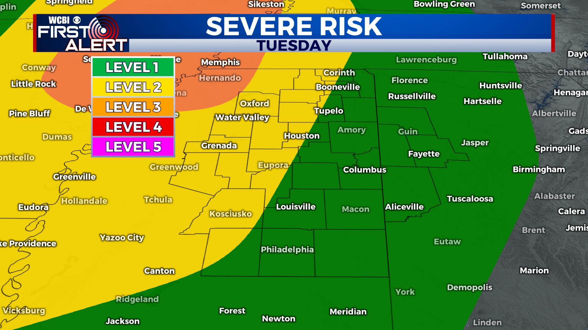
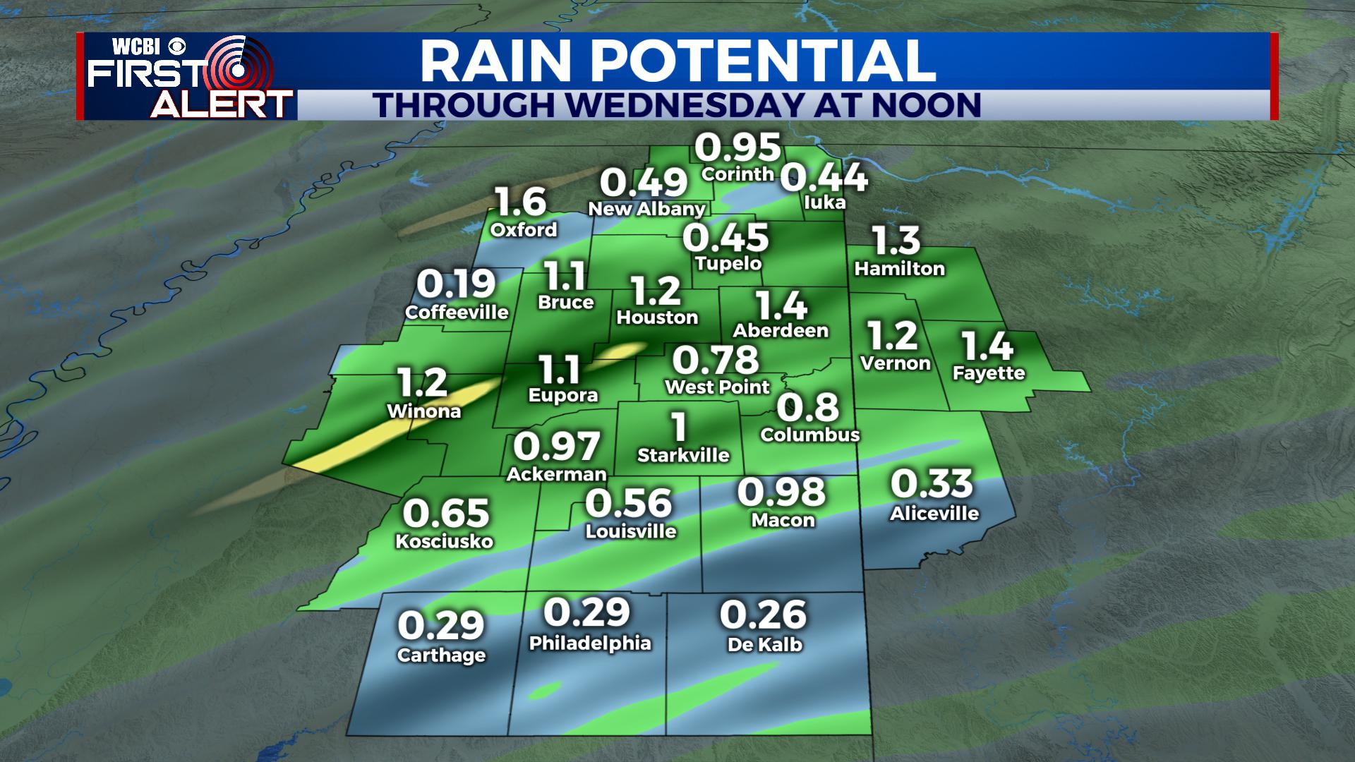
TONIGHT / WEDNESDAY MORNING: Several batches of rain and thunderstorms will slide into the region along and ahead of a cold front. Temperatures will generally remain steady in the 60s all night long until the rain and storms pass. There is a low chance for a strong to severe storm or two, with the main threat being gusty winds and perhaps an isolated tornado. The good news is that most of the ingredients necessary for a more robust severe event are disconnected, with the best thunderstorm energy to the south/west and the best wind shear to the north. We’re in the middle, so just enough of it could meet to spin something up somewhere. That’s why we’ll advertise a Level 1 threat from 6PM Tuesday to 4AM Wednesday.
WEDNESDAY: After the front passes through, winds will shift to the north and the west. We’ll keep things mostly cloudy through the day with some isolated showers/drizzle/mist possible. Look for highs in the upper 50s and low 60s. Wednesday Night temperatures drop into the upper 30s.
THANKSGIVING: We’ll advertise a mostly cloudy sky with some light and isolated showers in the region. No severe weather is expected. Look for highs in the upper 50s with a few slipping to the 60s. Thursday Night look for lows to fall into the upper 40s.
BLACK FRIDAY: With a mostly cloudy sky and some isolated showers, highs climb into the mid to upper 60s. Lows Friday Night fall into the mid to upper 50s.
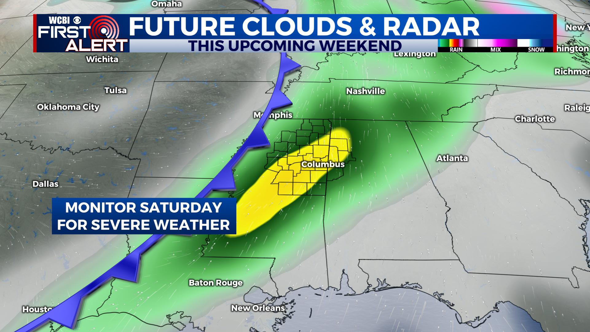
THIS WEEKEND: Another strong system is poised to slide into the region. Right now we’ll advertise rain and storms sometime during Saturday and into Saturday Night, with a few showers possibly lasting into Sunday morning. Some severe weather is possible given impressive atmospheric dynamics. Ahead of the front, we’ll be in the 60s, while temperatures behind the front fall into the 50s during the day and into the 30s at night. We’ll keep you advised with the first alert.
STAY WITH @WCBIWEATHER ON FACEBOOK, INSTAGRAM, TWITTER AND ON THE WCBI MOBILE APP.


Leave a Reply