Severe storms Wednesday night & Thursday
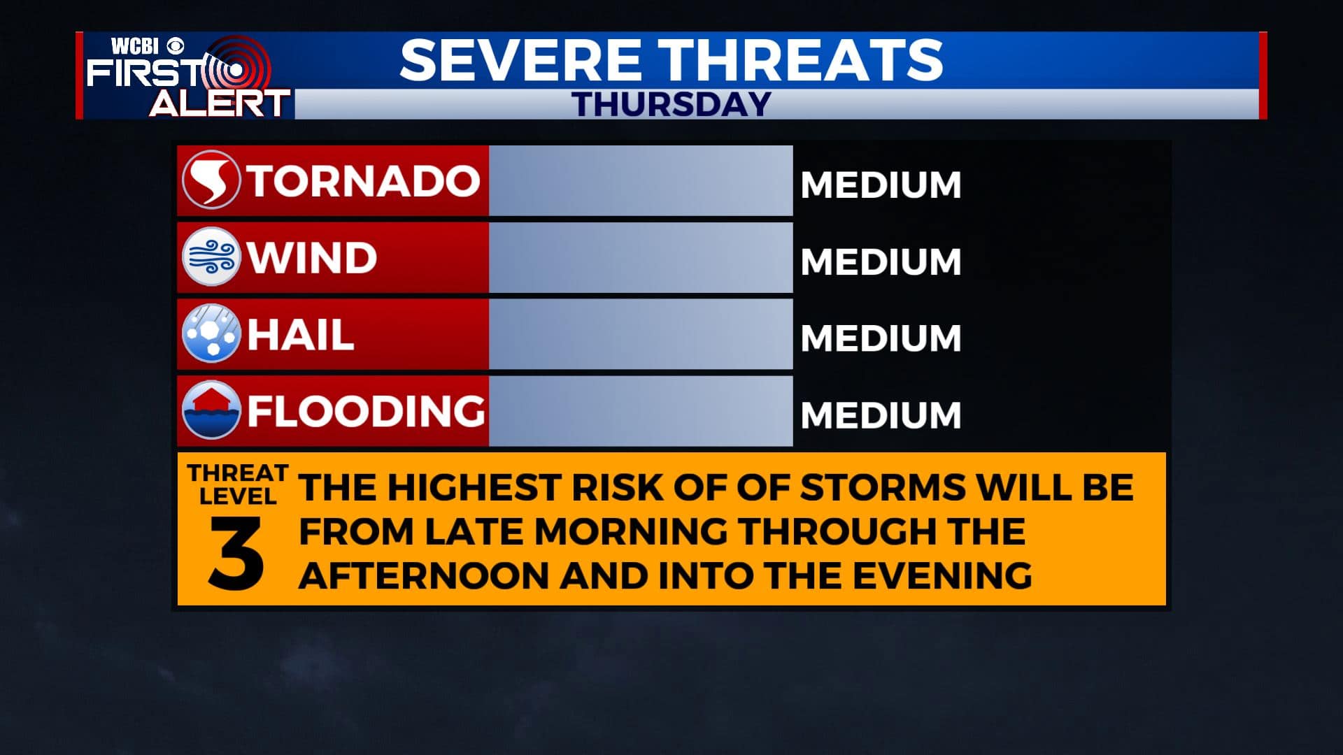
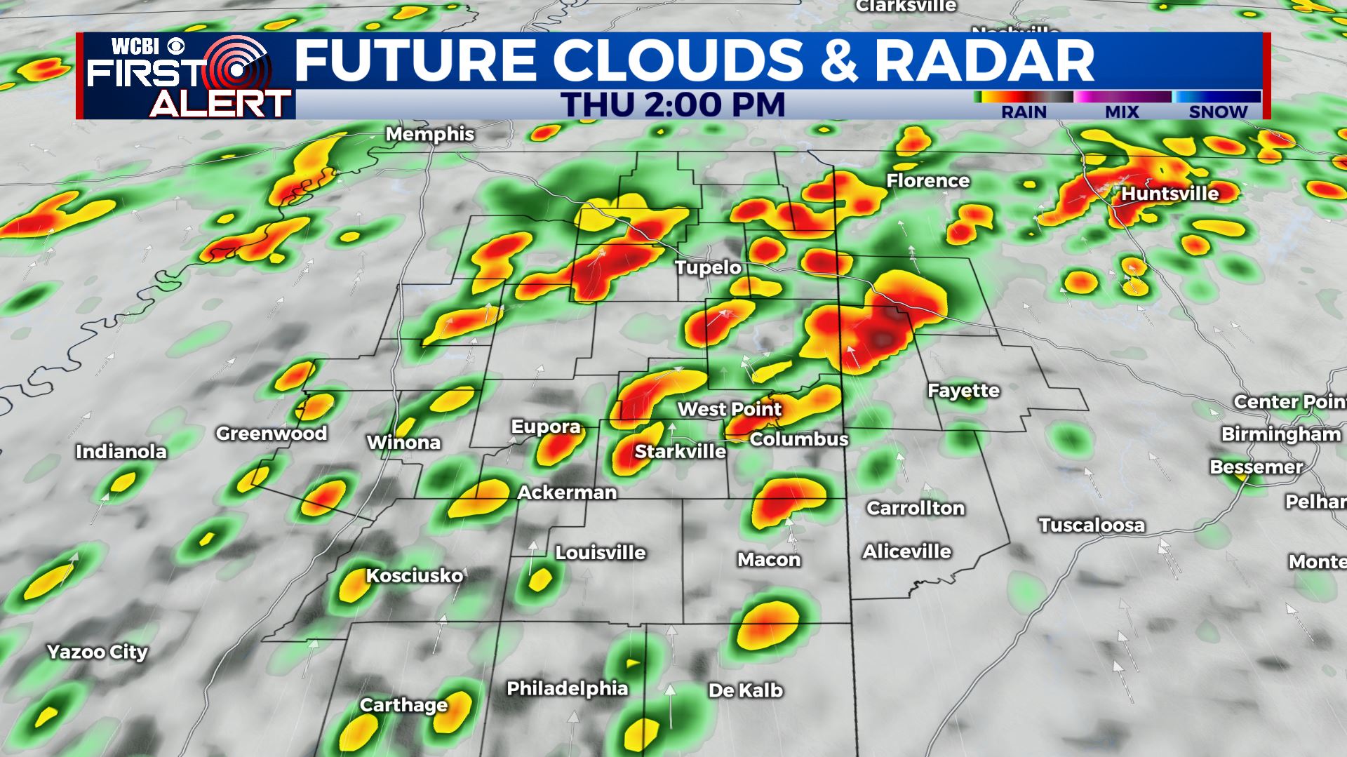
SUMMARY: Another round of active weather is looking more likely Wednesday night into Thursday. Some significant severe weather is possible Thursday afternoon with all modes possible, including tornadoes. Another 1-3″ of rain or more could also lead to some flooding issues. Stay with us at WCBI for more details over the next 2 days and be sure to have multiple ways of getting warning information.
TUESDAY NIGHT: Partly to mostly cloudy. Lows in the mid to low 50s. Winds SE 5-15 mph.
WEDNESDAY: Cloudy to start with some sun developing during the day. Highs in the mid 70s with SSE winds 5-10 mph.
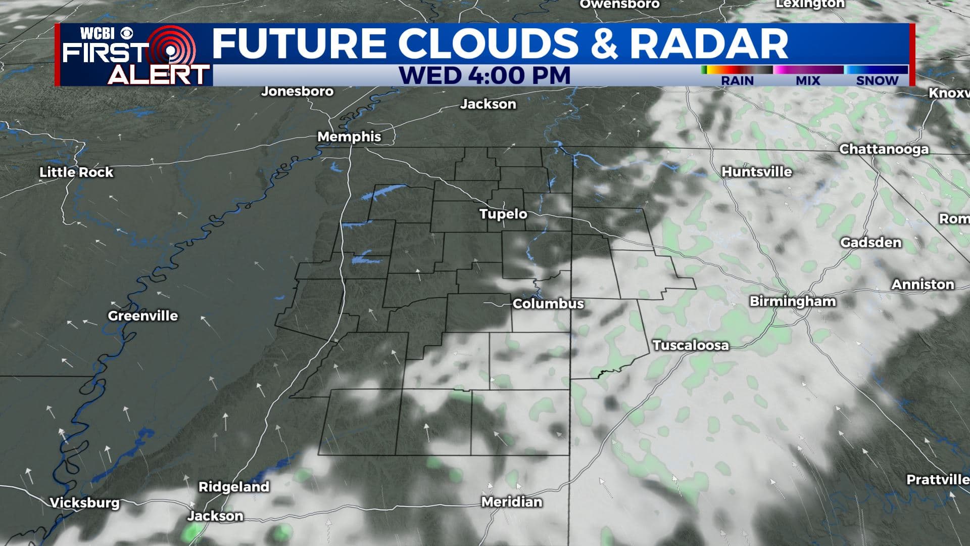
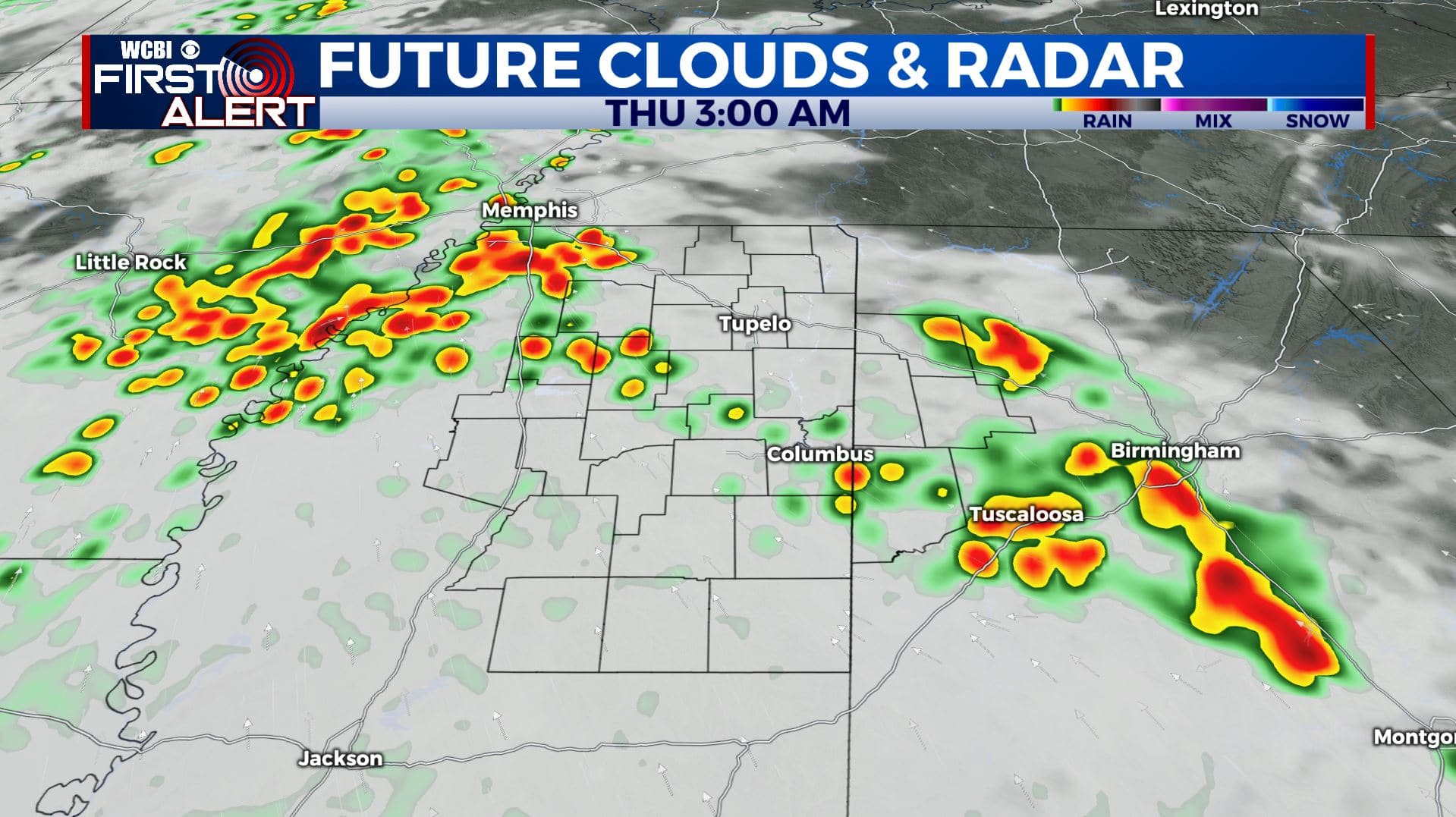
WEDNESDAY NIGHT: Mostly cloudy with rain and storms developing along a warm from that will be pushing from south to north across the area. Some storms could be strong to severe with large hail, lightning, and heavy rain being the main threats. Lows in the low 60s.
THURSDAY: Expect some morning rain and storms with a brief lull possible at some point. Anytime from late morning through the early to mid evening hours more strong to severe storms could develop with large hail, damaging winds, and tornadoes. Breezy southerly winds 10-25 mph will keep a steady flow of moisture around that will fuel the storms. Highs in the 70s to low 80s.
THURSDAY NIGHT: Evening rain and storms will continue and some may remain strong to severe. Conditions settle down after midnight in the wake of a cold front that will be pushing through. Lows should be down into the mid to low 50s by sunrise Friday.
FRIDAY: Pretty nice overall with plenty of sun and highs well into the 70s.
FRIDAY NIGHT: Variably cloudy. Lows in the upper 50s.
WEEKEND: Mostly cloudy cloudy area of rain and storms possible. Highs in the upper 70s to low 80s Saturday with cooler low 70s on Sunday.
Follow @WCBIWEATHER on Facebook, Twitter, Instagram, and the WCBI News App


Leave a Reply