Severe weather outbreak possible Wednesday
SUMMARY: Widespread strong to severe storms are possible Wednesday. While some strong activity may be around early in the day, the highest odds will occur from mid afternoon through about 1-2 a.m. Thursday. All modes of severe weather are possible, including large hail, damaging wind gusts, and tornadoes. A few strong tornadoes could occur somewhere in the region as well. Stay weather aware and have multiple sources of warning information.+
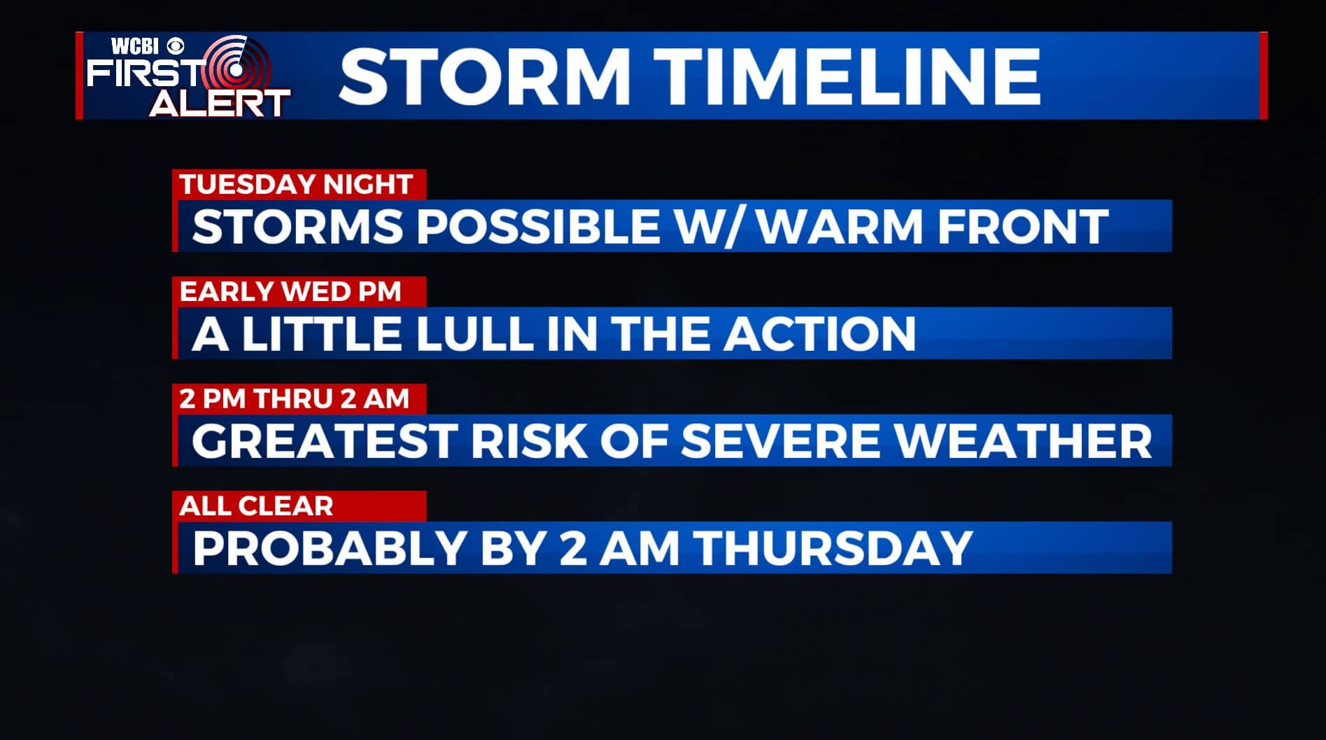
TUESDAY NIGHT: Mostly cloudy. Areas of rain and storms will develop as a warm front moves from S to N across the area. Any storm that develops along the front could become strong to severe with hail being the main threat. Heavy rain, gusty winds, and lightning could also occur. While the tornado risk tonight is low, it’s not totally zero. Look for lows in the 60s with southerly winds between 3 and 8 mph.
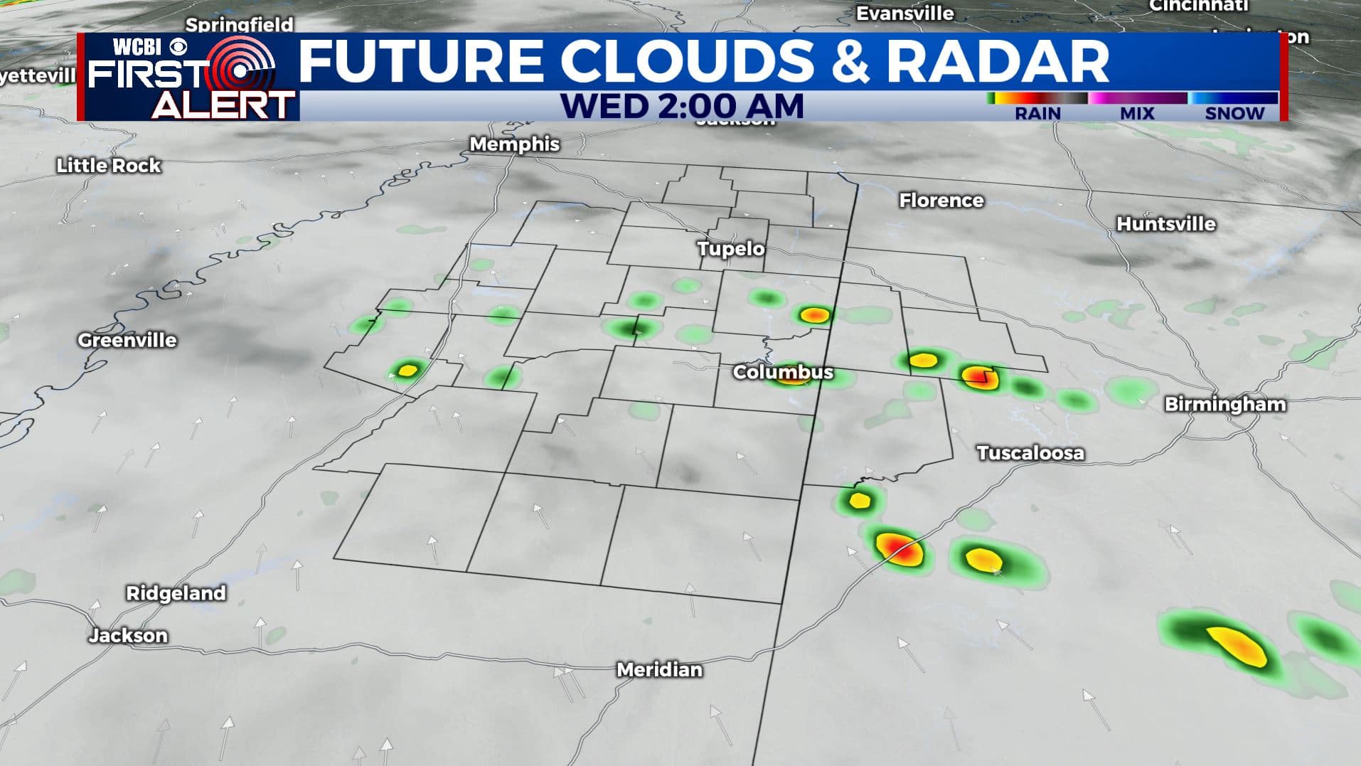
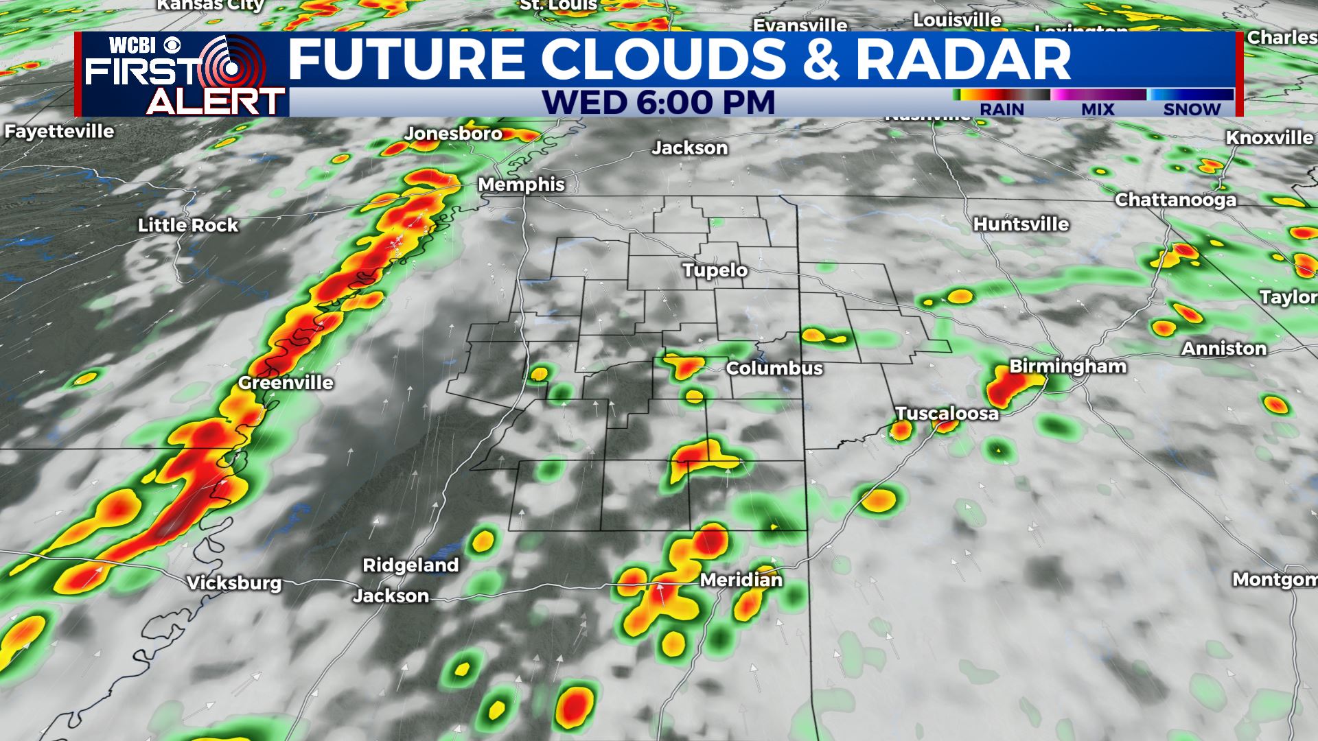
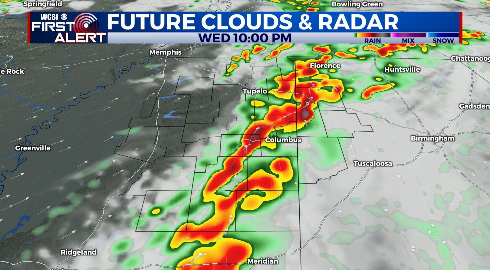
WEDNESDAY: Morning rain and storms should push north into Tennessee by midday. We expect there to be in a lull for a few hours before new activity develops. Isolated storms may be the first to develop across MS & AL. They would possess a higher tornado and hail risk. Heading into the evening, a line of storms will sweep across the entire area bringing a risk for damaging wind, hail, and isolated tornadoes once again to all locations. Highs will range from the upper 70s to low 80s. Southerly winds between 10 and 25 mph will usher in plenty of humidity for the developing storms.
WEDNESDAY NIGHT: The risk of severe storms should end by 1 or 2 a.m. Look for gradual clearing from W to E with lows in the low to mid 50s by sunrise Thursday.
THURSDAY: Turning mostly cloudy, breezy, and cool. Afternoon temperatures will probably only be in the 50s. Winds in the 10-25 mph range are likely with higher gusts.
THURSDAY NIGHT: Mostly cloudy. Cooler lows in the mid 40s.
FRIDAY: Staying cool with more sunshine developing as the day wears on. Highs in the upper 50s.
WEEKEND: Mostly sunny to partly cloudy. Highs in the mid to upper 60s. Lows in the upper 30s to low 40s.
Stay connected with @WCBIWEATHER on Facebook, Twitter, Instagram, and the WCBI News App


Leave a Reply