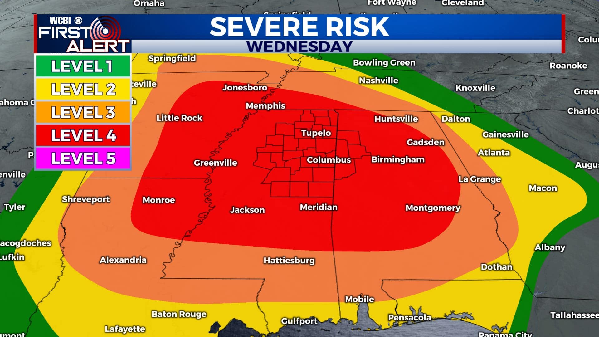
Severe weather threat continues to increase for Wednesday
SUMMARY: Several chances of storms will be possible between now and Wednesday night. The greatest risk is still likely to be Wednesday when the main system pushed through the region. We are now under a Level 4 Threat for severe weather for Wednesday as of Tuesday morning from the Storm Prediction Center. Confidence is continuing to increase that we will be dealing with all modes of severe weather, including tornadoes Wednesday afternoon into Wednesday night. Stay weather aware and have multiple ways of getting warning information. Now is the time to get your severe weather plan in place and get it ready to be put into action.
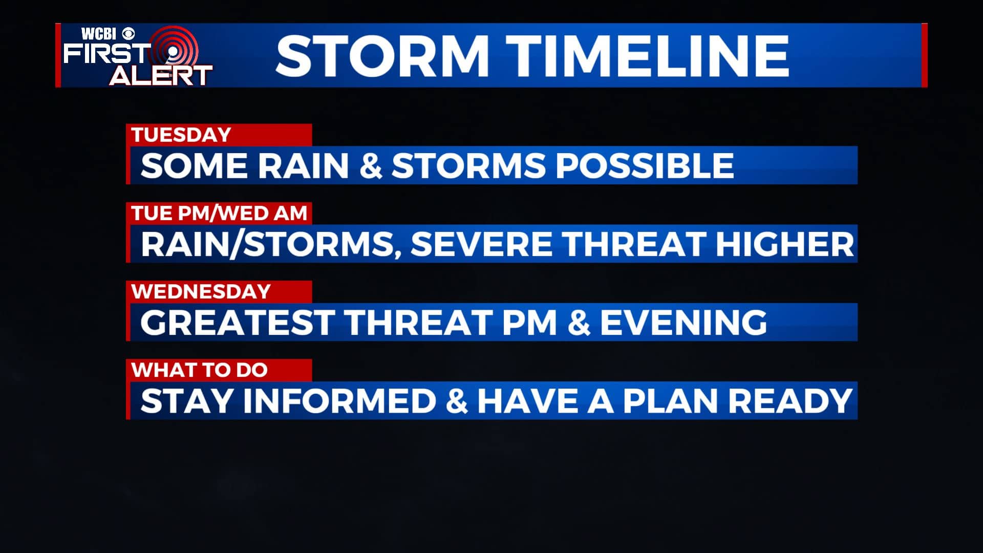
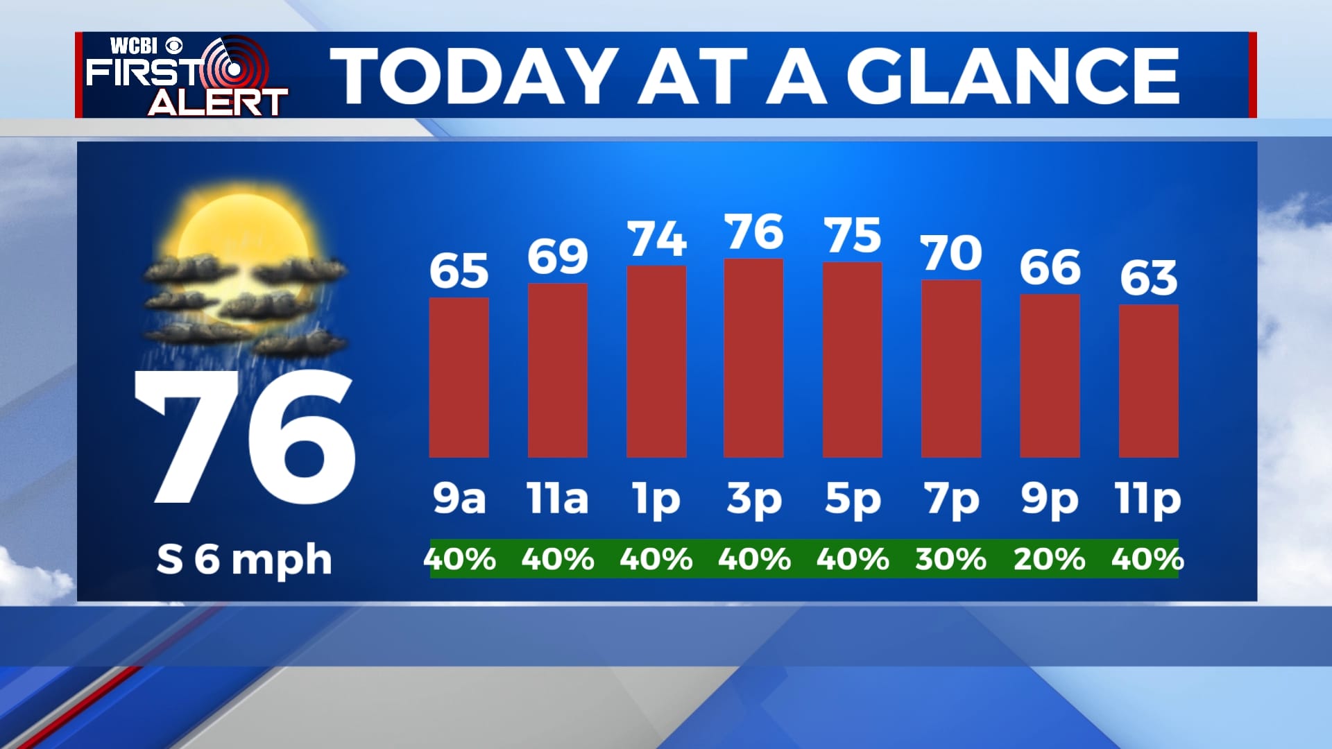
TUESDAY: Mostly cloudy skies. A chance of showers and storms mainly across areas south of Highway 82. The severe threat is low but not totally zero during the day. Mild highs in the mid to upper 70s. Winds SW at 5-10 mph.
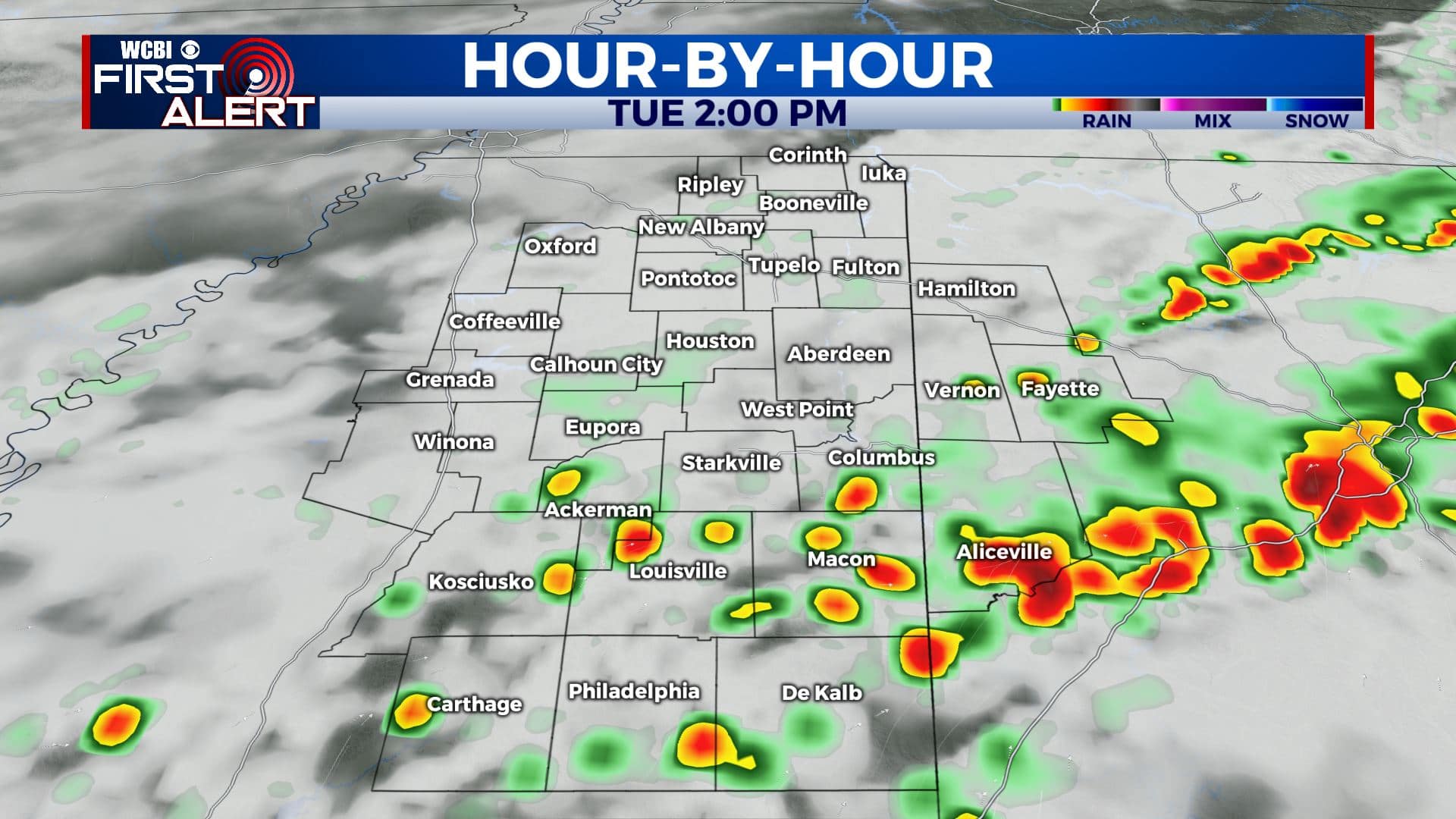
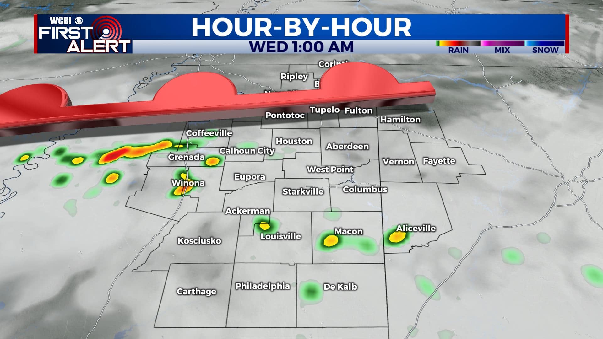
TUESDAY EVENING/NIGHT: A warm front will start to push from south to north across the region. This boundary is likely going to kick off several batches of rain and storms. Some of them could become strong to severe, but it will mostly be a hail and wind threat. Overnight lows in the lower 60s.
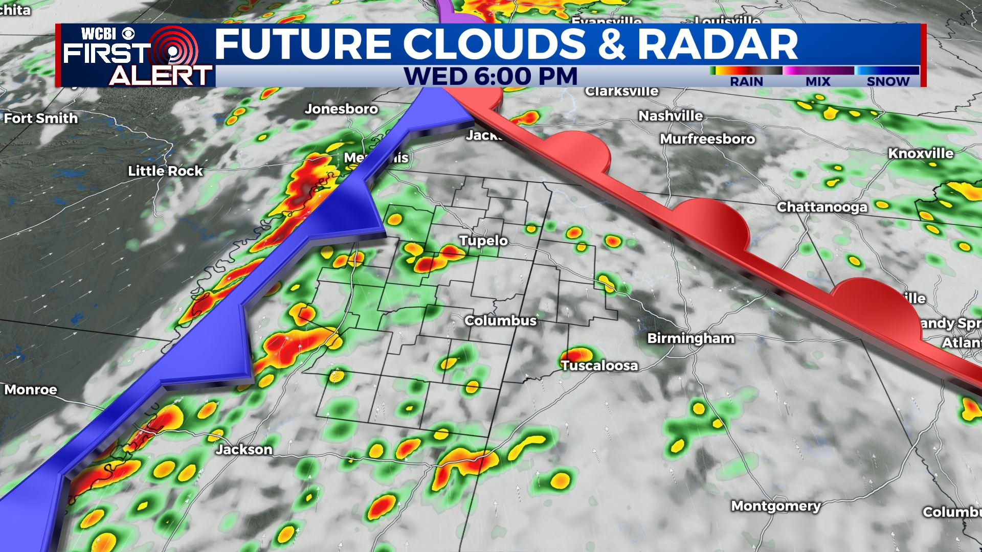
WEDNESDAY: After some morning rain and storms, we could get a bit of a break or even see some sunshine by the afternoon. We expect the best chance of strong to severe storms on Wednesday afternoon and evening. Any storm that develops will be capable of severe weather, including tornadoes. Highs should be around 80 degrees. Southerly winds between 10-20 mph will keep plenty of moisture around to help fuel the storms. Take some time now to review your severe weather safety plan. The most important things are to have a way to get the warning and know where to go if a warning is issued.
WEDNESDAY NIGHT: The risk of severe storms should wrap up by 1 or 2 a.m. Lows in the 50s by sunrise Thursday.
THURSDAY: A mix of clouds and sun. Much cooler. Highs in the 60s. Overnight lows in the 40s Thursday night.
FRIDAY – MONDAY: Pretty quiet and mostly sunny once again with high pressure moving back into the region. Highs in the 60s to lower 70s with overnight lows in the 40s.
Stay connected with @WCBIWEATHER on Facebook, Twitter, Instagram, and the WCBI News App


Leave a Reply