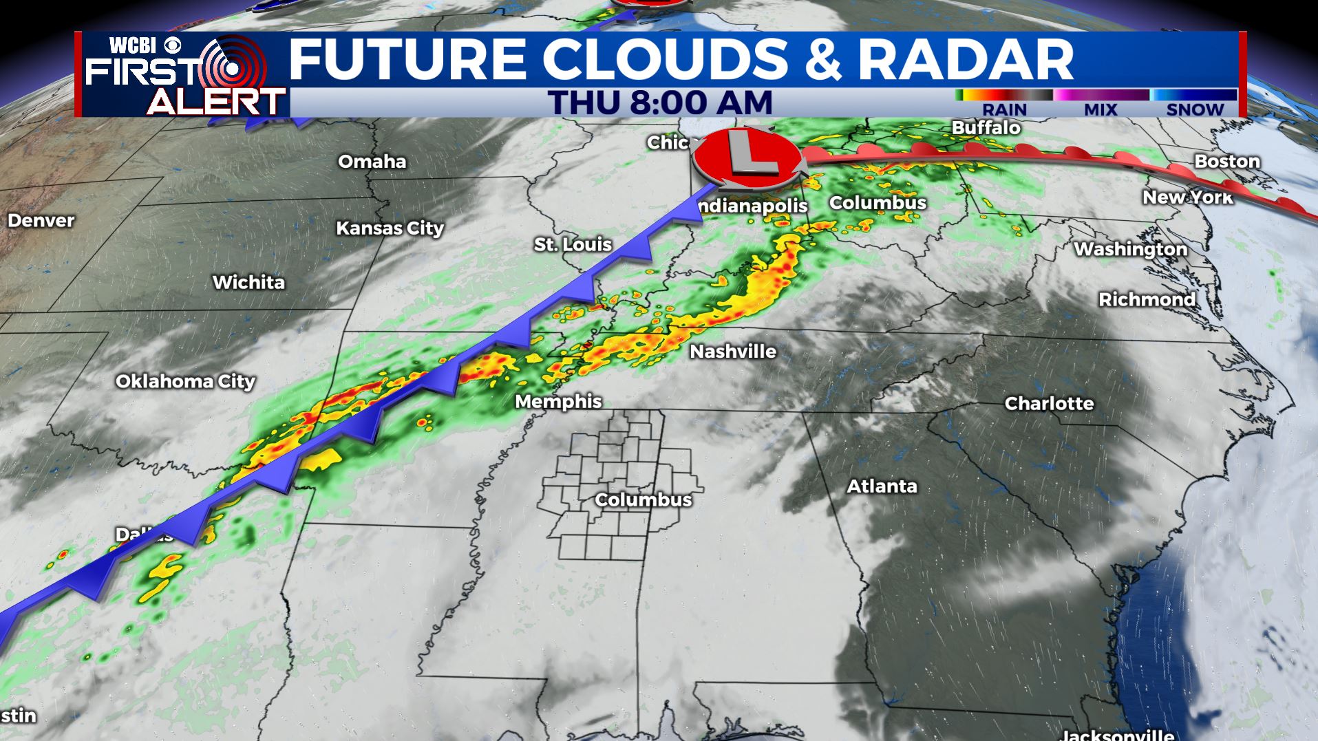
Showers and storms return for our Thursday
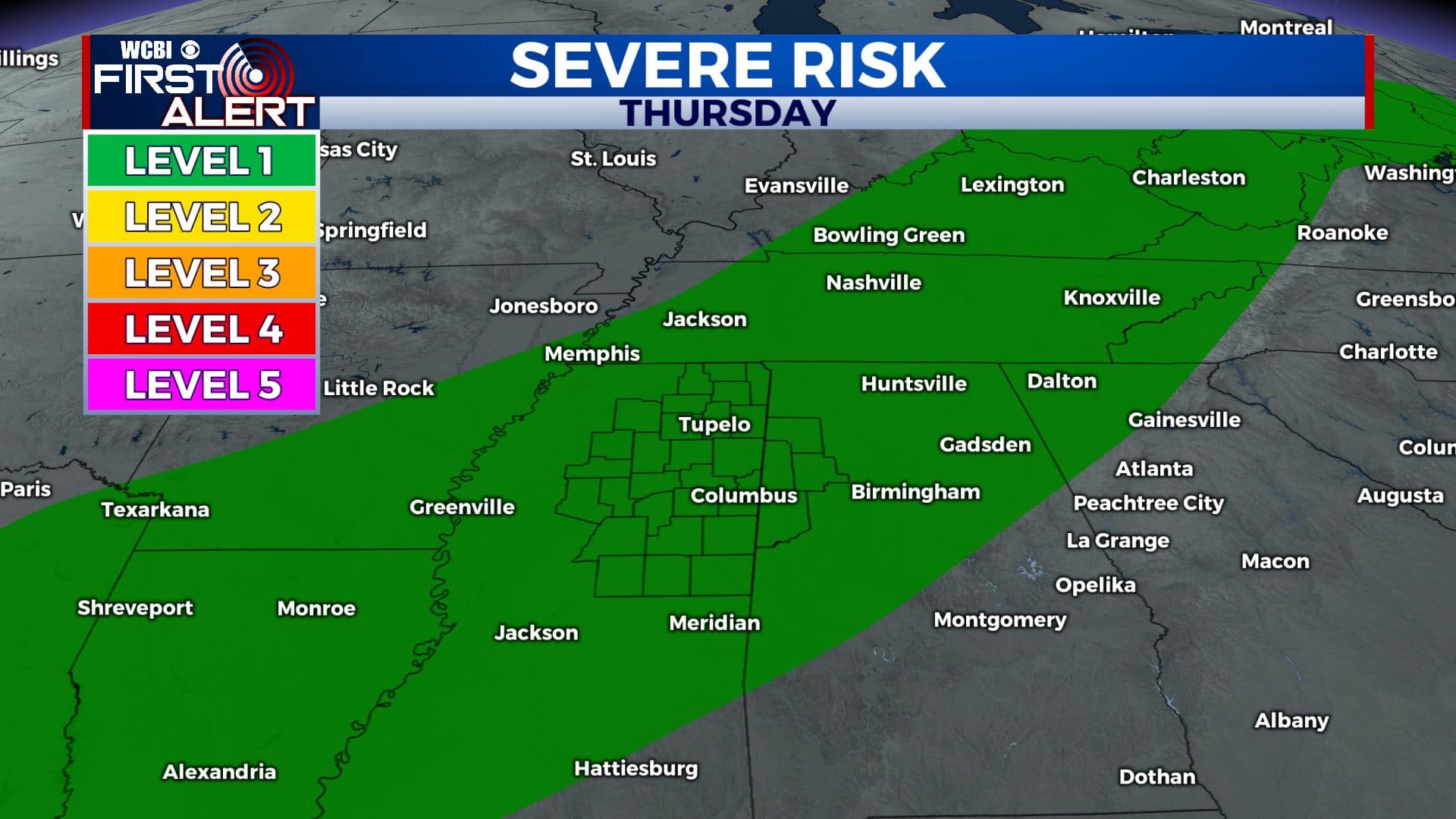
SUMMARY: Showers and storms will return to the area Thursday afternoon and evening as a cold front pushes through. Some strong storms are possible, but not expecting widespread severe weather with this system. Drier conditions are going to build in Friday and Saturday. More showers & storms are possible late in the weekend through early next week.
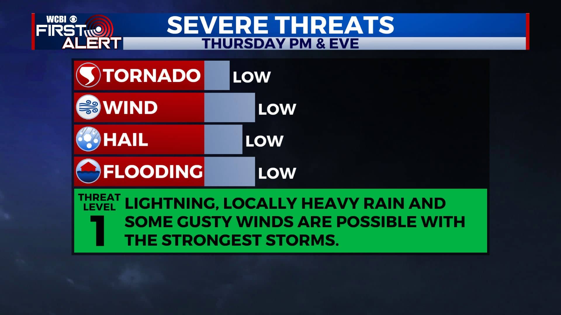
THURSDAY: Another warm & humid day is ahead for north MS & west AL. Cloudy skies will continue to increase this morning ahead of our cold front. Chances of showers and storms will increase during the afternoon into the evening hours. Lightning, gusty winds and locally heavy rain are possible with some stronger storms. Highs in the mid 80s with breezy SW winds 10-20 mph.
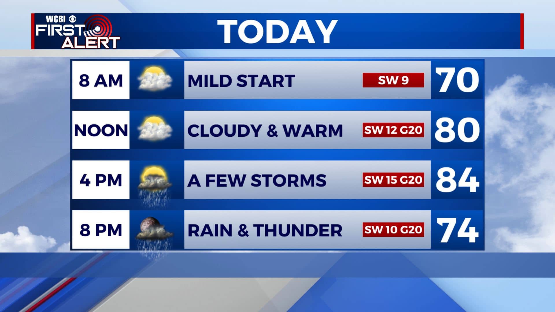
THURSDAY NIGHT: Mostly cloudy with some lingering showers. Lows around 60.
FRIDAY: Morning clouds and rain with sunshine developing during the afternoon. Much cooler with highs in the lower to mid 70s.
FRIDAY NIGHT: Mainly clear and cool. Lows near 50.
SATURDAY: Lots of sunshine with a few clouds. Highs in the mid to upper 70s.
SUNDAY: More clouds than sun. A chance of rain. Highs in the upper 70s to around 80 degrees.
MONDAY-WEDNESDAY: We’ll be staying in an unsettled weather pattern though early next week. Mostly cloudy skies with daily chance of showers and storms. Highs in the lower 80s.
Stay connected with @WCBIWEATHER on Facebook, Twitter, Instagram, and the WCBI News App.


Leave a Reply