Some showers Friday & early Saturday
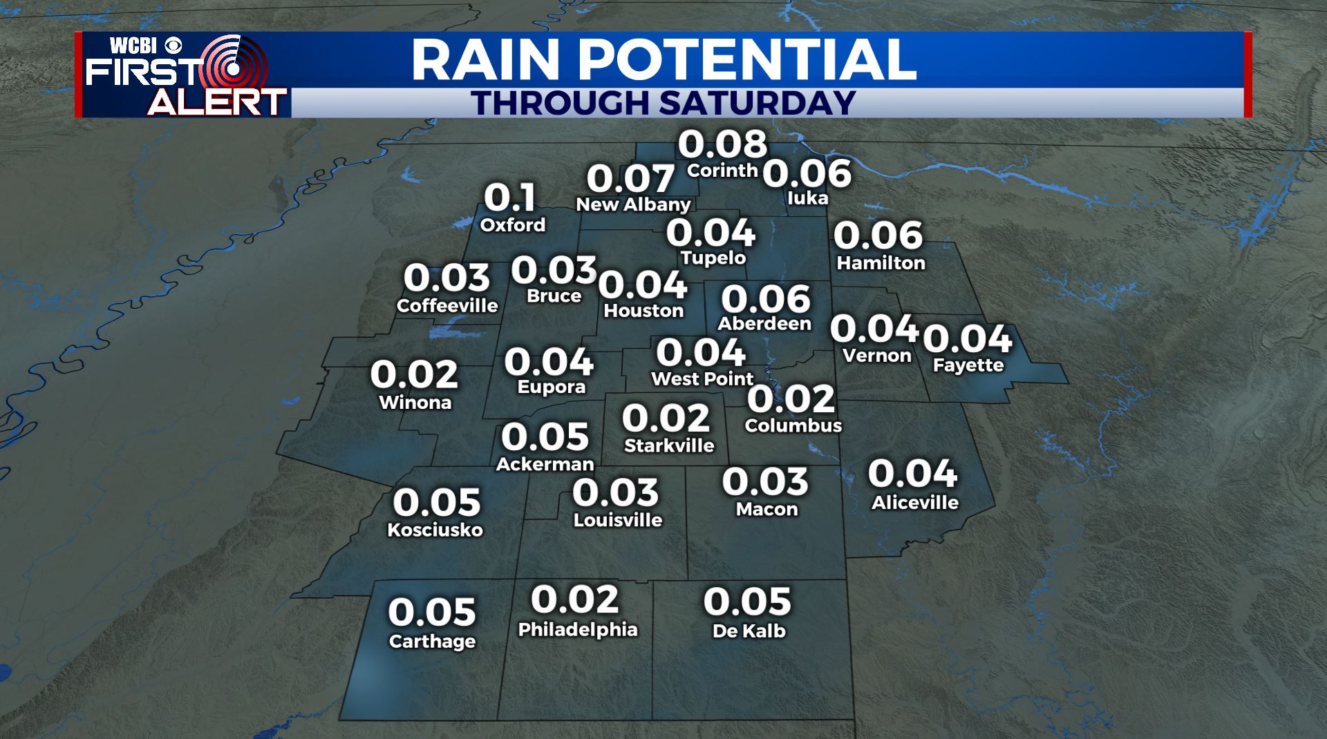
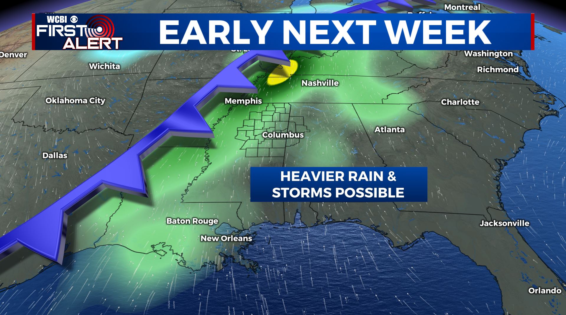
SUMMARY: More clouds and a few showers are possible Friday, Friday night, and the first part of Saturday. Rainfall amounts less than 1/4″ are expected. Sunshine returns for Sunday and a good part of Monday. A more powerful system will swing through the region Tuesday into Wednesday and it could produce heavier rain and even a few strong to severe storms.
THURSDAY NIGHT: Variably cloudy during the evening with clouds gradually moving back in during the night. Lows in the upper 30s to lower 40s. Winds light and variable.
FRIDAY: Mostly cloudy with a 20% chance of showers. Highs in the mid to upper 50s.
FRIDAY NIGHT: Mostly cloudy. Lows in the low 40s. A few spotty showers are possible.
SATURDAY: Look for a cloudy start with even a few isolated showers. Gradual clearing from west to east is expected during the afternoon. Highs top out in the mid 50s.
SATURDAY NIGHT: Mainly clear and quiet. Lows in the mid 30s.
SUNDAY: Sunny and mild. Highs in the mid to upper 60s. Low 40s for lows Sunday night.
MONDAY: Increasing clouds. Some showers are possible late but most of the daylight hours should be dry. Highs in the mid 60s. Milder 50s Monday night.
TUESDAY-WEDNESDAY: Rain and storms are likely. If there are any strong storms in the area the favored window of opportunity looks to be Tuesday night and early Wednesday morning. We’ll continue to adjust the forecast as new data arrive. Highs in the 60s to low 70s remain a possibility during this time period.
Follow @WCBIWEATHER on Facebook, Twitter, Instagram, and the WCBI News app


Leave a Reply