Staying hot & humid; Watching Fred in the tropics
SUMMARY: Another hot & humid day is ahead for us. A Heat Advisory will once again take effect so make sure you take the proper precautions. We’re also watching rain chances increasing for the weekend & the tropics as we now have Tropical Storm Fred in the Caribbean. 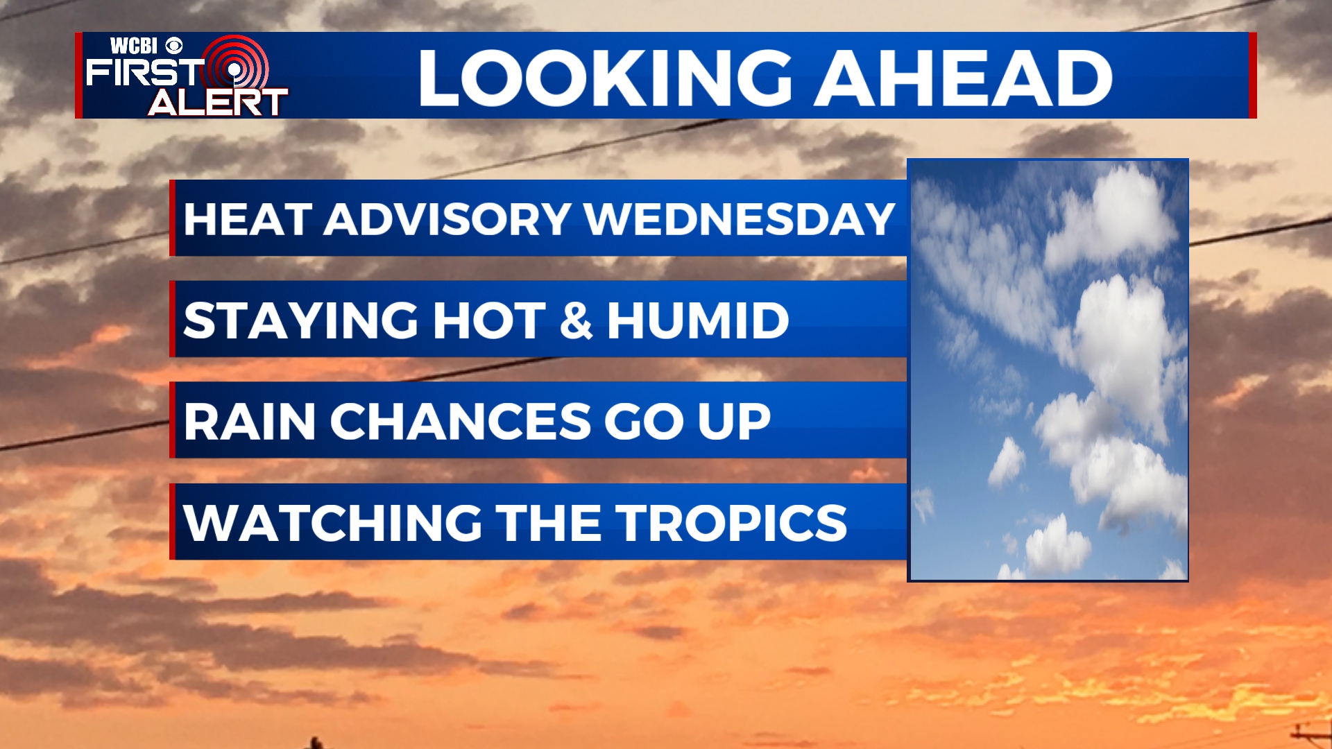 TROPICS: We are continuing to watch now Tropical Storm Fred as it’s moving SE of Puerto Rico with 40 mph winds. It’s looking right now to be an issue for the Caribbean islands late week and Florida into the weekend/early next week. Stay tuned!
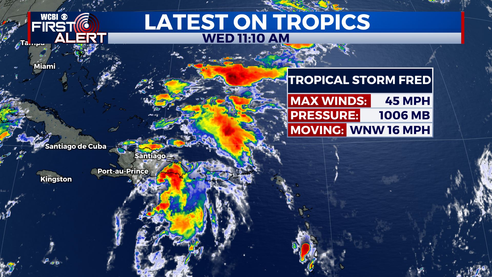
 WEDNESDAY: A Heat Advisory is in effect for all our Mississippi and Alabama counties today as highs will get up to the mid 90s, but with the heat index..it’s going to feel like 105 degrees or more out there. A mix of sun & clouds. A chance of showers & storms is possible in the afternoon as well. SW winds 5-10 mph.
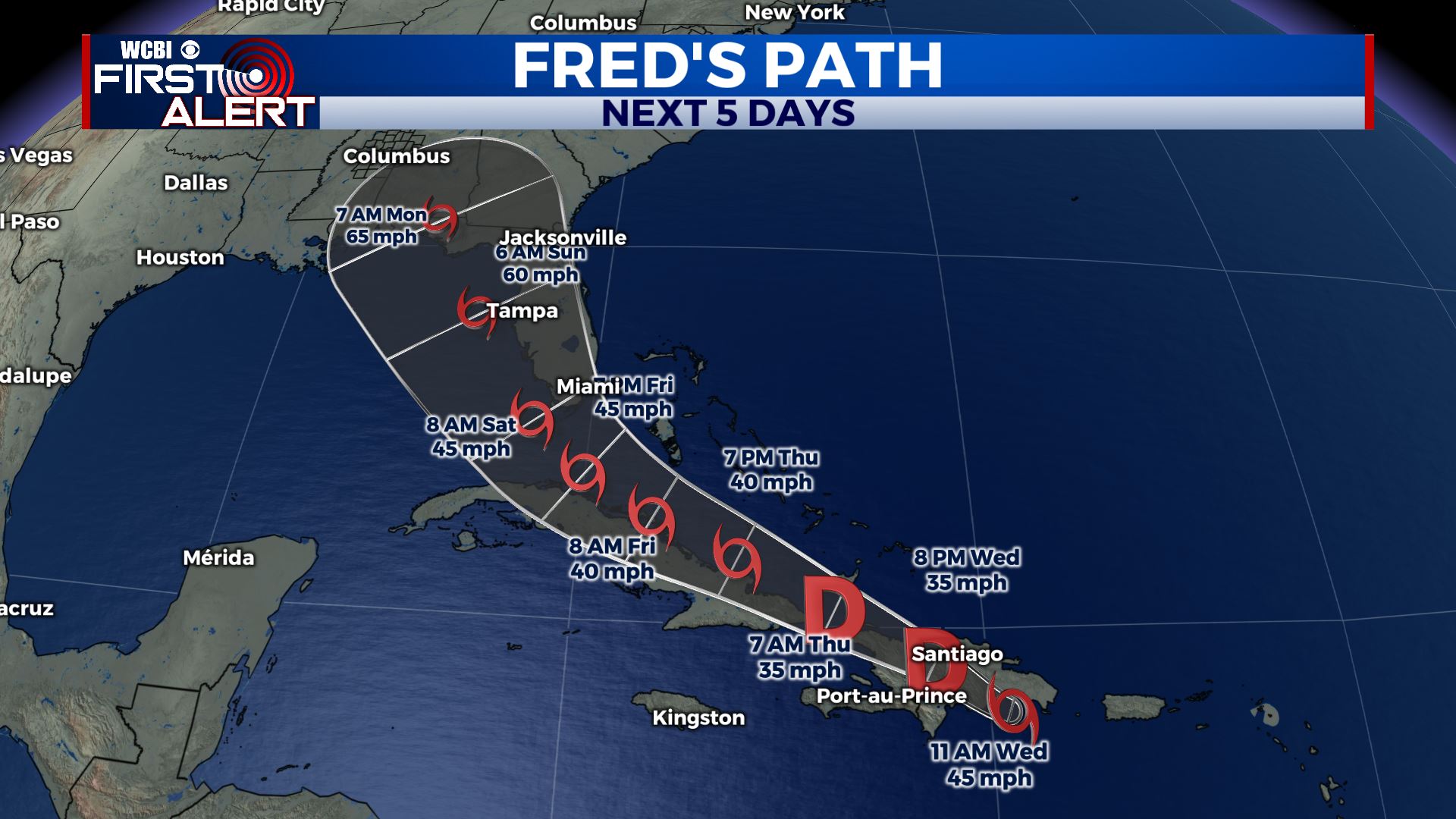
 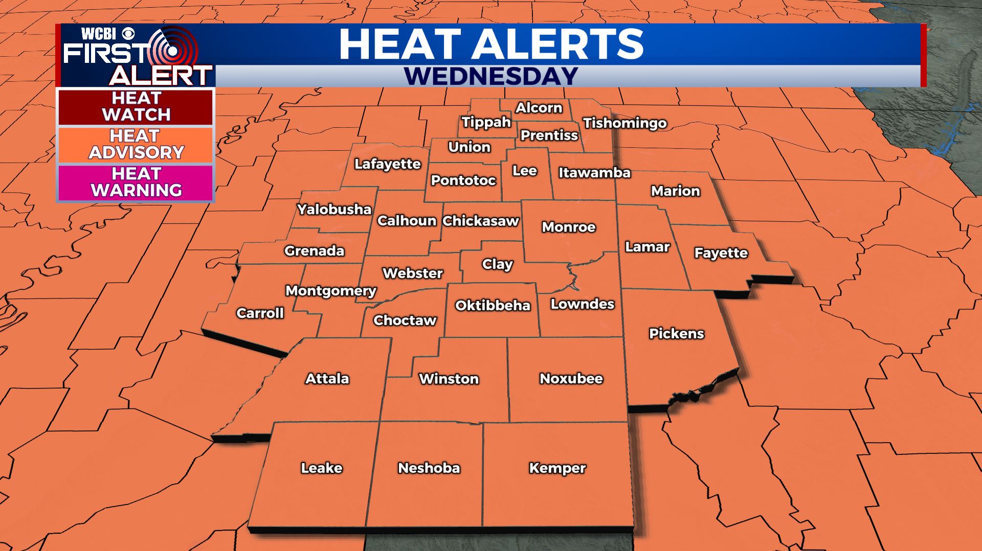 WEDNESDAY NIGHT: Partly cloudy skies. Warm and muggy with overnight lows in the mid 70s. Calm winds. THURSDAY- FRIDAY: Our summer weather pattern continues. Temperatures will remain in the mid 90s with heat indices in the 100s. Rain and storms chances are possible in the afternoon. WEEKEND-TUESDAY: Scattered showers & storms remain possible with a mix of sun & clouds. Chances could get higher by Sunday into Monday as Fred moves into the Gulf and affects Florida. We’ll keep you updated! Highs in the upper 80s to lower 90s. Stay connected with @WCBIWEATHER on Facebook, Twitter, Instagram and the WCBI News App


Leave a Reply