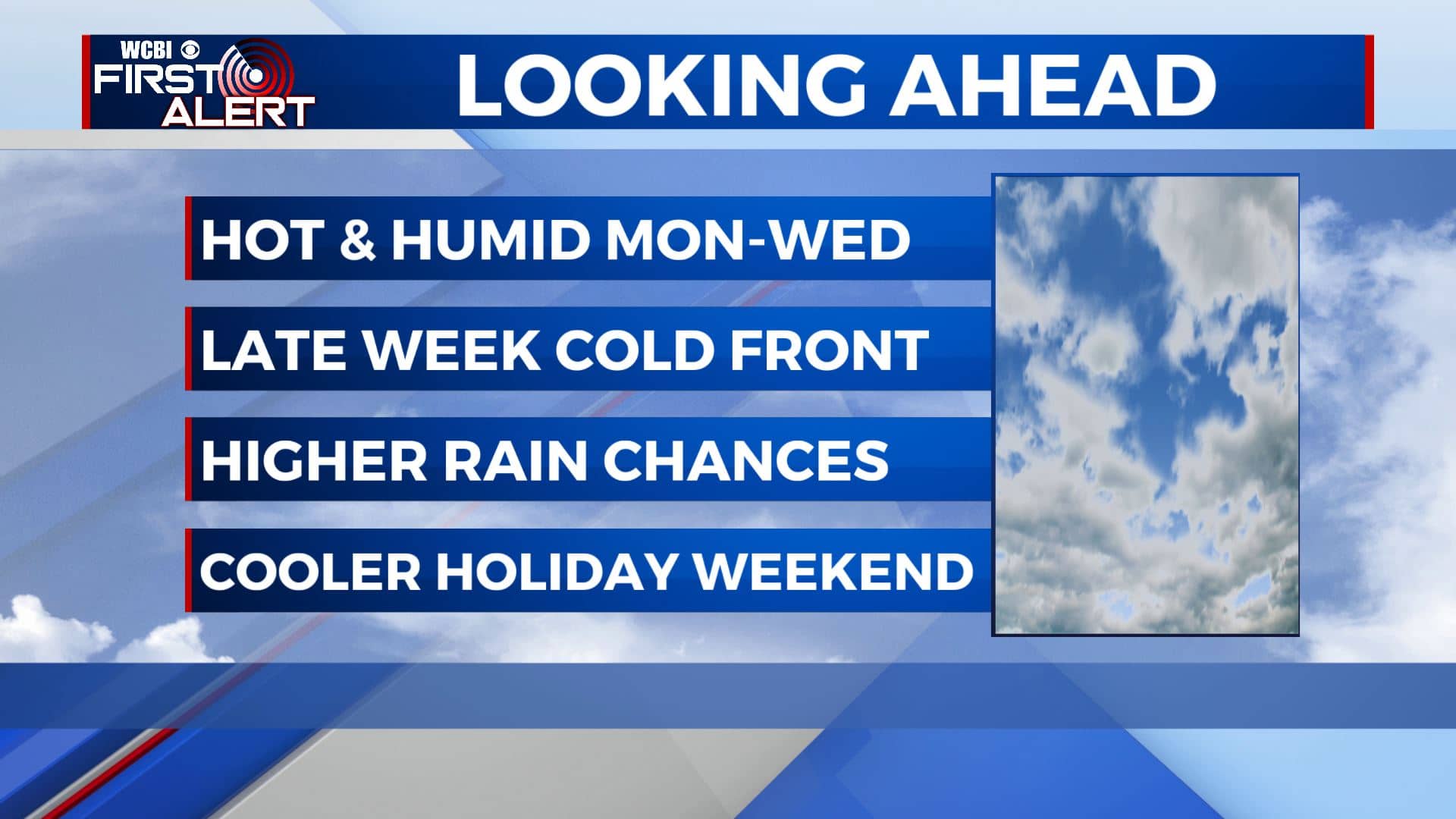
Staying humid then more rain & storms chances this workweek
SUMMARY: Summer weather is here to stay as we head into a new week. It will stay hot and humid with temps in the upper 80s to lower 90s. Rain & storm chances will go up mid to late week as a cold front will push through. Temperatures will cool down a bit. We could see scattered chances of showers and storms as we near the 4th of July holiday weekend.
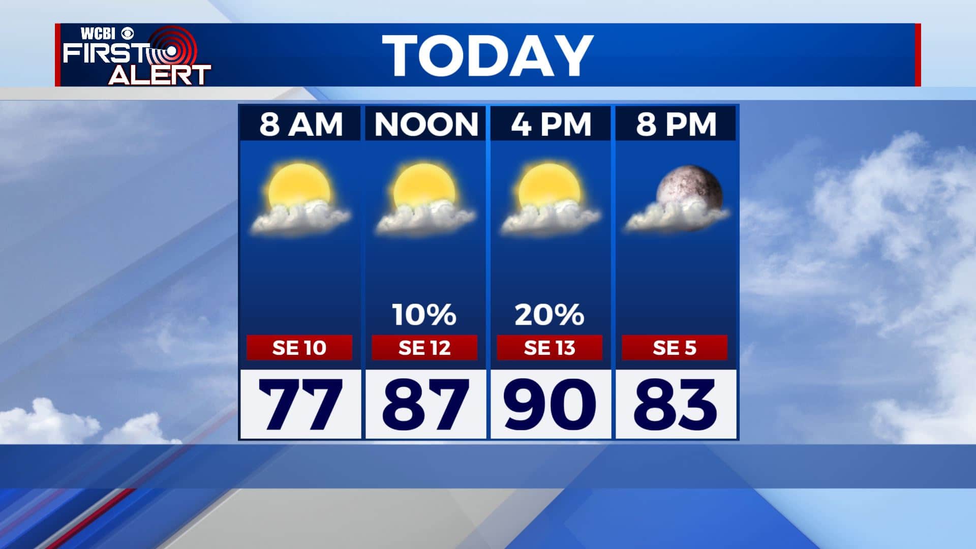
MONDAY: A mix of sun & clouds with a chance of a stray afternoon shower and storm as we start off the new workweek. Seasonable but warm & humid with high temperatures in the lower 90s. SE winds 10-15 mph.
MONDAY NIGHT: Partly cloudy skies. Overnight lows mild & muggy around 70 degrees.
TUESDAY: Afternoon rain & storm chances will start increasing. Highs will once again be around the 90 degree mark.
TUESDAY NIGHT: Partly cloudy skies. Overnight lows mild & muggy once again around 70 degrees.
LATE WEEK: Rain & storm chances will continue to increase with scattered to widespread showers and storms as a cold front will be pushing through north Mississippi and west Alabama. High temperatures through Thursday will remain near 90 before cooling down in the mid 80s on Friday.
HOLIDAY WEEKEND: The passage of the cold front will determine how the holiday weekend plays out. As of right now, Saturday will be the wetter day while Sunday could be a drier day with some isolated showers & storms in the afternoon. Stay tuned! Highs in the mid 80s with and overngiht lows in the upper 60s.
Stay connected with @WCBIWEATHER on Facebook, Twitter, Instagram and the WCBI News App


Leave a Reply