Summery weather continues
SUMMARY: Summer-like conditions will hold for the next 2 days. Highs should be well into the 80s. The next chance of rain and storms will come Saturday evening and night. Some of them could be on the strong to severe side.
THURSDAY NIGHT: Mostly clear to partly cloudy. Mild lows in the lower 60s. Southerly winds 5 to 10 mph.
FRIDAY: Partly cloudy and warm. Highs in the mid to upper 80s. Some new record highs are possible once again. Breezy southerly winds 10-20 mph.
FRIDAY NIGHT: Clouds fill back in during the night. Lows in the mid 60s.
SATURDAY: Mostly cloudy to start with a mix of sun and clouds developing during the day. Southerly breezes keep high temperatures well into the 80s.
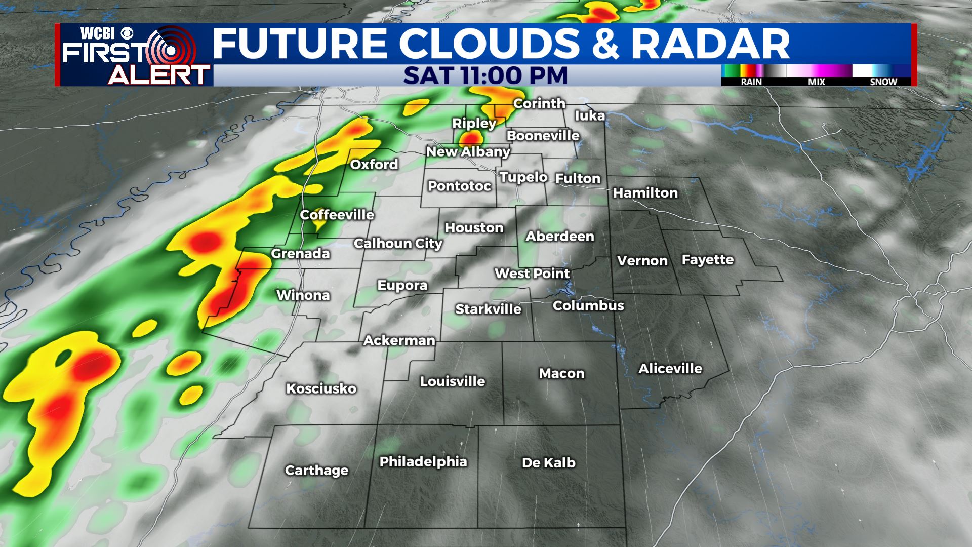
SATURDAY EVENING/NIGHT: A line of gusty storms is expected to move across the area with a cold front. Damaging wind gusts and hail appear to be the main threats if severe weather does occur. Lows will be in the upper 50s by sunrise.
SUNDAY: Mostly sunny to partly cloudy skies return. A pleasant day is likely with highs in the 70s.
Follow @WCBIWEATHER on Facebook, Twitter, Instagram, and on the WCBI News App


Leave a Reply