Sunny, cool, & dry Friday
CLICK HERE FOR THE LATEST RIVER LEVELS
SUMMARY: Drier air is returning for a few days and that will allow river flooding to get under control through the weekend. A few showers are possible by Sunday with better rain chances returning by Monday and Tuesday.
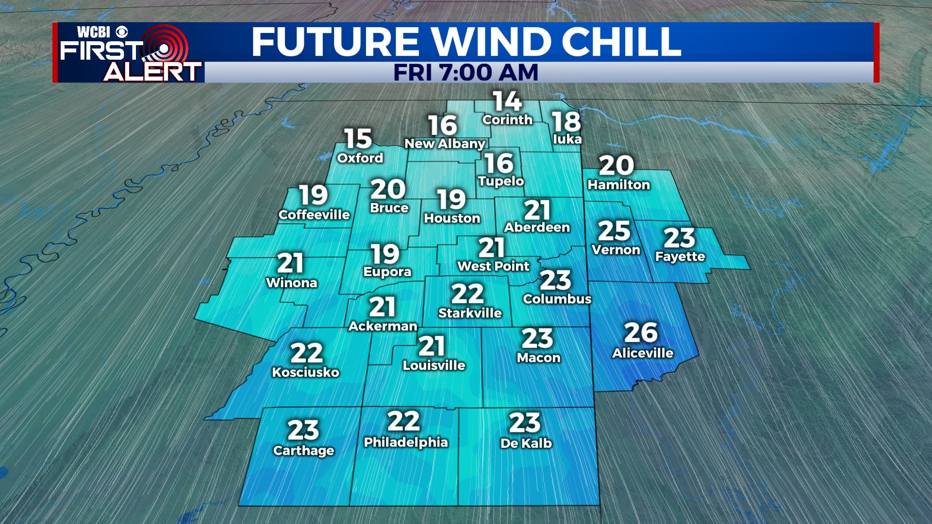
THURSDAY NIGHT: Clearing skies. Much colder lows in the mid to upper 20s. Wind chill values by sunrise will be in the mid teens to low 20s. Bundle up!
FRIDAY: Sunny. Highs in the 40s. Northerly winds around 10 mph are going to keep a winter chill going all day long. Bring some warm weather gear to the ballparks in Starkville and Oxford for the college baseball home openers.
FRIDAY NIGHT: Clear and quiet. Cold lows in the mid to low 20s.
SATURDAY: Mostly sunny. Highs in the mid to upper 50s.
SATURDAY NIGHT: Variably cloudy. Lows in the low 40s.
SUNDAY: Partly to mostly cloudy with a 20% chance of showers. Higher odds of rain look to be closer to the coast. Afternoon highs should top out in the upper 50s to around 60.
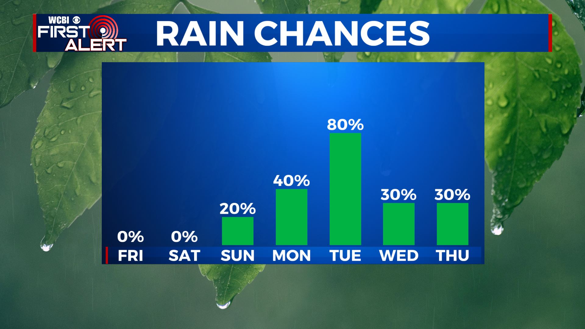
MONDAY: Areas of showers develop during the day. The chance of rain is 40%. Mild highs in the mid 60s are likely.
TUESDAY: Rain and Thunder. Highs in the upper 60s to around 70.
WEDNESDAY & THURSDAY: Colder air returns with highs falling back into the 40s. Some rain is possible but the exact details are up in the air.
Stay connected with @WCBIWEATHER on Facebook, Twitter, Instagram, and the WCBI News App


Leave a Reply