The sunshine and cooler temperatures return for Thursday
SUMMARY: Winter has made its return as we wrap up the workweek. We’ll be waking up to the 30s, even the 20s in the morning. Afternoon highs will only top out in the 40s into the 50s. Some rain chances, maybe some rumbles of thunder are still possible this weekend.
THURSDAY: BRRRRRRRR!!!! It’s sure feeling like winter again here in the Deep South this Thursday morning as we’re waking up to temperatures in the 30s. Bundle up as you’re heading out the door! Some morning clouds to start your Thursday before the full sunshine makes a return. A much cooler day with highs only in the upper 40s. North winds 5-10 mph.
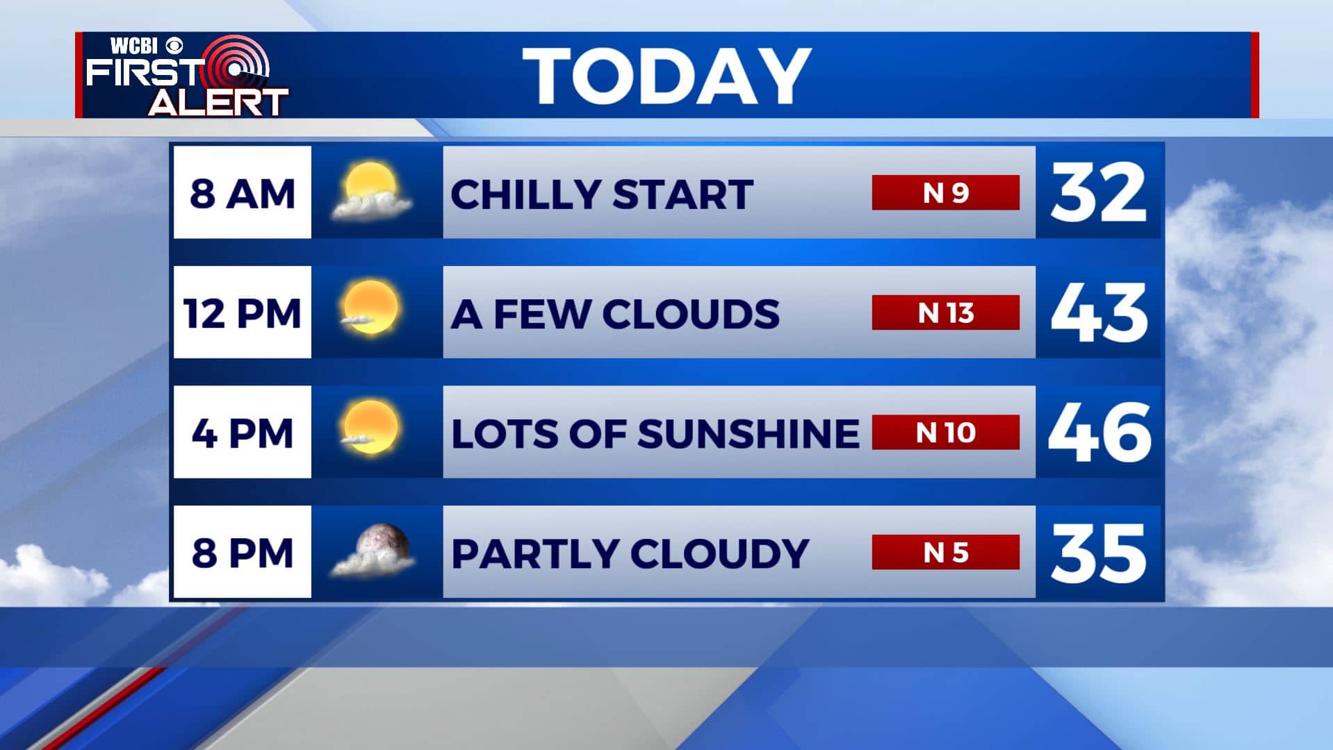
THURSDAY NIGHT: Clear skies and another cold night. Overnight lows in the mid 20s. Widespread frost is likely.
FRIDAY: Mostly sunny skies to wrap up the workweek. Highs in the mid 50s. Light SE wind.
FRIDAY NIGHT: Mostly clear skies. Overnight lows in the mid 30s.
SATURDAY: Clouds will be increasing throughout the day. Highs in the upper 50s to lower 60s. Some showers & storms are possible late in the day and into the evening. No severe weather is expected at this time.
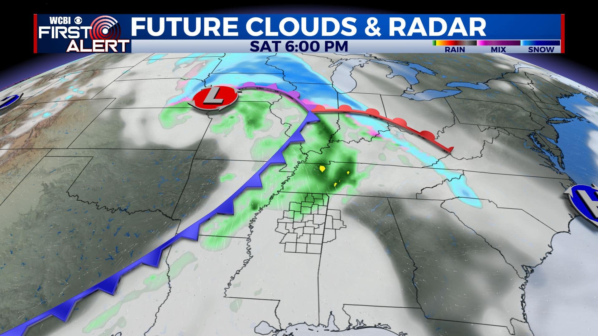
SATURDAY NIGHT: Areas of rain and thunder possible. Overnight lows in the upper 40s.
SUNDAY: Mostly cloudy with a chance of showers. Highs in the lower 60s.
MONDAY-TUESDAY: Mostly sunny skies once again return. Cooling down once again with highs in the upper 40s to lower 50s.
WEDNESDAY: A mix of sun & clouds. Highs in the mid 50s.
Stay connected with @WCBIWEATHER on Facebook, Twitter, Instagram, and the WCBI News App


Leave a Reply