Typical summer weather sticking around through midweek
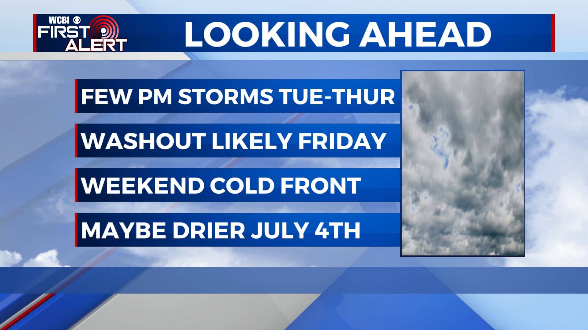
SUMMARY: It will stay hot and humid with temps in the upper 80s to lower 90s through midweek. Rain & storm chances will also continue to increase mid to late week as a cold front will push through the region. Temperatures will cool down a bit. We could see scattered chances of showers and storms for the 4th of July holiday. All depends on how fast the cold front pushes through here. We’ll keep you updated!
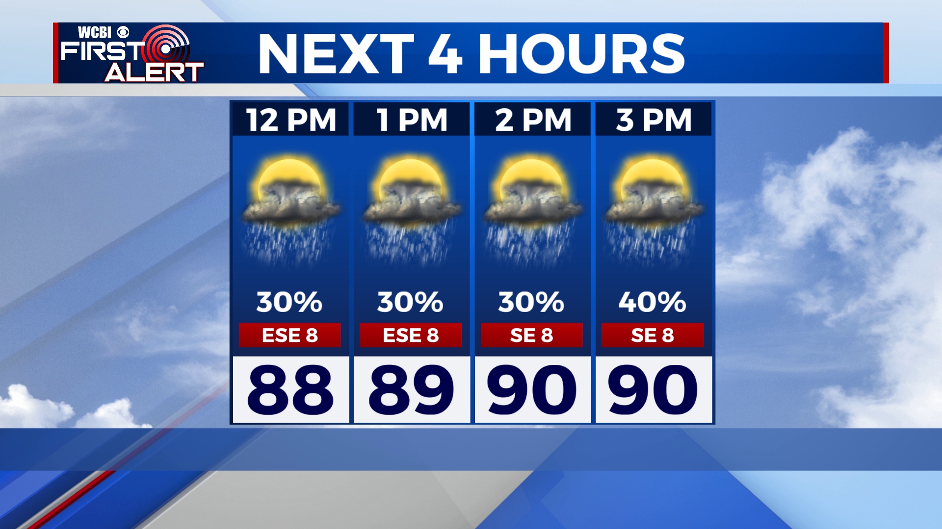
TUESDAY: Afternoon rain & storm chances will start increasing due to moisture from the remnants of Tropical Storm Danny as it moves west. Highs will once again be seasonable for late June around the 90 degree mark. SE winds 5-10 mph.
TUESDAY NIGHT: Partly cloudy skies after any showers and storms die down after sunset and the lost of the daytime heating. Overnight lows mild & muggy once again around 70 degrees.
WEDNESDAY: Pretty much hitting the repeat button again with our weather. Scattered showers and storms will once again pop up in the afternoon. Highs in the upper 80s to around 90.
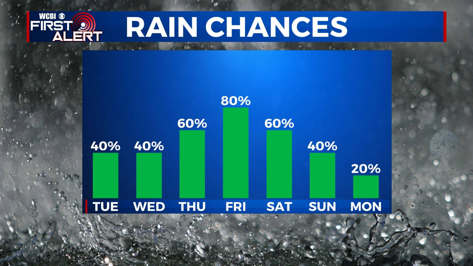
LATE WEEK: Rain & storm chances will continue to increase with scattered to widespread showers and storms as a cold front will be pushing through north Mississippi and west Alabama Thursday into Friday. High temperatures Thursday will remain near 90 degrees before cooling down into the lower to mid 80s on Friday.
HOLIDAY WEEKEND: The passage of the cold front will determine how the holiday weekend plays out. As of right now, Saturday will be the wetter day while the Fourth of July on Sunday could be a drier day with some isolated showers & storms in the afternoon. Stay tuned! Highs in the mid 80s with and overnight lows in the mid to upper 60s.
Stay connected with @WCBIWEATHER on Facebook, Twitter, Instagram and the WCBI News App


Leave a Reply