Typical summertime weather returns this week
SUMMARY: Hoping you’ve enjoyed the amazing weather this holiday weekend. Our typical summertime weather pattern will be making its return starting today into the workweek. Expect the return of the humidity and afternoon chances of showers & storms.
MONDAY: Sunshine with a few clouds moving in and a bit more humid as some tropical moisture moves back into the region. Highs in the lower 90s. Just a chance of a stray afternoon storm. Winds SE 5-10 mph.
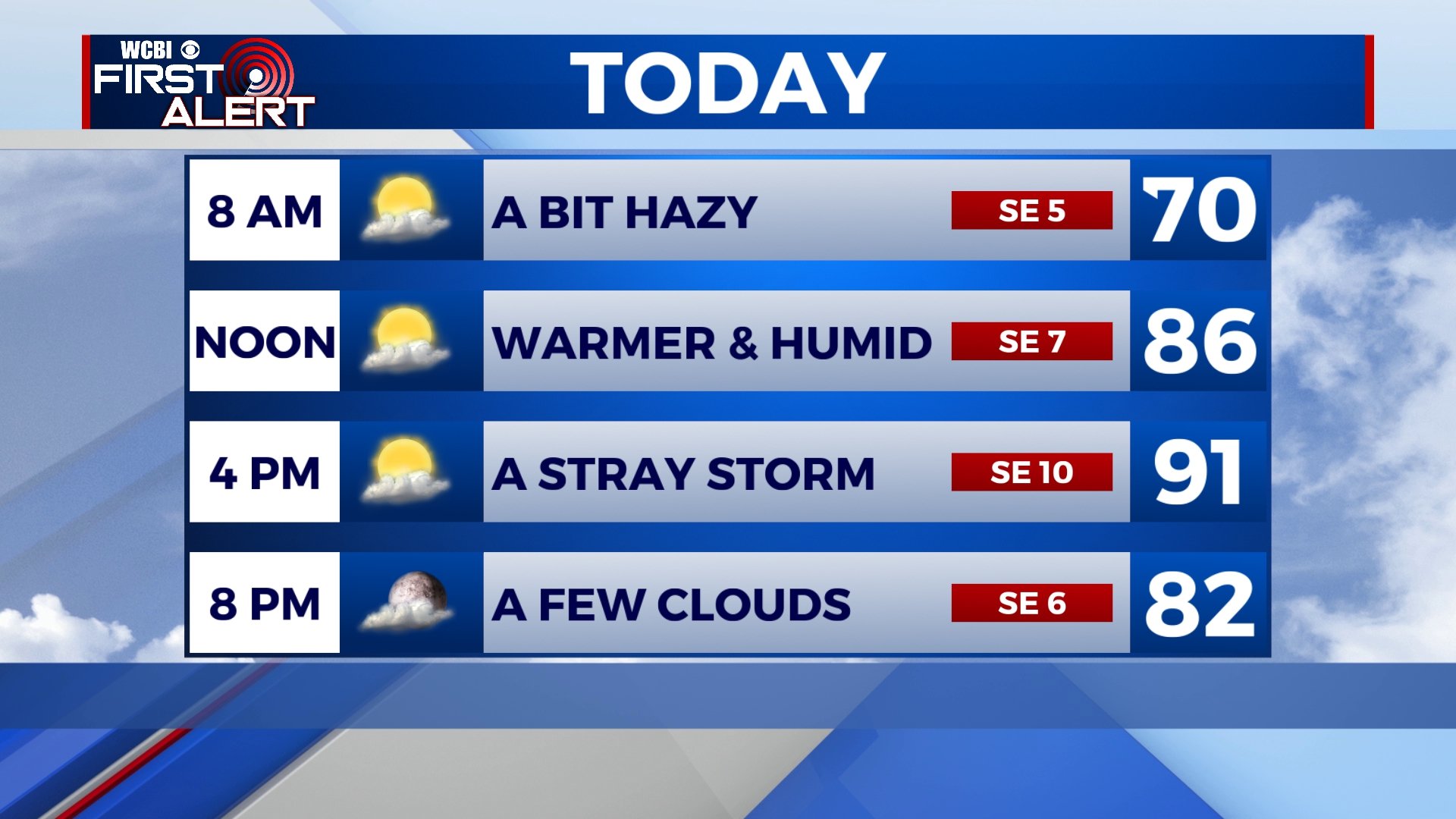
MONDAY NIGHT: Partly cloudy skies. Muggy and mild lows around 70 degrees. Calm winds.
TUESDAY: A mix of sun & clouds with a few chances for afternoon summertime showers & storms. Highs in the mid to upper 80s.
WEDNESDAY-FRIDAY: Mostly cloudy with scattered showers and storms each and every day, primarily during the daytime heating. Highs in the mid to upper 80s with overnight lows in the 70s.
WEEKEND: A possible cold front could bring us some additional chances of showers & storms both on Saturday & Sunday. High temperatures in the upper 80s to near 90 degrees.
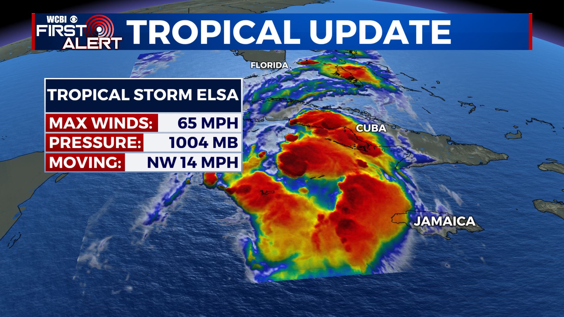
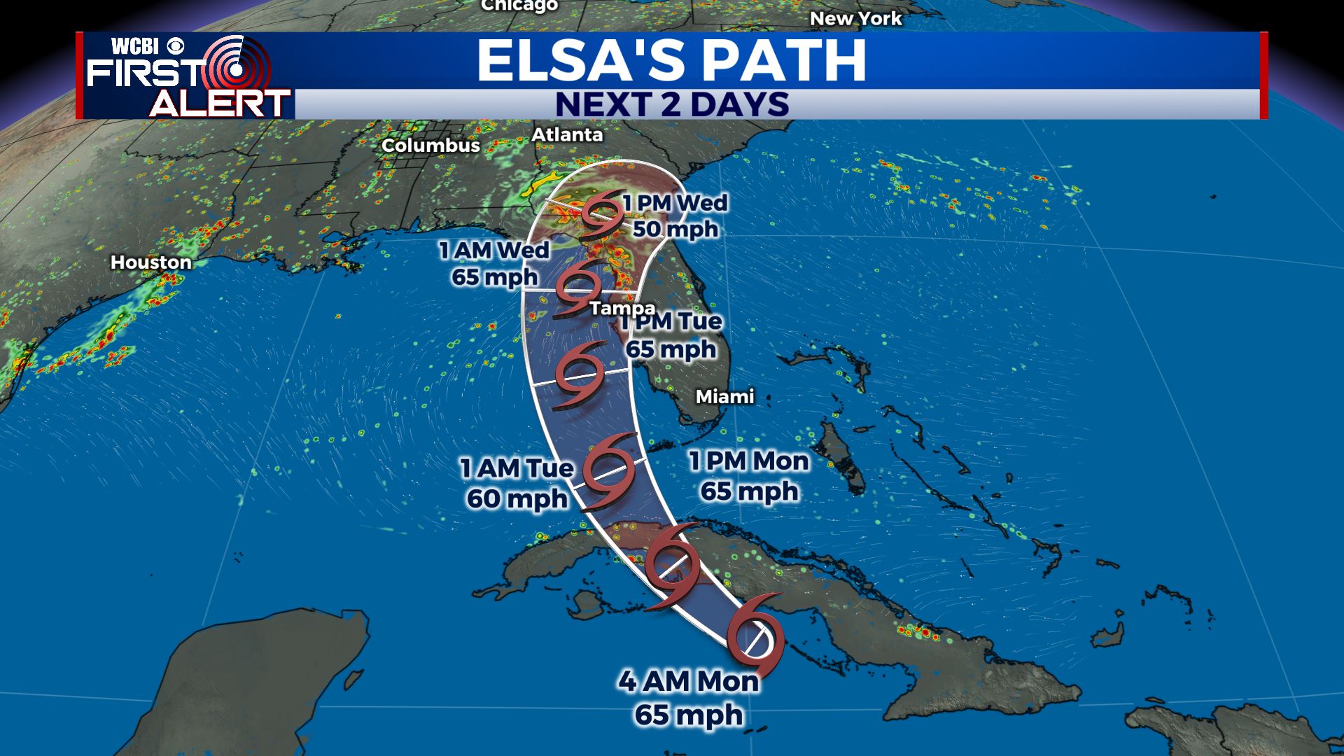
TROPICS: Tropical Storm Elsa is just to the south of Cuba as of Monday morning. Tropical Storm Warnings and Watches extended northward along the west coast of Florida.The potential for heavy rain, a few tornadoes & frequent wind gusts to tropical storm force winds are possible Monday into Wednesday for all of Florida. Storm Surge impact concerns exist for coastal west Florida.
Stay connected with @WCBIWEATHER on Facebook, Twitter, Instagram and the WCBI News App


Leave a Reply