Warm & humid weekend; Watching storms early Monday
SUMMARY: A very warm weekend is ahead for us here in north MS and west AL. Look for highs well into the 70s with some low 80s possible. Try to take advantage of the nice weather if you can. Strong to severe storms will remain a possibility late Sunday night into Monday. We’ll continue to keep you updated. More rain and storms could occur during the middle of next week before a return to cooler, more stable weather.
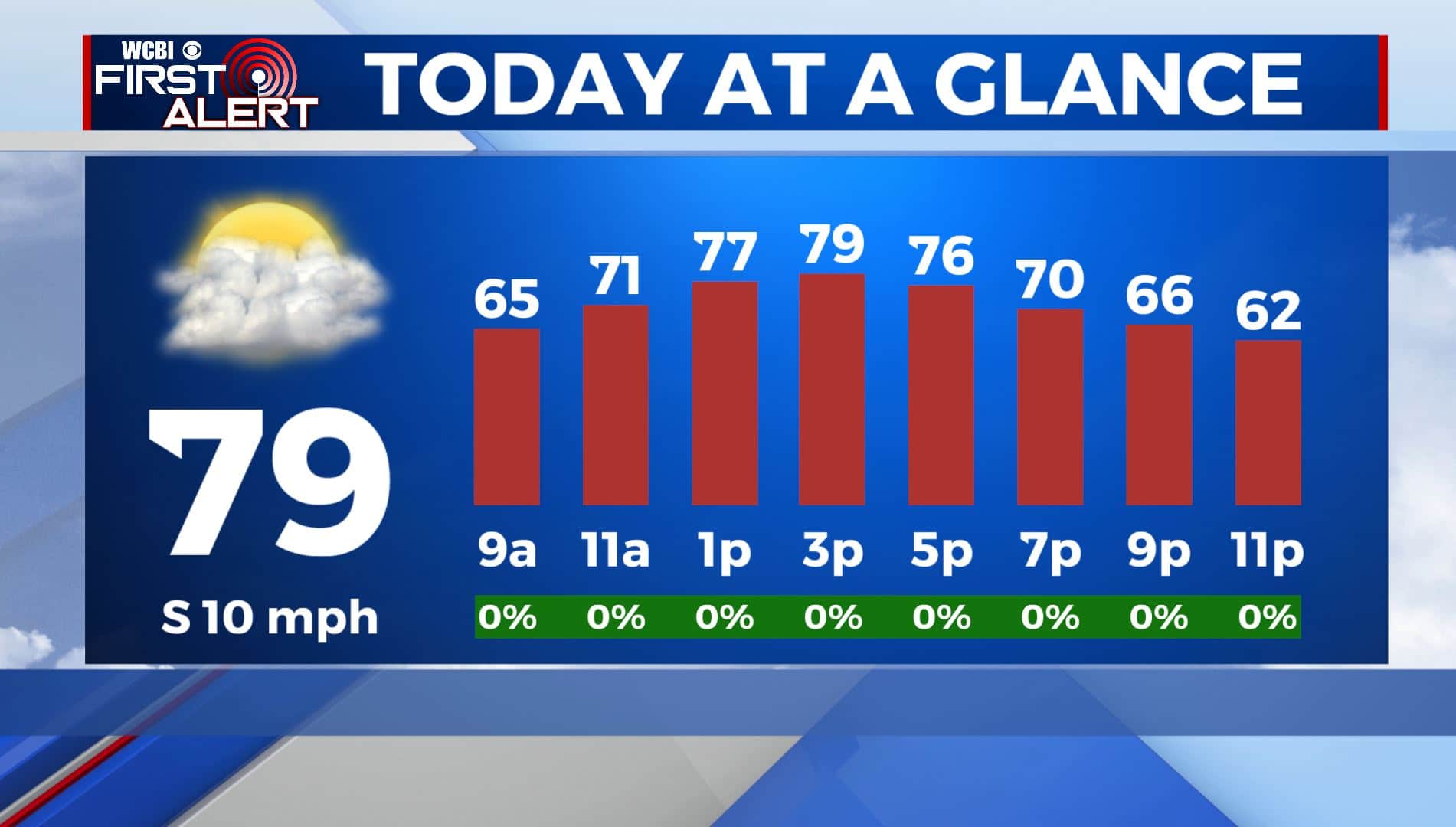
FRIDAY: Cloudy skies for the end of the workweek for your Friday with a few peeks of sunshine. Highs in the upper 70s to near 80 degrees once again. South winds 5-10 mph. It will feel a bit humid as well.
FRIDAY NIGHT: Mostly cloudy skies. Mild overnight lows continue in the mid to upper 50s.
SATURDAY: A stray sprinkle is possible on Saturday with cloudy skies. Highs will be near 80 degrees.
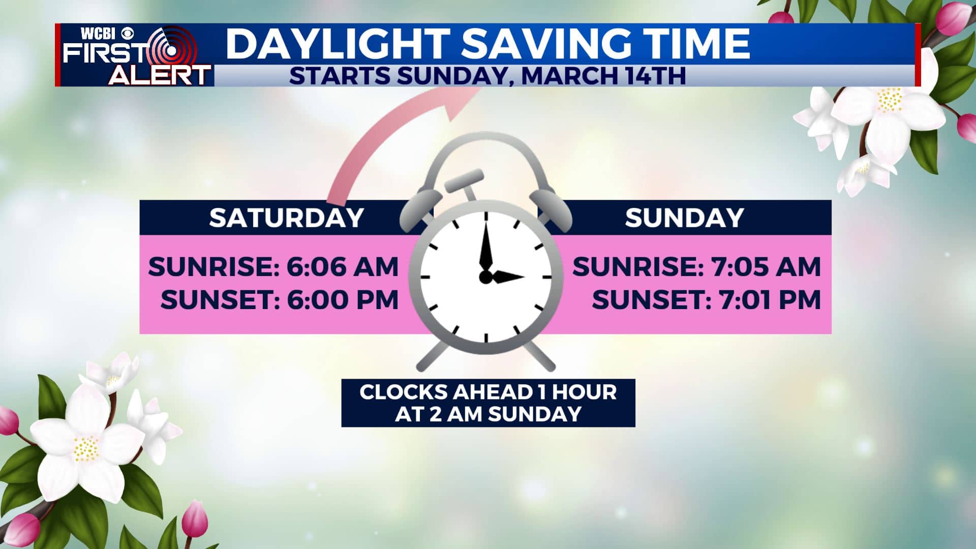
SATURDAY NIGHT: Mostly cloudy skies. Mild overnight lows continue in the mid to upper 50s. Don’t forget to Spring Forward one hour late Saturday night/early Sunday morning. Daylight Saving Time begins 2 am Sunday.
SUNDAY: Cloudy skies and warm. Highs well into the 70s with some low 80s possible. Lows in the 50s. Southerly winds continue they could be breezy at times. A few showers can’t be ruled out. We’ll be watching storms out to our west Sunday evening.
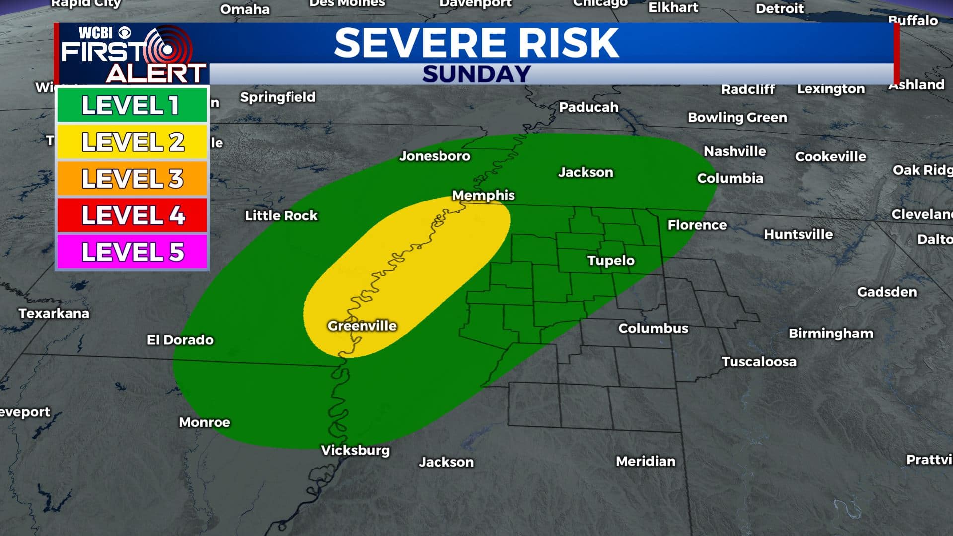
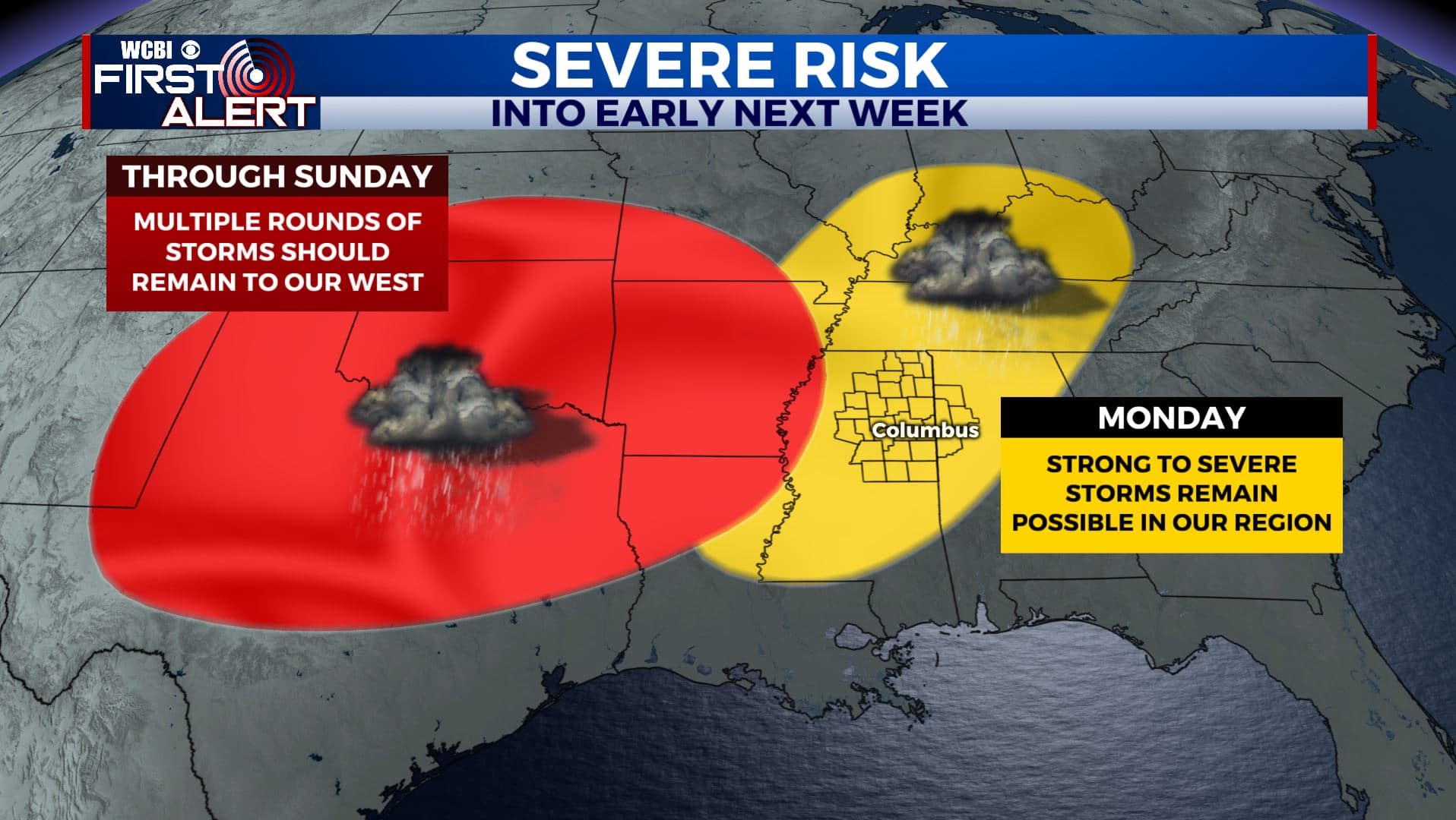
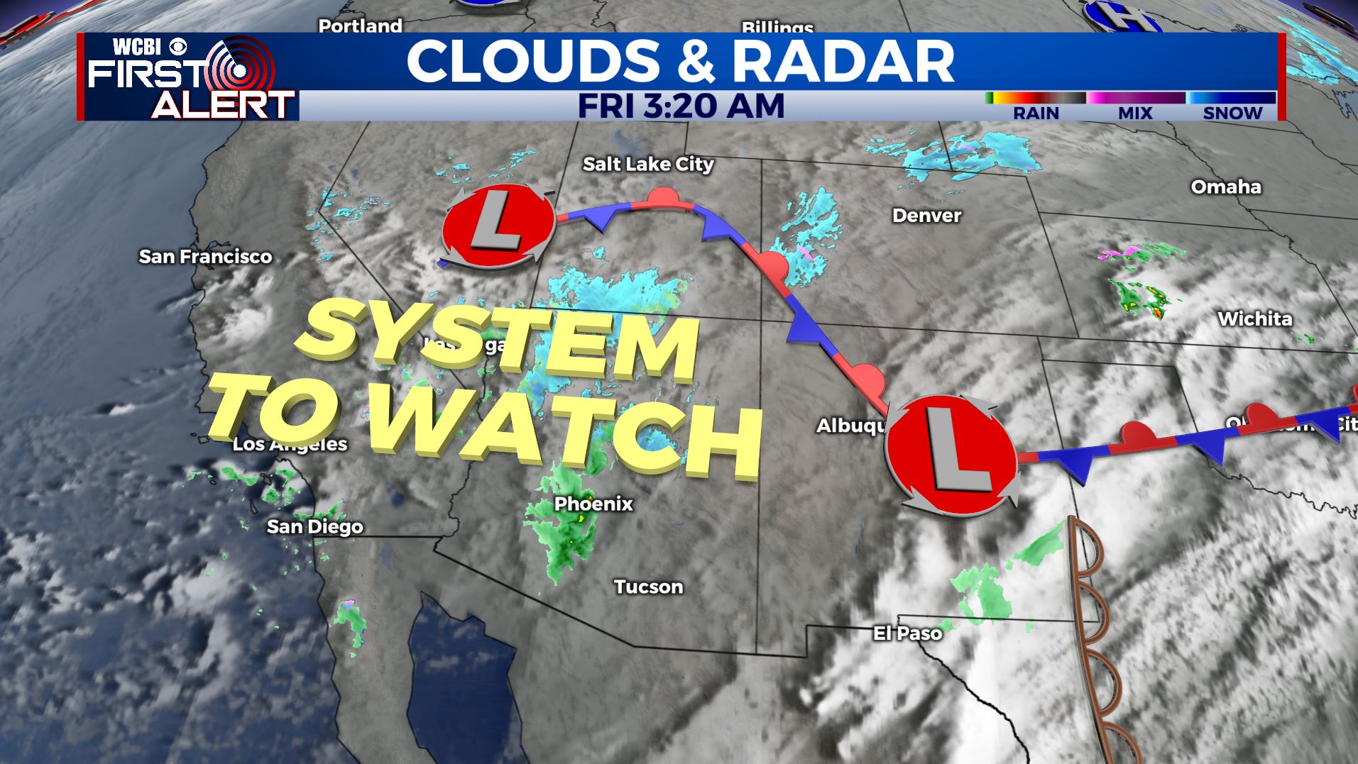
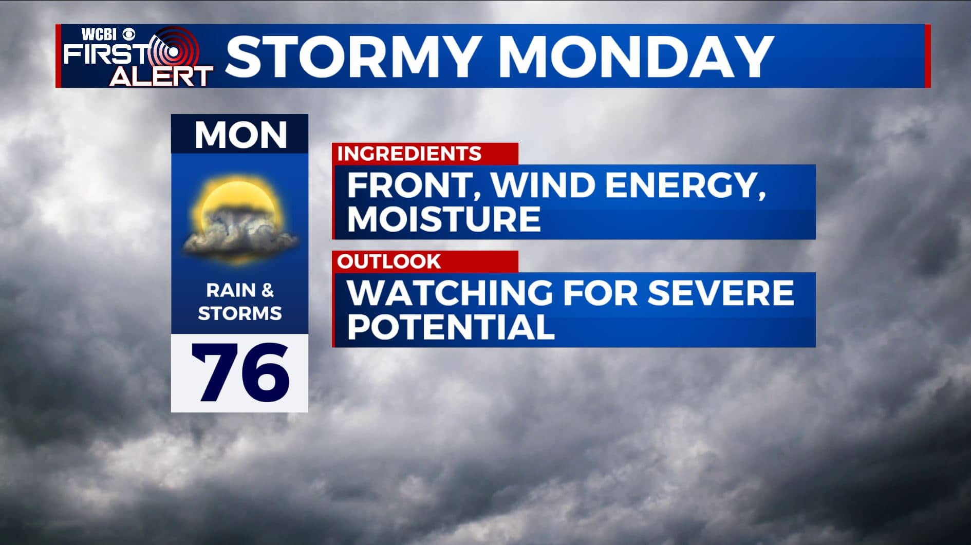
MONDAY: Rain and storms are likely. Recent trends suggest there could be a better environment for storms that could become strong or severe. It’s something we’ll continue to watch during the weekend. Highs remain in the 70s.
TUESDAY – WEDNESDAY: Additional rain and storms are possible but the exact timing and placement remains up in the air. Look for continued mild conditions with highs in the 70s and lows around 60.
THURSDAY: Cooler and drier weather builds back into the region. Highs in the 60s are more likely with some upper 30s possible again by Friday morning.
Stay connected with @WCBIWEATHER on Facebook, Twitter, Instagram, and the WCBI News App


Leave a Reply