Warm all weekend long, storms possible Monday
SUMMARY: Unseasonably warm air will continue through the weekend. Look for highs well into the 70s with some low 80s possible the next 3 days. Strong to severe storms will remain a possibility on Monday and we’ll continue to monitor trends. More rain and storms could occur during the middle of next week before a return to cooler, more stable weather.
THURSDAY NIGHT: Partly cloudy and mild. Lows in the mid 50s. Winds S 4-10 mph.
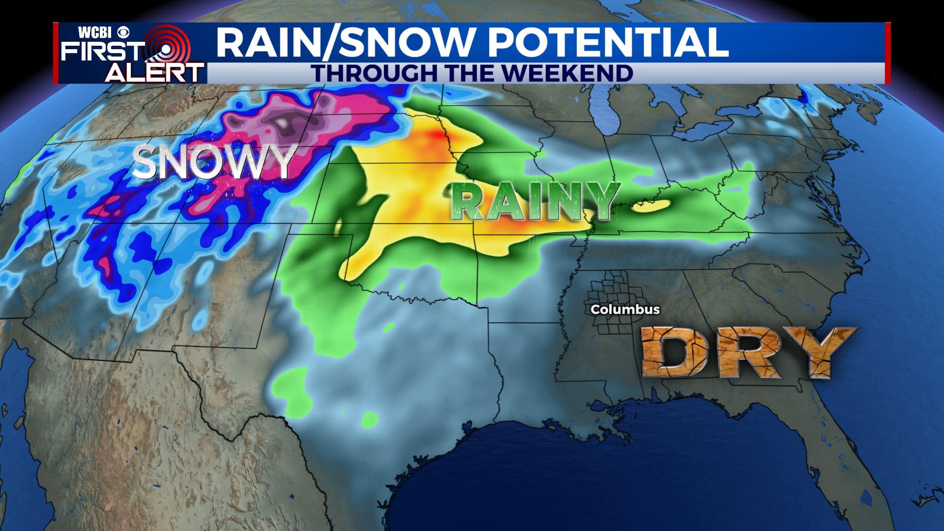
FRIDAY – SUNDAY: Variably cloudy and warm. Highs well into the 70s with some low 80s possible. Lows in the 50s. Southerly winds continue they could be breezy at times. A few showers can’t be ruled out each day but many spots will likely remain dry all weekend. Try to take advantage of the nice weather if you can.
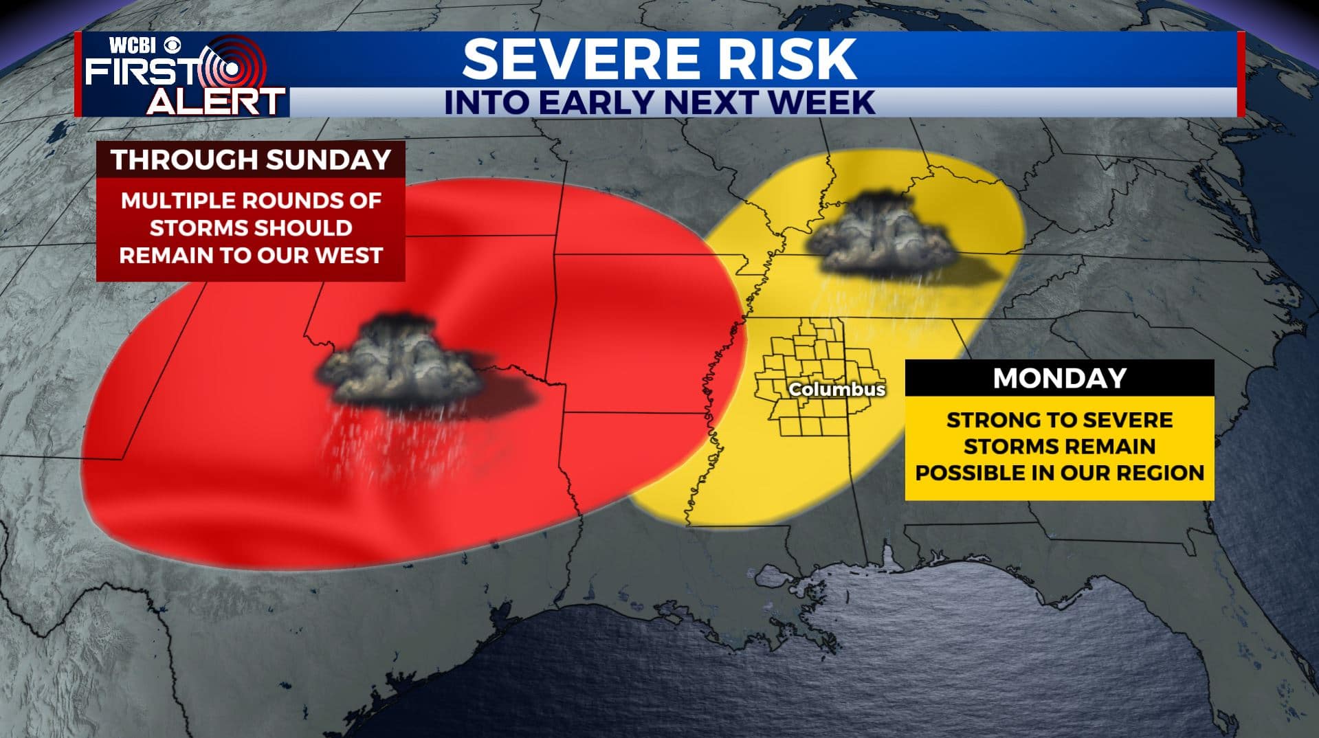
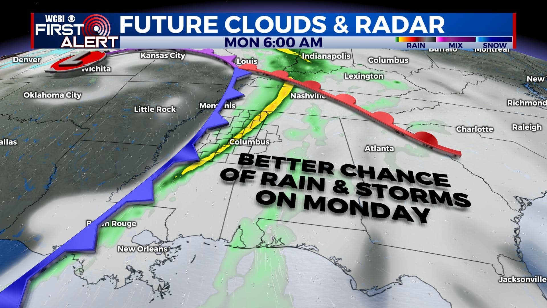
MONDAY: Rain and storms are likely. Recent trends suggest there could be a better environment for storms that could become strong or severe. It’s something we’ll continue to watch during the weekend. Highs remain in the 70s.
TUESDAY – WEDNESDAY: Additional rain and storms are possible but the exact timing and placement remains up in the air. Look for continued mild conditions with highs in the 70s and lows around 60.
THURSDAY: Cooler and drier weather builds back into the region. Highs in the 60s are more likely with some upper 30s possible again by Friday morning.
Follow @WCBIWEATHER on Facebook, Twitter, Instagram, and the WCBI News App


Leave a Reply