More Warmth Today; Continuing to Monitor the Tropics
The heat wave continues with temperatures into the 90s out there, with heat index values likely in the triple digits. Look for some isolated showers and storms today possible area-wide.
TODAY: A few isolated showers are expected as temperatures climb into the low to mid 90s. Look for a mostly sunny to partly cloudy sky with southeast winds 2-6 mph. Most will stay dry as heat index values climb closer to 100 by the afternoon.
TONIGHT: Lows fall into the low 70s and perhaps upper 60s in a few places under a mostly clear sky. Winds remain light from the east at 0-4 mph.
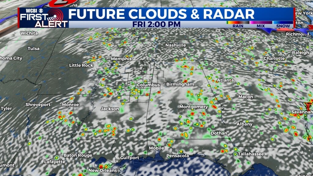
FRIDAY: Temperatures stay toasty in the 90s, with the heat index values likely above 100 again. We’ll keep our eyes open for an isolated shower. Look for lots of sunshine with a few clouds each day.
SATURDAY: We’re expecting a few isolated to scattered showers and storms as a boundary stalls out. It doesn’t seem to bring a whole lot of activity as of now, but that could change. We’re still thinking football games will overall be okay as temperatures climb into the low to middle 90s again. Heat index values likely still look to push into the triple digits, but if clouds increase and more showers form, that will help keep things a touch cooler.
LATE THIS WEEKEND INTO EARLY NEXT WEEK: Uncertainty remains on how a tropical low will impact the Gulf of Mexico and the Southeast United States. There is still potential for it to come into the Gulf and strengthen into a Tropical Storm, but there also remains a chance that it will lift to the north prior to making it to Mississippi leaving us high and dry. The next 24 hours are crucial for understanding how Invest 95L will interact. The latest update from the NHC brings it into the Gulf of Mexico with high probabilities of forming into a tropical cyclone. If it does follow this projection, then the storm would likely only reach tropical storm status and bring mostly rain.
The forecast of the track depends on how we will see impacts. A further east track will leave us drier while a more west and southward track in the Gulf of Mexico means we’ll likely see more rain from it into next week. For now, we’ll keep things with scattered storms with temperatures into the 80s under a partly cloudy sky.
The track of the low will continue to be monitored and the forecast will be fine-tuned in the coming days.
EXTENDED OUTLOOK – NEXT WEEK: The latest trends suggest the heat won’t go far. Odds remain in our favor to continue having above normal temperatures, but we may end up bringing scattered showers and storms each day into the forecast as trends suggest above normal rainfall in the region. We’ll monitor.
TROPICAL OUTLOOK: Two tropical waves continue to be monitored. One wave north of Cuba is lifting north and west towards Florida with high odds of becoming a tropical cyclone. It is likely to come into the Gulf of Mexico, but not 100% certain. In addition, a 2nd wave out in the open Atlantic has medium odds of developing over the next 5 days as it pushes west towards the Lesser Antilles and U.S. Virgin Islands. Both features will have to be watched closely. The next two names on the list are Humberto and Imelda.
FOLLOW @WCBI WEATHER ON FACEBOOK, INSTAGRAM AND TWITTER.


Leave a Reply