Wintry weather pushing through the area this Monday morning
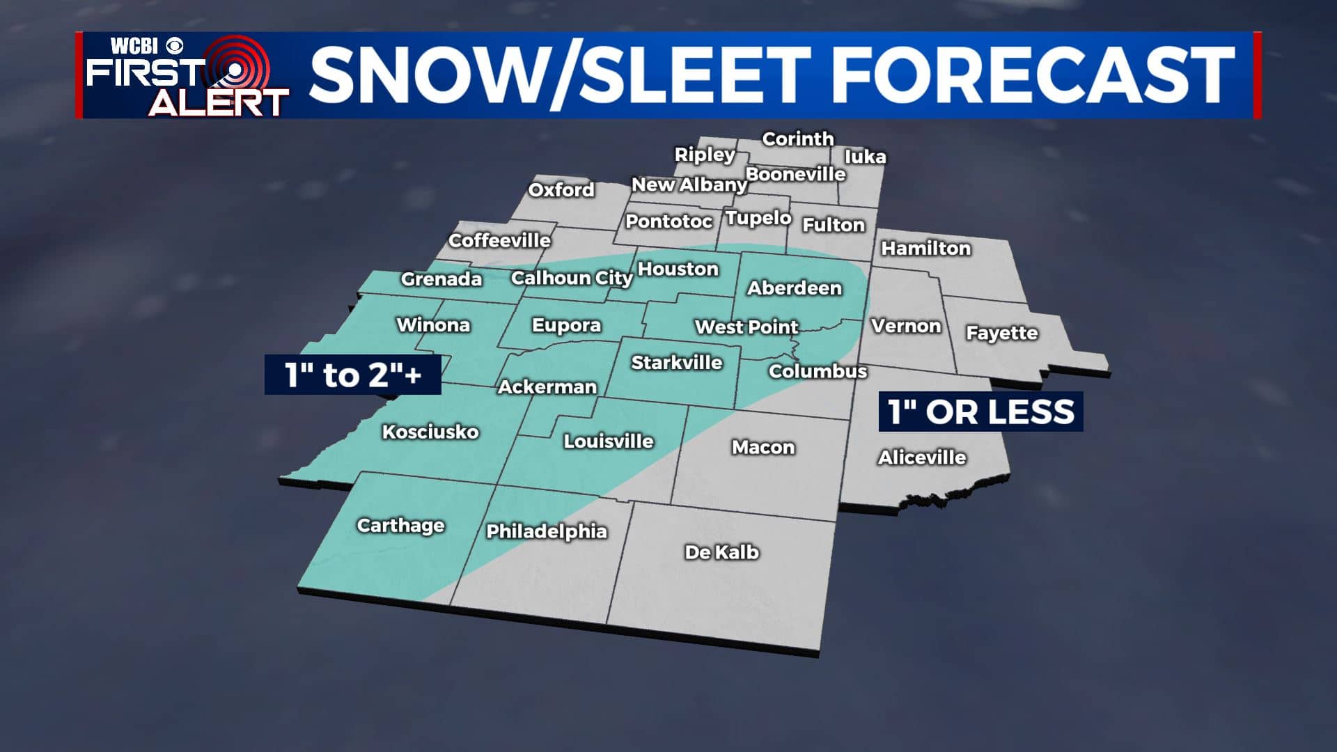
SUMMARY: An area of low pressure moving across the northern Gulf of Mexico will give our local area a mixed bag of rain, sleet, and snow from late Sunday evening through Monday afternoon. The best potential for wintry accumulations will be through Monday morning.
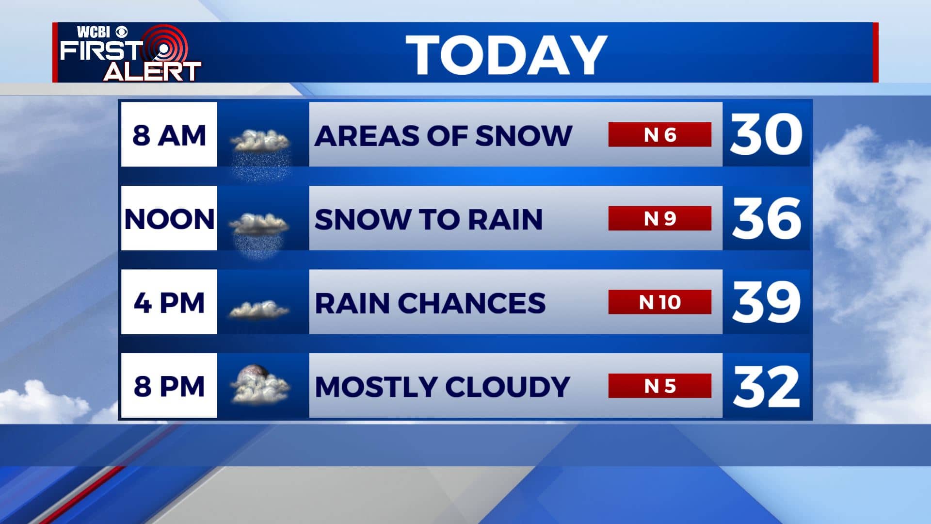
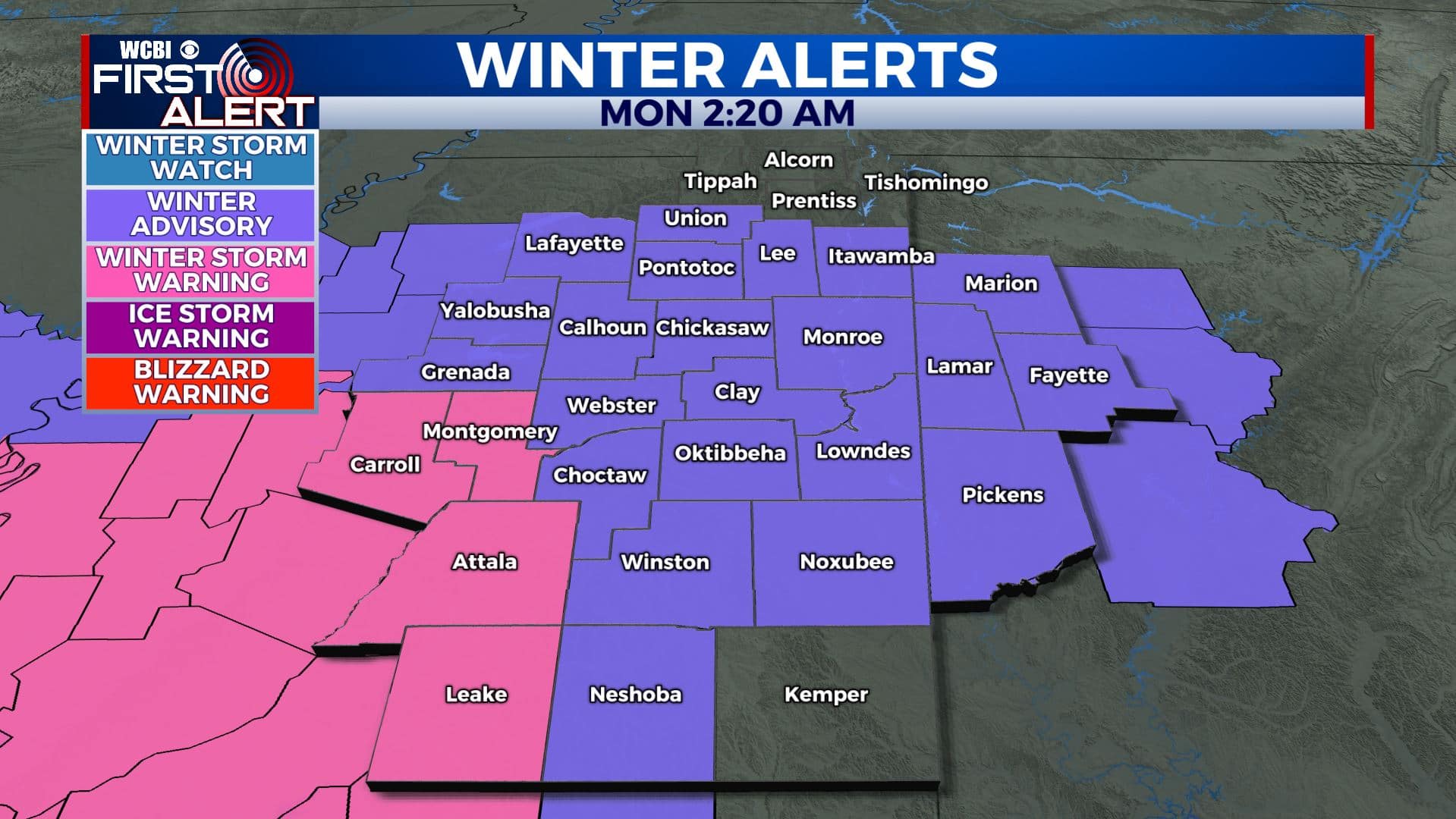
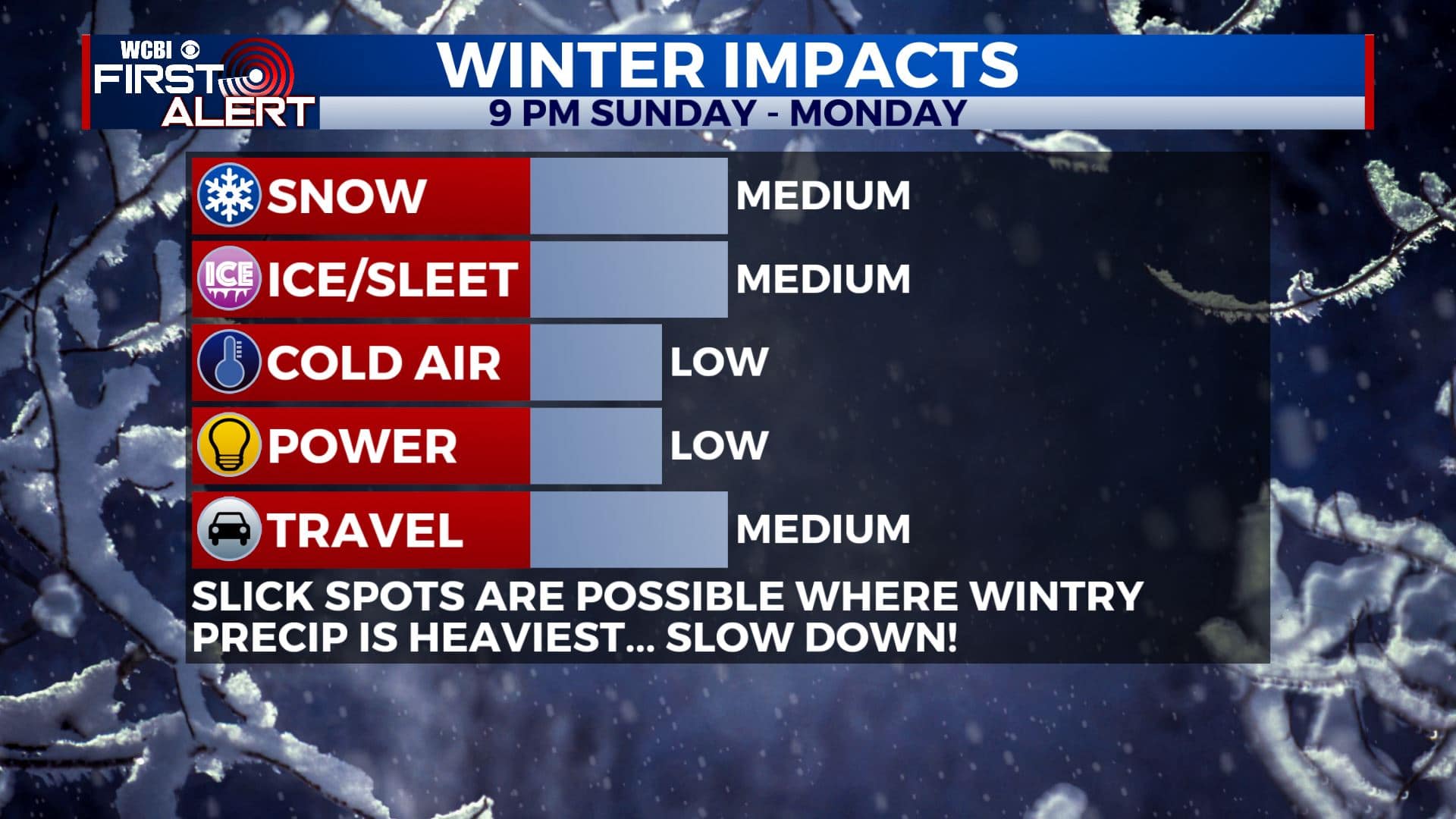
AMOUNTS: Anywhere from zero to 2″ of sleet and snow are possible. Some locations could get locally higher amounts in the 3″ to 4″ range if a heavy band of snow can setup somewhere.
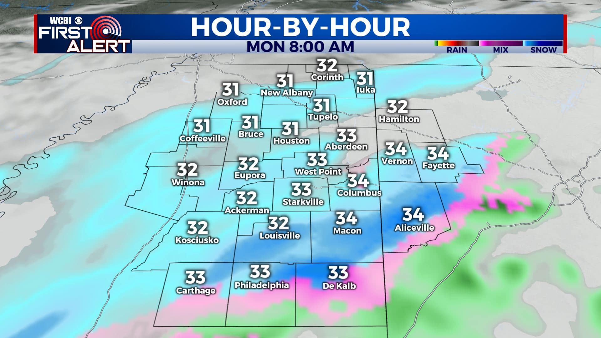
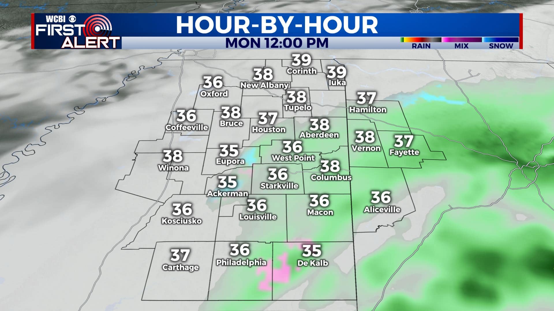
ROADS: In general, road surface temperatures will remain above freezing during this event and that will mitigate widespread travel issues we think. Things could become slick if a heavy band of precipitation happens to setup over any one spot for a bit. Also keep in mind bridges can become slick faster than regular road surfaces. When it doubt, slow down! Some additional slippery spots could redevelop Monday night when air temperatures dip back below freezing.
MONDAY NIGHT: Mostly cloudy and cold. Overnight lows in the upper 20s. Lingering moisture on roads could freeze up and cause some slippery spots, especially on bridges and elevated surfaces.
TUESDAY: A mix of clouds with some sunshine. Highs in the mid to upper 40s.
WEDNESDAY: More sunshine returns to the region along with some warmer winter temperatures. Highs in the lower to mid 50s.
THURSDAY: Mostly sunny skies. Highs in the upper 50s.
FRIDAY: Mostly sunny skies. Highs in the mid 50s.
SATURDAY: Mostly sunny skies but a bit cooler. Highs in the upper 40s to lower 50s.
Stay connected with @WCBIWEATHER on Facebook, Twitter, Instagram, and the WCBI News App


Leave a Reply